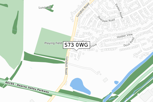
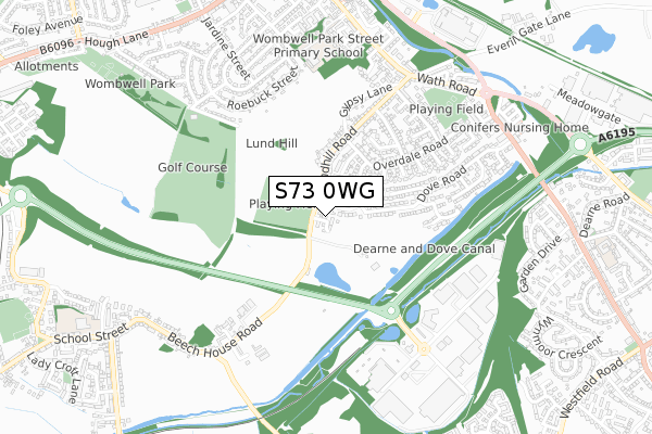
S73 0WG is located in the Wombwell electoral ward, within the metropolitan district of Barnsley and the English Parliamentary constituency of Barnsley East. The Sub Integrated Care Board (ICB) Location is NHS South Yorkshire ICB - 02P and the police force is South Yorkshire. This postcode has been in use since February 2020.


GetTheData
Source: OS Open Zoomstack (Ordnance Survey)
Licence: Open Government Licence (requires attribution)
Attribution: Contains OS data © Crown copyright and database right 2025
Source: Open Postcode Geo
Licence: Open Government Licence (requires attribution)
Attribution: Contains OS data © Crown copyright and database right 2025; Contains Royal Mail data © Royal Mail copyright and database right 2025; Source: Office for National Statistics licensed under the Open Government Licence v.3.0
| Easting | 440441 |
| Northing | 401931 |
| Latitude | 53.512531 |
| Longitude | -1.391634 |
GetTheData
Source: Open Postcode Geo
Licence: Open Government Licence
| Country | England |
| Postcode District | S73 |
➜ See where S73 is on a map ➜ Where is Wombwell? | |
GetTheData
Source: Land Registry Price Paid Data
Licence: Open Government Licence
| Ward | Wombwell |
| Constituency | Barnsley East |
GetTheData
Source: ONS Postcode Database
Licence: Open Government Licence
2024 8 MAR £226,000 |
2023 20 OCT £255,000 |
3, LUNDHILL DRIVE, WOMBWELL, BARNSLEY, S73 0WG 2023 7 JUL £279,995 |
1, LUNDHILL DRIVE, WOMBWELL, BARNSLEY, S73 0WG 2023 26 JUN £299,995 |
91, LUNDHILL DRIVE, WOMBWELL, BARNSLEY, S73 0WG 2022 7 NOV £258,000 |
2022 8 JUL £325,000 |
89, LUNDHILL DRIVE, WOMBWELL, BARNSLEY, S73 0WG 2022 31 MAR £225,000 |
79, LUNDHILL DRIVE, WOMBWELL, BARNSLEY, S73 0WG 2022 31 MAR £240,000 |
87, LUNDHILL DRIVE, WOMBWELL, BARNSLEY, S73 0WG 2022 18 MAR £240,000 |
85, LUNDHILL DRIVE, WOMBWELL, BARNSLEY, S73 0WG 2022 11 MAR £205,000 |
GetTheData
Source: HM Land Registry Price Paid Data
Licence: Contains HM Land Registry data © Crown copyright and database right 2025. This data is licensed under the Open Government Licence v3.0.
| Dearne Valley Parkway (Corton Wood) | Cortonwood | 456m |
| Dearne Valley Parkway (Corton Wood) | Cortonwood | 467m |
| Lundhill Road (Park Street) | Wombwell | 609m |
| Reginald Road (Park Street) | Wombwell | 645m |
| Junction Street (Brampton Road) | Wombwell | 668m |
| Wombwell Station | 1.7km |
| Elsecar Station | 2.8km |
GetTheData
Source: NaPTAN
Licence: Open Government Licence
GetTheData
Source: ONS Postcode Database
Licence: Open Government Licence


➜ Get more ratings from the Food Standards Agency
GetTheData
Source: Food Standards Agency
Licence: FSA terms & conditions
| Last Collection | |||
|---|---|---|---|
| Location | Mon-Fri | Sat | Distance |
| Cortonwood | 18:45 | 503m | |
| Beech House Road | 16:15 | 11:45 | 575m |
| Lundhill Road | 17:10 | 11:00 | 604m |
GetTheData
Source: Dracos
Licence: Creative Commons Attribution-ShareAlike
The below table lists the International Territorial Level (ITL) codes (formerly Nomenclature of Territorial Units for Statistics (NUTS) codes) and Local Administrative Units (LAU) codes for S73 0WG:
| ITL 1 Code | Name |
|---|---|
| TLE | Yorkshire and The Humber |
| ITL 2 Code | Name |
| TLE3 | South Yorkshire |
| ITL 3 Code | Name |
| TLE31 | Barnsley, Doncaster and Rotherham |
| LAU 1 Code | Name |
| E08000016 | Barnsley |
GetTheData
Source: ONS Postcode Directory
Licence: Open Government Licence
The below table lists the Census Output Area (OA), Lower Layer Super Output Area (LSOA), and Middle Layer Super Output Area (MSOA) for S73 0WG:
| Code | Name | |
|---|---|---|
| OA | E00037778 | |
| LSOA | E01007455 | Barnsley 026E |
| MSOA | E02001534 | Barnsley 026 |
GetTheData
Source: ONS Postcode Directory
Licence: Open Government Licence
| S73 0QZ | Lundhill Grove | 96m |
| S73 0SN | Dove Road | 154m |
| S73 0RR | Orwell Close | 196m |
| S73 0RP | Glenmore Rise | 201m |
| S73 0SH | Hoober View | 227m |
| S73 0RL | Lundhill Road | 228m |
| S73 0RW | Lundhill Close | 232m |
| S73 0RS | Medway Place | 244m |
| S73 0RN | Overdale Road | 258m |
| S73 0SP | Grantley Close | 267m |
GetTheData
Source: Open Postcode Geo; Land Registry Price Paid Data
Licence: Open Government Licence