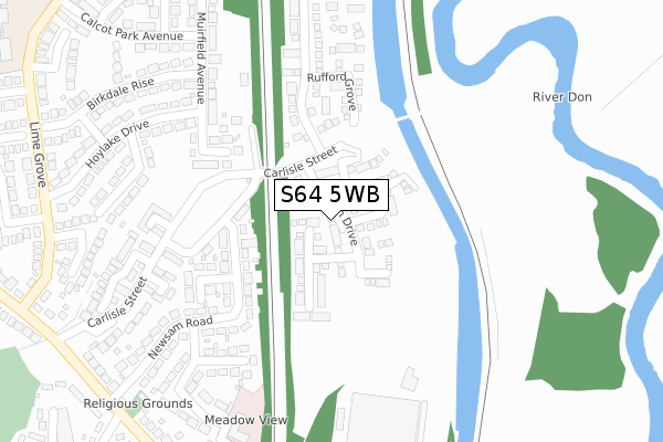
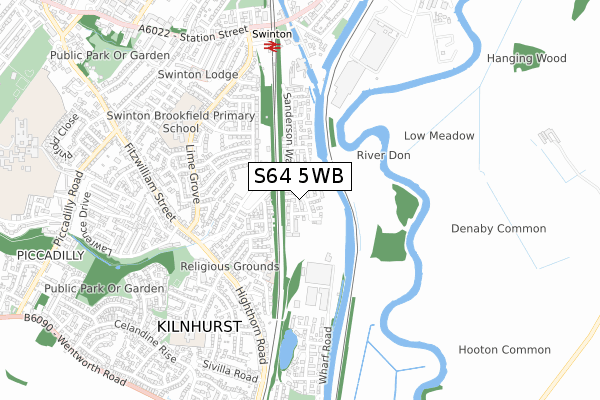
S64 5WB is located in the Kilnhurst & Swinton East electoral ward, within the metropolitan district of Rotherham and the English Parliamentary constituency of Wentworth and Dearne. The Sub Integrated Care Board (ICB) Location is NHS South Yorkshire ICB - 03L and the police force is South Yorkshire. This postcode has been in use since November 2017.


GetTheData
Source: OS Open Zoomstack (Ordnance Survey)
Licence: Open Government Licence (requires attribution)
Attribution: Contains OS data © Crown copyright and database right 2025
Source: Open Postcode Geo
Licence: Open Government Licence (requires attribution)
Attribution: Contains OS data © Crown copyright and database right 2025; Contains Royal Mail data © Royal Mail copyright and database right 2025; Source: Office for National Statistics licensed under the Open Government Licence v.3.0
| Easting | 446300 |
| Northing | 398386 |
| Latitude | 53.480187 |
| Longitude | -1.303812 |
GetTheData
Source: Open Postcode Geo
Licence: Open Government Licence
| Country | England |
| Postcode District | S64 |
➜ See where S64 is on a map ➜ Where is Kilnhurst? | |
GetTheData
Source: Land Registry Price Paid Data
Licence: Open Government Licence
| Ward | Kilnhurst & Swinton East |
| Constituency | Wentworth And Dearne |
GetTheData
Source: ONS Postcode Database
Licence: Open Government Licence
50, ELLISON DRIVE, KILNHURST, MEXBOROUGH, S64 5WB 2022 28 NOV £241,995 |
46, ELLISON DRIVE, KILNHURST, MEXBOROUGH, S64 5WB 2022 17 NOV £241,995 |
48, ELLISON DRIVE, KILNHURST, MEXBOROUGH, S64 5WB 2022 11 OCT £256,995 |
2022 12 SEP £245,000 |
23, ELLISON DRIVE, KILNHURST, MEXBOROUGH, S64 5WB 2021 11 JUN £191,995 |
25, ELLISON DRIVE, KILNHURST, MEXBOROUGH, S64 5WB 2021 11 JUN £227,995 |
21, ELLISON DRIVE, KILNHURST, MEXBOROUGH, S64 5WB 2020 11 NOV £155,995 |
40, ELLISON DRIVE, KILNHURST, MEXBOROUGH, S64 5WB 2020 31 JUL £171,995 |
17, ELLISON DRIVE, KILNHURST, MEXBOROUGH, S64 5WB 2019 25 MAR £181,995 |
34, ELLISON DRIVE, KILNHURST, MEXBOROUGH, S64 5WB 2019 15 MAR £186,995 |
GetTheData
Source: HM Land Registry Price Paid Data
Licence: Contains HM Land Registry data © Crown copyright and database right 2025. This data is licensed under the Open Government Licence v3.0.
| Carlisle Park (Carlisle Street) | Kilnhurst | 150m |
| Birdwell Road (Highthorn Road) | Kilnhurst | 403m |
| Birdwell Road (Highthorn Road) | Kilnhurst | 412m |
| Carlisle Street (Fitzwilliam Street) | Kilnhurst | 430m |
| Carlisle Street (Highthorn Road) | Kilnhurst | 447m |
| Swinton (South Yorks) Station | 0.7km |
| Mexborough Station | 1.6km |
| Bolton-Upon-Dearne Station | 4.3km |
GetTheData
Source: NaPTAN
Licence: Open Government Licence
| Percentage of properties with Next Generation Access | 100.0% |
| Percentage of properties with Superfast Broadband | 100.0% |
| Percentage of properties with Ultrafast Broadband | 96.4% |
| Percentage of properties with Full Fibre Broadband | 96.4% |
Superfast Broadband is between 30Mbps and 300Mbps
Ultrafast Broadband is > 300Mbps
| Percentage of properties unable to receive 2Mbps | 0.0% |
| Percentage of properties unable to receive 5Mbps | 0.0% |
| Percentage of properties unable to receive 10Mbps | 0.0% |
| Percentage of properties unable to receive 30Mbps | 0.0% |
GetTheData
Source: Ofcom
Licence: Ofcom Terms of Use (requires attribution)
GetTheData
Source: ONS Postcode Database
Licence: Open Government Licence


➜ Get more ratings from the Food Standards Agency
GetTheData
Source: Food Standards Agency
Licence: FSA terms & conditions
| Last Collection | |||
|---|---|---|---|
| Location | Mon-Fri | Sat | Distance |
| Meadow View Road | 17:00 | 12:00 | 418m |
| 5 Highthorn Road / Kilnhurst | 16:00 | 12:00 | 419m |
| 49 Lansdowne Crescent | 17:00 | 11:45 | 535m |
GetTheData
Source: Dracos
Licence: Creative Commons Attribution-ShareAlike
| Risk of S64 5WB flooding from rivers and sea | Low |
| ➜ S64 5WB flood map | |
GetTheData
Source: Open Flood Risk by Postcode
Licence: Open Government Licence
The below table lists the International Territorial Level (ITL) codes (formerly Nomenclature of Territorial Units for Statistics (NUTS) codes) and Local Administrative Units (LAU) codes for S64 5WB:
| ITL 1 Code | Name |
|---|---|
| TLE | Yorkshire and The Humber |
| ITL 2 Code | Name |
| TLE3 | South Yorkshire |
| ITL 3 Code | Name |
| TLE31 | Barnsley, Doncaster and Rotherham |
| LAU 1 Code | Name |
| E08000018 | Rotherham |
GetTheData
Source: ONS Postcode Directory
Licence: Open Government Licence
The below table lists the Census Output Area (OA), Lower Layer Super Output Area (LSOA), and Middle Layer Super Output Area (MSOA) for S64 5WB:
| Code | Name | |
|---|---|---|
| OA | E00039374 | |
| LSOA | E01007777 | Rotherham 004A |
| MSOA | E02001581 | Rotherham 004 |
GetTheData
Source: ONS Postcode Directory
Licence: Open Government Licence
| S64 5UL | Newsam Road | 219m |
| S64 5UN | Newsam Road | 235m |
| S64 8FF | Rufford Grove | 250m |
| S64 5UZ | Carlisle Street | 253m |
| S64 5UJ | Carlisle Street | 259m |
| S64 5UW | Randerson Drive | 286m |
| S64 5WA | Twigg Court | 296m |
| S64 8SX | Muirfield Avenue | 319m |
| S64 8SS | Sunningdale Close | 324m |
| S64 8FG | Sanderson Way | 330m |
GetTheData
Source: Open Postcode Geo; Land Registry Price Paid Data
Licence: Open Government Licence