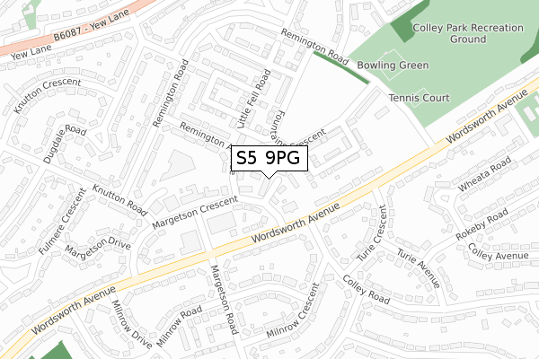
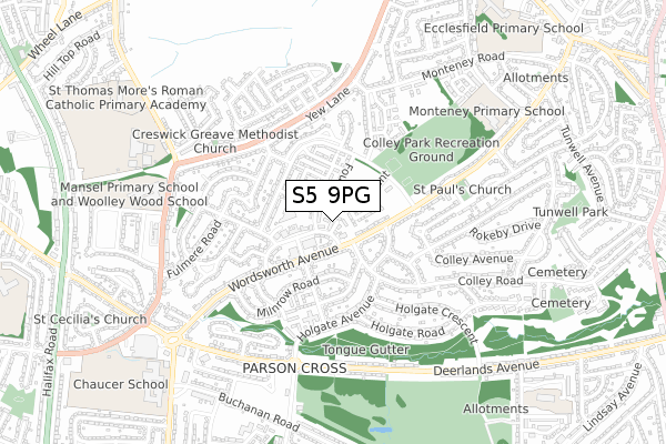
S5 9PG is located in the Southey electoral ward, within the metropolitan district of Sheffield and the English Parliamentary constituency of Sheffield, Brightside and Hillsborough. The Sub Integrated Care Board (ICB) Location is NHS South Yorkshire ICB - 03N and the police force is South Yorkshire. This postcode has been in use since November 2018.


GetTheData
Source: OS Open Zoomstack (Ordnance Survey)
Licence: Open Government Licence (requires attribution)
Attribution: Contains OS data © Crown copyright and database right 2025
Source: Open Postcode Geo
Licence: Open Government Licence (requires attribution)
Attribution: Contains OS data © Crown copyright and database right 2025; Contains Royal Mail data © Royal Mail copyright and database right 2025; Source: Office for National Statistics licensed under the Open Government Licence v.3.0
| Easting | 434874 |
| Northing | 392940 |
| Latitude | 53.432115 |
| Longitude | -1.476573 |
GetTheData
Source: Open Postcode Geo
Licence: Open Government Licence
| Country | England |
| Postcode District | S5 |
➜ See where S5 is on a map ➜ Where is Sheffield? | |
GetTheData
Source: Land Registry Price Paid Data
Licence: Open Government Licence
| Ward | Southey |
| Constituency | Sheffield, Brightside And Hillsborough |
GetTheData
Source: ONS Postcode Database
Licence: Open Government Licence
2024 19 JUL £225,000 |
2022 29 APR £210,000 |
2021 11 JAN £170,000 |
2019 26 SEP £159,995 |
14, YARLSIDE CLOSE, SHEFFIELD, S5 9PG 2019 28 JUN £151,995 |
2, YARLSIDE CLOSE, SHEFFIELD, S5 9PG 2019 29 MAR £143,995 |
7, YARLSIDE CLOSE, SHEFFIELD, S5 9PG 2019 31 JAN £151,995 |
2018 21 DEC £151,995 |
5, YARLSIDE CLOSE, SHEFFIELD, S5 9PG 2018 20 DEC £179,995 |
1, YARLSIDE CLOSE, SHEFFIELD, S5 9PG 2018 14 DEC £181,995 |
GetTheData
Source: HM Land Registry Price Paid Data
Licence: Contains HM Land Registry data © Crown copyright and database right 2025. This data is licensed under the Open Government Licence v3.0.
| Margetson Crescent (Wordsworth Avenue) | Parson Cross | 83m |
| Margetson Crescent (Wordsworth Avenue) | Parson Cross | 112m |
| Wordsworth Avenue (Colley Road) | Parson Cross | 156m |
| Wordsworth Avenue (Margetson Road) | Parson Cross | 162m |
| Milnrow Crescent (Colley Road) | Parson Cross | 207m |
| Chapeltown Station | 3.4km |
| Meadowhall Station | 4.5km |
GetTheData
Source: NaPTAN
Licence: Open Government Licence
| Percentage of properties with Next Generation Access | 100.0% |
| Percentage of properties with Superfast Broadband | 100.0% |
| Percentage of properties with Ultrafast Broadband | 100.0% |
| Percentage of properties with Full Fibre Broadband | 100.0% |
Superfast Broadband is between 30Mbps and 300Mbps
Ultrafast Broadband is > 300Mbps
| Percentage of properties unable to receive 2Mbps | 0.0% |
| Percentage of properties unable to receive 5Mbps | 0.0% |
| Percentage of properties unable to receive 10Mbps | 0.0% |
| Percentage of properties unable to receive 30Mbps | 0.0% |
GetTheData
Source: Ofcom
Licence: Ofcom Terms of Use (requires attribution)
GetTheData
Source: ONS Postcode Database
Licence: Open Government Licence


➜ Get more ratings from the Food Standards Agency
GetTheData
Source: Food Standards Agency
Licence: FSA terms & conditions
| Last Collection | |||
|---|---|---|---|
| Location | Mon-Fri | Sat | Distance |
| Margetson Crescent Post Office | 17:30 | 11:30 | 161m |
| Dugdale Drive | 17:30 | 09:30 | 282m |
| Coppin Square | 17:30 | 09:15 | 428m |
GetTheData
Source: Dracos
Licence: Creative Commons Attribution-ShareAlike
The below table lists the International Territorial Level (ITL) codes (formerly Nomenclature of Territorial Units for Statistics (NUTS) codes) and Local Administrative Units (LAU) codes for S5 9PG:
| ITL 1 Code | Name |
|---|---|
| TLE | Yorkshire and The Humber |
| ITL 2 Code | Name |
| TLE3 | South Yorkshire |
| ITL 3 Code | Name |
| TLE32 | Sheffield |
| LAU 1 Code | Name |
| E08000019 | Sheffield |
GetTheData
Source: ONS Postcode Directory
Licence: Open Government Licence
The below table lists the Census Output Area (OA), Lower Layer Super Output Area (LSOA), and Middle Layer Super Output Area (MSOA) for S5 9PG:
| Code | Name | |
|---|---|---|
| OA | E00172479 | |
| LSOA | E01008117 | Sheffield 009D |
| MSOA | E02001619 | Sheffield 009 |
GetTheData
Source: ONS Postcode Directory
Licence: Open Government Licence
| S5 9NB | Margetson Crescent | 67m |
| S5 9JE | Wordsworth Avenue | 106m |
| S5 9ND | Margetson Crescent | 111m |
| S5 9JD | Wordsworth Avenue | 120m |
| S5 9BF | Fountains Crescent | 123m |
| S5 9BG | Little Fell Road | 125m |
| S5 9PA | Remington Avenue | 131m |
| S5 9GY | Colley Road | 166m |
| S5 9JB | Turie Crescent | 209m |
| S5 9LX | Milnrow Road | 216m |
GetTheData
Source: Open Postcode Geo; Land Registry Price Paid Data
Licence: Open Government Licence