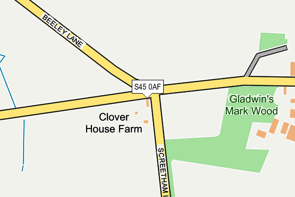
S45 0AF is located in the Ashover electoral ward, within the local authority district of North East Derbyshire and the English Parliamentary constituency of North East Derbyshire. The Sub Integrated Care Board (ICB) Location is NHS Derby and Derbyshire ICB - 15M and the police force is Derbyshire. This postcode has been in use since January 2017.


GetTheData
Source: OS OpenMap – Local (Ordnance Survey)
Source: OS VectorMap District (Ordnance Survey)
Licence: Open Government Licence (requires attribution)
| Easting | 430352 |
| Northing | 366710 |
| Latitude | 53.196629 |
| Longitude | -1.547130 |
GetTheData
Source: Open Postcode Geo
Licence: Open Government Licence
| Country | England |
| Postcode District | S45 |
➜ See where S45 is on a map | |
GetTheData
Source: Land Registry Price Paid Data
Licence: Open Government Licence
Elevation or altitude of S45 0AF as distance above sea level:
| Metres | Feet | |
|---|---|---|
| Elevation | 330m | 1,083ft |
Elevation is measured from the approximate centre of the postcode, to the nearest point on an OS contour line from OS Terrain 50, which has contour spacing of ten vertical metres.
➜ How high above sea level am I? Find the elevation of your current position using your device's GPS.
GetTheData
Source: Open Postcode Elevation
Licence: Open Government Licence
| Ward | Ashover |
| Constituency | North East Derbyshire |
GetTheData
Source: ONS Postcode Database
Licence: Open Government Licence
| Gladwins Mark | Uppertown | 310m |
| Gladwins Mark | Uppertown | 325m |
| Screetham Lane | Uppertown | 569m |
| Screetham Lane | Uppertown | 569m |
GetTheData
Source: NaPTAN
Licence: Open Government Licence
GetTheData
Source: ONS Postcode Database
Licence: Open Government Licence
| Last Collection | |||
|---|---|---|---|
| Location | Mon-Fri | Sat | Distance |
| Uppertown | 16:00 | 10:30 | 2,436m |
| Spitewinter / Matlock Road | 16:00 | 08:15 | 3,756m |
| Devonshire Square | 17:00 | 11:00 | 3,894m |
GetTheData
Source: Dracos
Licence: Creative Commons Attribution-ShareAlike
The below table lists the International Territorial Level (ITL) codes (formerly Nomenclature of Territorial Units for Statistics (NUTS) codes) and Local Administrative Units (LAU) codes for S45 0AF:
| ITL 1 Code | Name |
|---|---|
| TLF | East Midlands (England) |
| ITL 2 Code | Name |
| TLF1 | Derbyshire and Nottinghamshire |
| ITL 3 Code | Name |
| TLF12 | East Derbyshire |
| LAU 1 Code | Name |
| E07000038 | North East Derbyshire |
GetTheData
Source: ONS Postcode Directory
Licence: Open Government Licence
The below table lists the Census Output Area (OA), Lower Layer Super Output Area (LSOA), and Middle Layer Super Output Area (MSOA) for S45 0AF:
| Code | Name | |
|---|---|---|
| OA | E00100027 | |
| LSOA | E01019769 | North East Derbyshire 010A |
| MSOA | E02004114 | North East Derbyshire 010 |
GetTheData
Source: ONS Postcode Directory
Licence: Open Government Licence
| S45 0LR | Gladwins Mark | 302m |
| DE4 5LJ | Flash Lane | 1204m |
| S42 7HR | 1492m | |
| S45 0DG | Cullumbell Lane | 2136m |
| S45 0LP | Hunger Hill | 2195m |
| S45 0JB | Hodge Lane | 2293m |
| S45 0JF | Cullumbell Lane | 2473m |
| DE4 5LH | Jaggers Lane | 2508m |
| DE4 5LN | Darwin Forest Country Park | 2760m |
| DE4 5LP | Back Lane | 2981m |
GetTheData
Source: Open Postcode Geo; Land Registry Price Paid Data
Licence: Open Government Licence