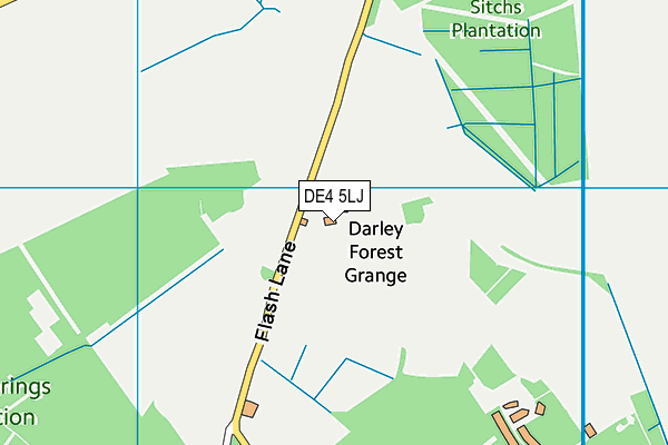
DE4 5LJ lies on Flash Lane in Darley Moor, Matlock. DE4 5LJ is located in the Darley Dale electoral ward, within the local authority district of Derbyshire Dales and the English Parliamentary constituency of Derbyshire Dales. The Sub Integrated Care Board (ICB) Location is NHS Derby and Derbyshire ICB - 15M and the police force is Derbyshire. This postcode has been in use since January 1980.


GetTheData
Source: OS OpenMap – Local (Ordnance Survey)
Source: OS VectorMap District (Ordnance Survey)
Licence: Open Government Licence (requires attribution)
| Easting | 429443 |
| Northing | 365920 |
| Latitude | 53.189560 |
| Longitude | -1.560811 |
GetTheData
Source: Open Postcode Geo
Licence: Open Government Licence
| Street | Flash Lane |
| Locality | Darley Moor |
| Town/City | Matlock |
| Country | England |
| Postcode District | DE4 |
➜ See where DE4 is on a map | |
GetTheData
Source: Land Registry Price Paid Data
Licence: Open Government Licence
Elevation or altitude of DE4 5LJ as distance above sea level:
| Metres | Feet | |
|---|---|---|
| Elevation | 320m | 1,050ft |
Elevation is measured from the approximate centre of the postcode, to the nearest point on an OS contour line from OS Terrain 50, which has contour spacing of ten vertical metres.
➜ How high above sea level am I? Find the elevation of your current position using your device's GPS.
GetTheData
Source: Open Postcode Elevation
Licence: Open Government Licence
| Ward | Darley Dale |
| Constituency | Derbyshire Dales |
GetTheData
Source: ONS Postcode Database
Licence: Open Government Licence
| Screetham Lane | Uppertown | 1,008m |
| Screetham Lane | Uppertown | 1,013m |
| Gladwins Mark | Uppertown | 1,470m |
| Gladwins Mark | Uppertown | 1,484m |
| Nursery Farm (Sydnope Hill) | Two Dales | 1,524m |
GetTheData
Source: NaPTAN
Licence: Open Government Licence
| Percentage of properties with Next Generation Access | 100.0% |
| Percentage of properties with Superfast Broadband | 66.7% |
| Percentage of properties with Ultrafast Broadband | 66.7% |
| Percentage of properties with Full Fibre Broadband | 66.7% |
Superfast Broadband is between 30Mbps and 300Mbps
Ultrafast Broadband is > 300Mbps
| Percentage of properties unable to receive 2Mbps | 0.0% |
| Percentage of properties unable to receive 5Mbps | 33.3% |
| Percentage of properties unable to receive 10Mbps | 33.3% |
| Percentage of properties unable to receive 30Mbps | 33.3% |
GetTheData
Source: Ofcom
Licence: Ofcom Terms of Use (requires attribution)
GetTheData
Source: ONS Postcode Database
Licence: Open Government Licence
| Last Collection | |||
|---|---|---|---|
| Location | Mon-Fri | Sat | Distance |
| Uppertown | 16:00 | 10:30 | 2,903m |
| Stancliffe Hall | 17:30 | 07:00 | 3,183m |
| Two Dales Village | 17:00 | 08:30 | 3,253m |
GetTheData
Source: Dracos
Licence: Creative Commons Attribution-ShareAlike
The below table lists the International Territorial Level (ITL) codes (formerly Nomenclature of Territorial Units for Statistics (NUTS) codes) and Local Administrative Units (LAU) codes for DE4 5LJ:
| ITL 1 Code | Name |
|---|---|
| TLF | East Midlands (England) |
| ITL 2 Code | Name |
| TLF1 | Derbyshire and Nottinghamshire |
| ITL 3 Code | Name |
| TLF13 | South and West Derbyshire |
| LAU 1 Code | Name |
| E07000035 | Derbyshire Dales |
GetTheData
Source: ONS Postcode Directory
Licence: Open Government Licence
The below table lists the Census Output Area (OA), Lower Layer Super Output Area (LSOA), and Middle Layer Super Output Area (MSOA) for DE4 5LJ:
| Code | Name | |
|---|---|---|
| OA | E00099186 | |
| LSOA | E01019610 | Derbyshire Dales 004B |
| MSOA | E02004071 | Derbyshire Dales 004 |
GetTheData
Source: ONS Postcode Directory
Licence: Open Government Licence
| S45 0LR | Gladwins Mark | 1472m |
| DE4 5LN | Darwin Forest Country Park | 1803m |
| DE4 5LP | Back Lane | 1886m |
| DE4 5LH | Jaggers Lane | 2219m |
| S45 0JB | Hodge Lane | 2510m |
| S42 7HR | 2670m | |
| S45 0DG | Cullumbell Lane | 2781m |
| DE4 2HP | Lumb Lane | 2790m |
| DE4 2FN | Sydnope Hill | 2872m |
| S45 0JF | Cullumbell Lane | 2918m |
GetTheData
Source: Open Postcode Geo; Land Registry Price Paid Data
Licence: Open Government Licence