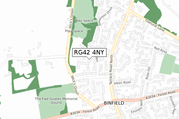
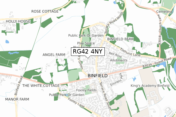
RG42 4NY is located in the Binfield North & Warfield West electoral ward, within the unitary authority of Bracknell Forest and the English Parliamentary constituency of Windsor. The Sub Integrated Care Board (ICB) Location is NHS Frimley ICB - D4U1Y and the police force is Thames Valley. This postcode has been in use since December 2017.


GetTheData
Source: OS Open Zoomstack (Ordnance Survey)
Licence: Open Government Licence (requires attribution)
Attribution: Contains OS data © Crown copyright and database right 2025
Source: Open Postcode Geo
Licence: Open Government Licence (requires attribution)
Attribution: Contains OS data © Crown copyright and database right 2025; Contains Royal Mail data © Royal Mail copyright and database right 2025; Source: Office for National Statistics licensed under the Open Government Licence v.3.0
| Easting | 484058 |
| Northing | 171207 |
| Latitude | 51.433640 |
| Longitude | -0.792155 |
GetTheData
Source: Open Postcode Geo
Licence: Open Government Licence
| Country | England |
| Postcode District | RG42 |
➜ See where RG42 is on a map ➜ Where is Binfield? | |
GetTheData
Source: Land Registry Price Paid Data
Licence: Open Government Licence
| Ward | Binfield North & Warfield West |
| Constituency | Windsor |
GetTheData
Source: ONS Postcode Database
Licence: Open Government Licence
2021 26 OCT £945,000 |
8, HALL GARDEN, BINFIELD, BRACKNELL, RG42 4NY 2019 4 APR £790,000 |
12, HALL GARDEN, BINFIELD, BRACKNELL, RG42 4NY 2019 7 MAR £825,000 |
23, HALL GARDEN, BINFIELD, BRACKNELL, RG42 4NY 2019 15 FEB £810,000 |
2, HALL GARDEN, BINFIELD, BRACKNELL, RG42 4NY 2019 1 FEB £846,200 |
2019 30 JAN £910,000 |
21, HALL GARDEN, BINFIELD, BRACKNELL, RG42 4NY 2018 26 JUL £752,500 |
5, HALL GARDEN, BINFIELD, BRACKNELL, RG42 4NY 2018 31 MAY £435,000 |
10, HALL GARDEN, BINFIELD, BRACKNELL, RG42 4NY 2018 29 MAY £715,000 |
3, HALL GARDEN, BINFIELD, BRACKNELL, RG42 4NY 2018 25 MAY £450,000 |
GetTheData
Source: HM Land Registry Price Paid Data
Licence: Contains HM Land Registry data © Crown copyright and database right 2025. This data is licensed under the Open Government Licence v3.0.
| Terrace Road North H & R 1 (Terrace Road North) | Binfield | 122m |
| Terrace Road North H & R 1 (Terrace Road North) | Binfield | 129m |
| Royal Standard Ph (Forest Road) | Binfield | 280m |
| Royal Standard Ph (Terrace Road South) | Binfield | 310m |
| Royal Standard Ph (Terrace Road South) | Binfield | 312m |
| Bracknell Station | 3.6km |
| Wokingham Station | 4.3km |
| Martins Heron Station | 5.5km |
GetTheData
Source: NaPTAN
Licence: Open Government Licence
| Percentage of properties with Next Generation Access | 100.0% |
| Percentage of properties with Superfast Broadband | 100.0% |
| Percentage of properties with Ultrafast Broadband | 100.0% |
| Percentage of properties with Full Fibre Broadband | 0.0% |
Superfast Broadband is between 30Mbps and 300Mbps
Ultrafast Broadband is > 300Mbps
| Median download speed | 39.2Mbps |
| Average download speed | 55.8Mbps |
| Maximum download speed | 350.00Mbps |
| Median upload speed | 9.9Mbps |
| Average upload speed | 9.0Mbps |
| Maximum upload speed | 19.53Mbps |
| Percentage of properties unable to receive 2Mbps | 0.0% |
| Percentage of properties unable to receive 5Mbps | 0.0% |
| Percentage of properties unable to receive 10Mbps | 0.0% |
| Percentage of properties unable to receive 30Mbps | 0.0% |
GetTheData
Source: Ofcom
Licence: Ofcom Terms of Use (requires attribution)


➜ Get more ratings from the Food Standards Agency
GetTheData
Source: Food Standards Agency
Licence: FSA terms & conditions
| Last Collection | |||
|---|---|---|---|
| Location | Mon-Fri | Sat | Distance |
| Binfield House | 16:15 | 11:00 | 123m |
| Monks Alley | 16:00 | 11:15 | 276m |
| Binfield Post Office | 16:15 | 11:00 | 316m |
GetTheData
Source: Dracos
Licence: Creative Commons Attribution-ShareAlike
The below table lists the International Territorial Level (ITL) codes (formerly Nomenclature of Territorial Units for Statistics (NUTS) codes) and Local Administrative Units (LAU) codes for RG42 4NY:
| ITL 1 Code | Name |
|---|---|
| TLJ | South East (England) |
| ITL 2 Code | Name |
| TLJ1 | Berkshire, Buckinghamshire and Oxfordshire |
| ITL 3 Code | Name |
| TLJ11 | Berkshire |
| LAU 1 Code | Name |
| E06000036 | Bracknell Forest |
GetTheData
Source: ONS Postcode Directory
Licence: Open Government Licence
The below table lists the Census Output Area (OA), Lower Layer Super Output Area (LSOA), and Middle Layer Super Output Area (MSOA) for RG42 4NY:
| Code | Name | |
|---|---|---|
| OA | E00081791 | |
| LSOA | E01016187 | Bracknell Forest 002D |
| MSOA | E02003353 | Bracknell Forest 002 |
GetTheData
Source: ONS Postcode Directory
Licence: Open Government Licence
| RG42 4NZ | Knox Green | 145m |
| RG42 5HX | Terrace Road North | 165m |
| RG42 5TF | Winch Close | 171m |
| RG42 5JB | Victoria Place | 184m |
| RG42 5JG | Terrace Road North | 192m |
| RG42 4HY | Chase Gardens | 200m |
| RG42 5JA | Terrace Road North | 208m |
| RG42 5TB | Stevenson Drive | 212m |
| RG42 5HR | Terrace Road North | 216m |
| RG42 5JQ | Eaglehurst Cottages | 225m |
GetTheData
Source: Open Postcode Geo; Land Registry Price Paid Data
Licence: Open Government Licence