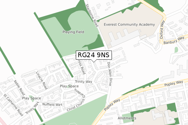
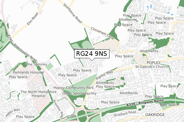
RG24 9NS is located in the Sherborne St John & Rooksdown electoral ward, within the local authority district of Basingstoke and Deane and the English Parliamentary constituency of Basingstoke. The Sub Integrated Care Board (ICB) Location is NHS Hampshire and Isle of Wight ICB - D9Y0V and the police force is Hampshire. This postcode has been in use since August 2018.


GetTheData
Source: OS Open Zoomstack (Ordnance Survey)
Licence: Open Government Licence (requires attribution)
Attribution: Contains OS data © Crown copyright and database right 2025
Source: Open Postcode Geo
Licence: Open Government Licence (requires attribution)
Attribution: Contains OS data © Crown copyright and database right 2025; Contains Royal Mail data © Royal Mail copyright and database right 2025; Source: Office for National Statistics licensed under the Open Government Licence v.3.0
| Easting | 462893 |
| Northing | 154279 |
| Latitude | 51.284187 |
| Longitude | -1.099564 |
GetTheData
Source: Open Postcode Geo
Licence: Open Government Licence
| Country | England |
| Postcode District | RG24 |
➜ See where RG24 is on a map ➜ Where is Basingstoke? | |
GetTheData
Source: Land Registry Price Paid Data
Licence: Open Government Licence
| Ward | Sherborne St John & Rooksdown |
| Constituency | Basingstoke |
GetTheData
Source: ONS Postcode Database
Licence: Open Government Licence
2024 25 MAR £385,000 |
2022 4 NOV £426,500 |
24, LADY MARGARET HALL WAY, BASINGSTOKE, RG24 9NS 2019 31 MAY £346,950 |
2019 31 MAY £345,950 |
20, LADY MARGARET HALL WAY, BASINGSTOKE, RG24 9NS 2019 20 MAY £349,950 |
28, LADY MARGARET HALL WAY, BASINGSTOKE, RG24 9NS 2019 30 APR £424,950 |
22, LADY MARGARET HALL WAY, BASINGSTOKE, RG24 9NS 2019 30 APR £359,950 |
26, LADY MARGARET HALL WAY, BASINGSTOKE, RG24 9NS 2019 26 APR £359,950 |
32, LADY MARGARET HALL WAY, BASINGSTOKE, RG24 9NS 2019 15 APR £354,950 |
30, LADY MARGARET HALL WAY, BASINGSTOKE, RG24 9NS 2019 11 APR £359,950 |
GetTheData
Source: HM Land Registry Price Paid Data
Licence: Contains HM Land Registry data © Crown copyright and database right 2025. This data is licensed under the Open Government Licence v3.0.
| Buckfast Close (Popley Way) | Popley | 246m |
| Romsey Close (Popley Way) | Popley | 301m |
| Tintern Close (Popley Way) | Popley | 376m |
| Tintern Close (Popley Way) | Popley | 434m |
| Farringdon Court (Banbury Way) | Popley | 498m |
| Basingstoke Station | 2km |
GetTheData
Source: NaPTAN
Licence: Open Government Licence
| Percentage of properties with Next Generation Access | 100.0% |
| Percentage of properties with Superfast Broadband | 100.0% |
| Percentage of properties with Ultrafast Broadband | 100.0% |
| Percentage of properties with Full Fibre Broadband | 100.0% |
Superfast Broadband is between 30Mbps and 300Mbps
Ultrafast Broadband is > 300Mbps
| Percentage of properties unable to receive 2Mbps | 0.0% |
| Percentage of properties unable to receive 5Mbps | 0.0% |
| Percentage of properties unable to receive 10Mbps | 0.0% |
| Percentage of properties unable to receive 30Mbps | 0.0% |
GetTheData
Source: Ofcom
Licence: Ofcom Terms of Use (requires attribution)
GetTheData
Source: ONS Postcode Database
Licence: Open Government Licence

➜ Get more ratings from the Food Standards Agency
GetTheData
Source: Food Standards Agency
Licence: FSA terms & conditions
| Last Collection | |||
|---|---|---|---|
| Location | Mon-Fri | Sat | Distance |
| Abbey Court | 16:45 | 11:00 | 524m |
| Abbey Road West | 17:15 | 11:15 | 532m |
| Abbey Road Post Office | 17:00 | 12:00 | 737m |
GetTheData
Source: Dracos
Licence: Creative Commons Attribution-ShareAlike
The below table lists the International Territorial Level (ITL) codes (formerly Nomenclature of Territorial Units for Statistics (NUTS) codes) and Local Administrative Units (LAU) codes for RG24 9NS:
| ITL 1 Code | Name |
|---|---|
| TLJ | South East (England) |
| ITL 2 Code | Name |
| TLJ3 | Hampshire and Isle of Wight |
| ITL 3 Code | Name |
| TLJ37 | North Hampshire |
| LAU 1 Code | Name |
| E07000084 | Basingstoke and Deane |
GetTheData
Source: ONS Postcode Directory
Licence: Open Government Licence
The below table lists the Census Output Area (OA), Lower Layer Super Output Area (LSOA), and Middle Layer Super Output Area (MSOA) for RG24 9NS:
| Code | Name | |
|---|---|---|
| OA | E00167846 | |
| LSOA | E01032844 | Basingstoke and Deane 007I |
| MSOA | E02004681 | Basingstoke and Deane 007 |
GetTheData
Source: ONS Postcode Directory
Licence: Open Government Licence
| RG24 9AW | Maldive Road | 69m |
| RG24 9AP | Maldive Road | 82m |
| RG24 9AD | Trinity Way | 192m |
| RG24 9HW | St Anne Gardens | 209m |
| RG24 9QE | St Anne Gardens | 225m |
| RG24 9LP | Sherborne Road | 267m |
| RG24 9FS | Marston Walk | 279m |
| RG24 9FP | Oxford Way | 293m |
| RG24 9HN | Linacre Road | 312m |
| RG24 9HE | Tintern Close | 312m |
GetTheData
Source: Open Postcode Geo; Land Registry Price Paid Data
Licence: Open Government Licence