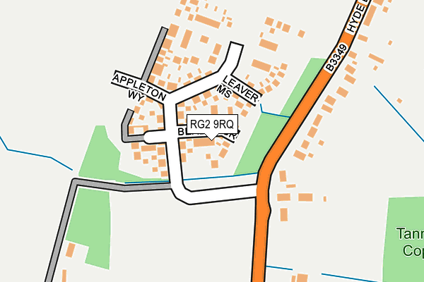
RG2 9RQ is located in the Shinfield South electoral ward, within the unitary authority of Wokingham and the English Parliamentary constituency of Wokingham. The Sub Integrated Care Board (ICB) Location is NHS Buckinghamshire, Oxfordshire and Berkshire West ICB - 15A and the police force is Thames Valley. This postcode has been in use since May 2017.


GetTheData
Source: OS OpenMap – Local (Ordnance Survey)
Source: OS VectorMap District (Ordnance Survey)
Licence: Open Government Licence (requires attribution)
| Easting | 473107 |
| Northing | 167406 |
| Latitude | 51.400985 |
| Longitude | -0.950439 |
GetTheData
Source: Open Postcode Geo
Licence: Open Government Licence
| Country | England |
| Postcode District | RG2 |
➜ See where RG2 is on a map ➜ Where is Shinfield? | |
GetTheData
Source: Land Registry Price Paid Data
Licence: Open Government Licence
| Ward | Shinfield South |
| Constituency | Wokingham |
GetTheData
Source: ONS Postcode Database
Licence: Open Government Licence
2021 4 NOV £601,000 |
14, BEALES GROVE, SHINFIELD, READING, RG2 9RQ 2017 16 JUN £460,000 |
2017 26 MAY £594,950 |
12, BEALES GROVE, SHINFIELD, READING, RG2 9RQ 2017 26 MAY £490,000 |
GetTheData
Source: HM Land Registry Price Paid Data
Licence: Contains HM Land Registry data © Crown copyright and database right 2025. This data is licensed under the Open Government Licence v3.0.
| School Green (Hollow Lane) | Shinfield | 613m |
| School Green (Hollow Lane) | Shinfield | 648m |
| Church Lane (Hollow Lane) | Shinfield | 861m |
| Church Lane (Hollow Lane) | Shinfield | 886m |
| Magpie And Parrot (Arborfield Road) | School Green | 931m |
| Earley Station | 5km |
| Winnersh Triangle Station | 5.7km |
GetTheData
Source: NaPTAN
Licence: Open Government Licence
| Percentage of properties with Next Generation Access | 100.0% |
| Percentage of properties with Superfast Broadband | 100.0% |
| Percentage of properties with Ultrafast Broadband | 100.0% |
| Percentage of properties with Full Fibre Broadband | 100.0% |
Superfast Broadband is between 30Mbps and 300Mbps
Ultrafast Broadband is > 300Mbps
| Percentage of properties unable to receive 2Mbps | 0.0% |
| Percentage of properties unable to receive 5Mbps | 0.0% |
| Percentage of properties unable to receive 10Mbps | 0.0% |
| Percentage of properties unable to receive 30Mbps | 0.0% |
GetTheData
Source: Ofcom
Licence: Ofcom Terms of Use (requires attribution)
GetTheData
Source: ONS Postcode Database
Licence: Open Government Licence


➜ Get more ratings from the Food Standards Agency
GetTheData
Source: Food Standards Agency
Licence: FSA terms & conditions
| Last Collection | |||
|---|---|---|---|
| Location | Mon-Fri | Sat | Distance |
| Shinfield Church | 17:15 | 08:00 | 694m |
| Shinfield Road Post Office | 17:00 | 12:00 | 1,494m |
| Three Mile Cross Post Office | 17:00 | 08:30 | 1,627m |
GetTheData
Source: Dracos
Licence: Creative Commons Attribution-ShareAlike
The below table lists the International Territorial Level (ITL) codes (formerly Nomenclature of Territorial Units for Statistics (NUTS) codes) and Local Administrative Units (LAU) codes for RG2 9RQ:
| ITL 1 Code | Name |
|---|---|
| TLJ | South East (England) |
| ITL 2 Code | Name |
| TLJ1 | Berkshire, Buckinghamshire and Oxfordshire |
| ITL 3 Code | Name |
| TLJ11 | Berkshire |
| LAU 1 Code | Name |
| E06000041 | Wokingham |
GetTheData
Source: ONS Postcode Directory
Licence: Open Government Licence
The below table lists the Census Output Area (OA), Lower Layer Super Output Area (LSOA), and Middle Layer Super Output Area (MSOA) for RG2 9RQ:
| Code | Name | |
|---|---|---|
| OA | E00167032 | |
| LSOA | E01032758 | Wokingham 012G |
| MSOA | E02003450 | Wokingham 012 |
GetTheData
Source: ONS Postcode Directory
Licence: Open Government Licence
| RG2 9EP | Hyde End Road | 117m |
| RG2 9EN | Millworth Lane | 367m |
| RG2 9EL | Chestnut Crescent | 493m |
| RG2 9HA | Chestnut Crescent | 509m |
| RG2 9EH | School Green | 519m |
| RG2 9EE | School Green | 534m |
| RG2 9AT | Mandarin Road | 551m |
| RG2 9EJ | Chestnut Crescent | 551m |
| RG2 9EF | Vickers Close | 594m |
| RG2 9EG | Hollow Lane | 617m |
GetTheData
Source: Open Postcode Geo; Land Registry Price Paid Data
Licence: Open Government Licence