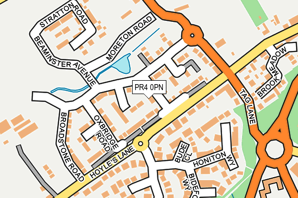
PR4 0PN is located in the Preston Rural North electoral ward, within the local authority district of Preston and the English Parliamentary constituency of Wyre and Preston North. The Sub Integrated Care Board (ICB) Location is NHS Lancashire and South Cumbria ICB - 01E and the police force is Lancashire. This postcode has been in use since March 2017.


GetTheData
Source: OS OpenMap – Local (Ordnance Survey)
Source: OS VectorMap District (Ordnance Survey)
Licence: Open Government Licence (requires attribution)
| Easting | 350538 |
| Northing | 432975 |
| Latitude | 53.790742 |
| Longitude | -2.752276 |
GetTheData
Source: Open Postcode Geo
Licence: Open Government Licence
| Country | England |
| Postcode District | PR4 |
➜ See where PR4 is on a map ➜ Where is Cottam? | |
GetTheData
Source: Land Registry Price Paid Data
Licence: Open Government Licence
| Ward | Preston Rural North |
| Constituency | Wyre And Preston North |
GetTheData
Source: ONS Postcode Database
Licence: Open Government Licence
2024 5 JUL £269,000 |
2022 9 DEC £274,000 |
2022 9 SEP £276,000 |
2020 7 FEB £232,000 |
25, DORCHESTER ROAD, COTTAM, PRESTON, PR4 0PN 2018 29 MAY £223,984 |
23, DORCHESTER ROAD, COTTAM, PRESTON, PR4 0PN 2018 23 MAR £274,995 |
19, DORCHESTER ROAD, COTTAM, PRESTON, PR4 0PN 2017 15 DEC £269,995 |
21, DORCHESTER ROAD, COTTAM, PRESTON, PR4 0PN 2017 23 NOV £249,995 |
17, DORCHESTER ROAD, COTTAM, PRESTON, PR4 0PN 2017 27 OCT £249,995 |
14, DORCHESTER ROAD, COTTAM, PRESTON, PR4 0PN 2017 29 SEP £269,995 |
GetTheData
Source: HM Land Registry Price Paid Data
Licence: Contains HM Land Registry data © Crown copyright and database right 2025. This data is licensed under the Open Government Licence v3.0.
| Tag Lane | Nog Tow | 147m |
| Tag Lane Shelter (Tag Lane) | Nog Tow | 150m |
| Post Ofice (Hoyles Lane) | Cottam | 192m |
| The Guild Merchant (Tanterton Hall Road) | Tanterton | 334m |
| Post Office (Hoyles Lane) | Cottam | 345m |
| Salwick Station | 4.4km |
| Preston Station | 4.8km |
GetTheData
Source: NaPTAN
Licence: Open Government Licence
| Percentage of properties with Next Generation Access | 100.0% |
| Percentage of properties with Superfast Broadband | 100.0% |
| Percentage of properties with Ultrafast Broadband | 100.0% |
| Percentage of properties with Full Fibre Broadband | 0.0% |
Superfast Broadband is between 30Mbps and 300Mbps
Ultrafast Broadband is > 300Mbps
| Median download speed | 100.0Mbps |
| Average download speed | 130.4Mbps |
| Maximum download speed | 350.00Mbps |
| Median upload speed | 14.8Mbps |
| Average upload speed | 14.8Mbps |
| Maximum upload speed | 19.53Mbps |
| Percentage of properties unable to receive 2Mbps | 0.0% |
| Percentage of properties unable to receive 5Mbps | 0.0% |
| Percentage of properties unable to receive 10Mbps | 0.0% |
| Percentage of properties unable to receive 30Mbps | 0.0% |
GetTheData
Source: Ofcom
Licence: Ofcom Terms of Use (requires attribution)
GetTheData
Source: ONS Postcode Database
Licence: Open Government Licence


➜ Get more ratings from the Food Standards Agency
GetTheData
Source: Food Standards Agency
Licence: FSA terms & conditions
| Last Collection | |||
|---|---|---|---|
| Location | Mon-Fri | Sat | Distance |
| Nog Tow | 16:00 | 10:30 | 121m |
| Ingol Post Office | 17:30 | 11:30 | 1,666m |
| 89 Landsdown Hill, Fulwood | 17:45 | 11:30 | 1,864m |
GetTheData
Source: Dracos
Licence: Creative Commons Attribution-ShareAlike
The below table lists the International Territorial Level (ITL) codes (formerly Nomenclature of Territorial Units for Statistics (NUTS) codes) and Local Administrative Units (LAU) codes for PR4 0PN:
| ITL 1 Code | Name |
|---|---|
| TLD | North West (England) |
| ITL 2 Code | Name |
| TLD4 | Lancashire |
| ITL 3 Code | Name |
| TLD45 | Mid Lancashire |
| LAU 1 Code | Name |
| E07000123 | Preston |
GetTheData
Source: ONS Postcode Directory
Licence: Open Government Licence
The below table lists the Census Output Area (OA), Lower Layer Super Output Area (LSOA), and Middle Layer Super Output Area (MSOA) for PR4 0PN:
| Code | Name | |
|---|---|---|
| OA | E00128321 | |
| LSOA | E01025280 | Preston 002C |
| MSOA | E02005254 | Preston 002 |
GetTheData
Source: ONS Postcode Directory
Licence: Open Government Licence
| PR4 0LU | Bude Close | 102m |
| PR4 0NA | Tag Lane | 131m |
| PR4 0LY | Barnstaple Way | 147m |
| PR4 0LW | Honiton Way | 186m |
| PR4 0LB | Hoyles Lane | 187m |
| PR4 0JE | Sandringham Way | 208m |
| PR4 0AA | Brook Meadow | 210m |
| PR4 0LX | Bideford Way | 217m |
| PR4 0LT | Kingsley Road | 268m |
| PR4 0JF | Blenheim Way | 289m |
GetTheData
Source: Open Postcode Geo; Land Registry Price Paid Data
Licence: Open Government Licence