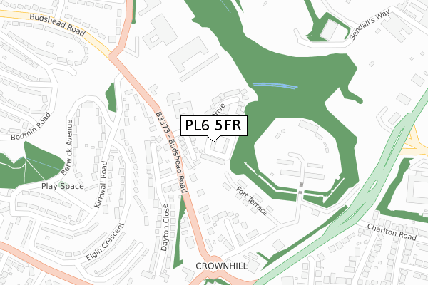
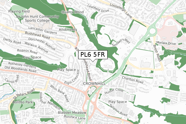
PL6 5FR is located in the Budshead electoral ward, within the unitary authority of Plymouth and the English Parliamentary constituency of Plymouth, Moor View. The Sub Integrated Care Board (ICB) Location is NHS Devon ICB - 15N and the police force is Devon & Cornwall. This postcode has been in use since August 2018.


GetTheData
Source: OS Open Zoomstack (Ordnance Survey)
Licence: Open Government Licence (requires attribution)
Attribution: Contains OS data © Crown copyright and database right 2025
Source: Open Postcode Geo
Licence: Open Government Licence (requires attribution)
Attribution: Contains OS data © Crown copyright and database right 2025; Contains Royal Mail data © Royal Mail copyright and database right 2025; Source: Office for National Statistics licensed under the Open Government Licence v.3.0
| Easting | 248540 |
| Northing | 59256 |
| Latitude | 50.413582 |
| Longitude | -4.133139 |
GetTheData
Source: Open Postcode Geo
Licence: Open Government Licence
| Country | England |
| Postcode District | PL6 |
➜ See where PL6 is on a map ➜ Where is Plymouth? | |
GetTheData
Source: Land Registry Price Paid Data
Licence: Open Government Licence
| Ward | Budshead |
| Constituency | Plymouth, Moor View |
GetTheData
Source: ONS Postcode Database
Licence: Open Government Licence
2020 20 NOV £460,000 |
2019 13 DEC £428,250 |
11, BERKELEY SQUARE, PLYMOUTH, PL6 5FR 2019 8 NOV £410,000 |
9, BERKELEY SQUARE, PLYMOUTH, PL6 5FR 2019 8 NOV £410,000 |
1, BERKELEY SQUARE, PLYMOUTH, PL6 5FR 2019 6 SEP £415,000 |
14, BERKELEY SQUARE, PLYMOUTH, PL6 5FR 2019 22 AUG £450,000 |
15, BERKELEY SQUARE, PLYMOUTH, PL6 5FR 2019 21 JUN £445,000 |
2019 22 MAR £450,000 |
6, BERKELEY SQUARE, PLYMOUTH, PL6 5FR 2019 21 MAR £465,000 |
5, BERKELEY SQUARE, PLYMOUTH, PL6 5FR 2019 8 MAR £465,000 |
GetTheData
Source: HM Land Registry Price Paid Data
Licence: Contains HM Land Registry data © Crown copyright and database right 2025. This data is licensed under the Open Government Licence v3.0.
| Dayton Close (Budshead Road) | Crownhill | 94m |
| Dayton Close (Budshead Road) | Crownhill | 98m |
| Budshead Road Filling Station (Budshead Road) | Crownhill | 188m |
| Rogers Garage (Budshead Road) | Crownhill | 223m |
| Kirkwall Road (Budshead Road) | Crownhill | 226m |
| Plymouth Station | 4km |
| St Budeaux Ferry Road Station | 4.1km |
| St Budeaux Victoria Road Station | 4.1km |
GetTheData
Source: NaPTAN
Licence: Open Government Licence
| Percentage of properties with Next Generation Access | 100.0% |
| Percentage of properties with Superfast Broadband | 100.0% |
| Percentage of properties with Ultrafast Broadband | 0.0% |
| Percentage of properties with Full Fibre Broadband | 0.0% |
Superfast Broadband is between 30Mbps and 300Mbps
Ultrafast Broadband is > 300Mbps
| Median download speed | 39.0Mbps |
| Average download speed | 35.4Mbps |
| Maximum download speed | 43.23Mbps |
| Median upload speed | 9.8Mbps |
| Average upload speed | 8.9Mbps |
| Maximum upload speed | 11.56Mbps |
| Percentage of properties unable to receive 2Mbps | 0.0% |
| Percentage of properties unable to receive 5Mbps | 0.0% |
| Percentage of properties unable to receive 10Mbps | 0.0% |
| Percentage of properties unable to receive 30Mbps | 0.0% |
GetTheData
Source: Ofcom
Licence: Ofcom Terms of Use (requires attribution)
GetTheData
Source: ONS Postcode Database
Licence: Open Government Licence


➜ Get more ratings from the Food Standards Agency
GetTheData
Source: Food Standards Agency
Licence: FSA terms & conditions
| Last Collection | |||
|---|---|---|---|
| Location | Mon-Fri | Sat | Distance |
| Crownhill Post Office | 18:15 | 12:00 | 708m |
| Hartley Vale | 18:00 | 12:00 | 1,606m |
| Treveneague Gardens | 17:15 | 12:45 | 1,706m |
GetTheData
Source: Dracos
Licence: Creative Commons Attribution-ShareAlike
The below table lists the International Territorial Level (ITL) codes (formerly Nomenclature of Territorial Units for Statistics (NUTS) codes) and Local Administrative Units (LAU) codes for PL6 5FR:
| ITL 1 Code | Name |
|---|---|
| TLK | South West (England) |
| ITL 2 Code | Name |
| TLK4 | Devon |
| ITL 3 Code | Name |
| TLK41 | Plymouth |
| LAU 1 Code | Name |
| E06000026 | Plymouth |
GetTheData
Source: ONS Postcode Directory
Licence: Open Government Licence
The below table lists the Census Output Area (OA), Lower Layer Super Output Area (LSOA), and Middle Layer Super Output Area (MSOA) for PL6 5FR:
| Code | Name | |
|---|---|---|
| OA | E00075910 | |
| LSOA | E01015029 | Plymouth 008A |
| MSOA | E02003129 | Plymouth 008 |
GetTheData
Source: ONS Postcode Directory
Licence: Open Government Licence
| PL6 5TZ | Oak Drive | 62m |
| PL6 5DP | Lodge Gardens | 154m |
| PL6 5BU | Fort Terrace | 160m |
| PL6 5DU | Budshead Road | 185m |
| PL6 5BY | Kingsway Gardens | 190m |
| PL6 5BX | Crownhill Fort Road | 202m |
| PL5 3BX | Elgin Crescent | 206m |
| PL6 5DY | Budshead Road | 210m |
| PL5 3TH | Kirkwall Road | 213m |
| PL6 5DX | Dayton Close | 230m |
GetTheData
Source: Open Postcode Geo; Land Registry Price Paid Data
Licence: Open Government Licence