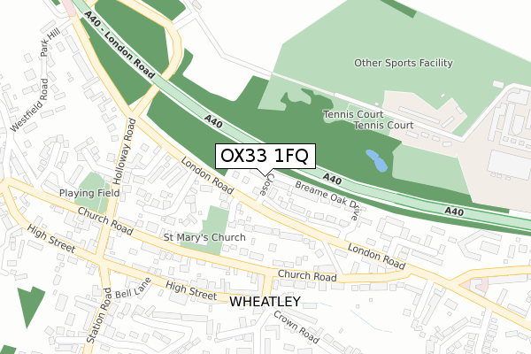
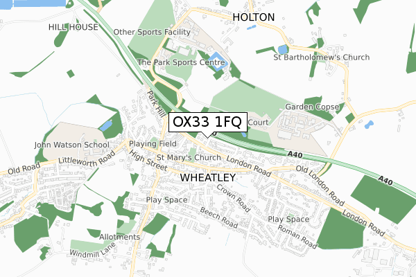
OX33 1FQ is located in the Wheatley electoral ward, within the local authority district of South Oxfordshire and the English Parliamentary constituency of Henley. The Sub Integrated Care Board (ICB) Location is NHS Buckinghamshire, Oxfordshire and Berkshire West ICB - 10Q and the police force is Thames Valley. This postcode has been in use since January 2018.


GetTheData
Source: OS Open Zoomstack (Ordnance Survey)
Licence: Open Government Licence (requires attribution)
Attribution: Contains OS data © Crown copyright and database right 2025
Source: Open Postcode Geo
Licence: Open Government Licence (requires attribution)
Attribution: Contains OS data © Crown copyright and database right 2025; Contains Royal Mail data © Royal Mail copyright and database right 2025; Source: Office for National Statistics licensed under the Open Government Licence v.3.0
| Easting | 459826 |
| Northing | 205910 |
| Latitude | 51.748706 |
| Longitude | -1.134786 |
GetTheData
Source: Open Postcode Geo
Licence: Open Government Licence
| Country | England |
| Postcode District | OX33 |
➜ See where OX33 is on a map ➜ Where is Wheatley? | |
GetTheData
Source: Land Registry Price Paid Data
Licence: Open Government Licence
| Ward | Wheatley |
| Constituency | Henley |
GetTheData
Source: ONS Postcode Database
Licence: Open Government Licence
2022 27 MAY £512,500 |
2021 18 JUN £725,000 |
2020 21 DEC £485,000 |
3, OCHRE CLOSE, WHEATLEY, OXFORD, OX33 1FQ 2018 4 MAY £675,000 |
2, OCHRE CLOSE, WHEATLEY, OXFORD, OX33 1FQ 2018 29 MAR £450,000 |
6, OCHRE CLOSE, WHEATLEY, OXFORD, OX33 1FQ 2018 26 JAN £800,000 |
2017 22 DEC £450,000 |
8, OCHRE CLOSE, WHEATLEY, OXFORD, OX33 1FQ 2017 20 DEC £795,000 |
2017 19 DEC £695,000 |
1, OCHRE CLOSE, WHEATLEY, OXFORD, OX33 1FQ 2017 18 DEC £720,000 |
GetTheData
Source: HM Land Registry Price Paid Data
Licence: Contains HM Land Registry data © Crown copyright and database right 2025. This data is licensed under the Open Government Licence v3.0.
| The Glebe (London Road) | Wheatley | 54m |
| The Glebe (London Road) | Wheatley | 68m |
| Friday Lane (Church Road) | Wheatley | 174m |
| Friday Lane (Church Road) | Wheatley | 174m |
| Kings Arms Ph (Church Road) | Wheatley | 254m |
GetTheData
Source: NaPTAN
Licence: Open Government Licence
| Percentage of properties with Next Generation Access | 100.0% |
| Percentage of properties with Superfast Broadband | 100.0% |
| Percentage of properties with Ultrafast Broadband | 100.0% |
| Percentage of properties with Full Fibre Broadband | 100.0% |
Superfast Broadband is between 30Mbps and 300Mbps
Ultrafast Broadband is > 300Mbps
| Percentage of properties unable to receive 2Mbps | 0.0% |
| Percentage of properties unable to receive 5Mbps | 0.0% |
| Percentage of properties unable to receive 10Mbps | 0.0% |
| Percentage of properties unable to receive 30Mbps | 0.0% |
GetTheData
Source: Ofcom
Licence: Ofcom Terms of Use (requires attribution)
GetTheData
Source: ONS Postcode Database
Licence: Open Government Licence


➜ Get more ratings from the Food Standards Agency
GetTheData
Source: Food Standards Agency
Licence: FSA terms & conditions
| Last Collection | |||
|---|---|---|---|
| Location | Mon-Fri | Sat | Distance |
| Wheatley Post Office | 18:15 | 11:45 | 224m |
| Church Road | 16:30 | 09:30 | 317m |
| London Road | 16:15 | 10:00 | 600m |
GetTheData
Source: Dracos
Licence: Creative Commons Attribution-ShareAlike
The below table lists the International Territorial Level (ITL) codes (formerly Nomenclature of Territorial Units for Statistics (NUTS) codes) and Local Administrative Units (LAU) codes for OX33 1FQ:
| ITL 1 Code | Name |
|---|---|
| TLJ | South East (England) |
| ITL 2 Code | Name |
| TLJ1 | Berkshire, Buckinghamshire and Oxfordshire |
| ITL 3 Code | Name |
| TLJ14 | Oxfordshire CC |
| LAU 1 Code | Name |
| E07000179 | South Oxfordshire |
GetTheData
Source: ONS Postcode Directory
Licence: Open Government Licence
The below table lists the Census Output Area (OA), Lower Layer Super Output Area (LSOA), and Middle Layer Super Output Area (MSOA) for OX33 1FQ:
| Code | Name | |
|---|---|---|
| OA | E00145877 | |
| LSOA | E01028639 | South Oxfordshire 002B |
| MSOA | E02005959 | South Oxfordshire 002 |
GetTheData
Source: ONS Postcode Directory
Licence: Open Government Licence
| OX33 1YN | The Glebe | 76m |
| OX33 1YA | London Road | 131m |
| OX33 1YP | St Marys Close | 181m |
| OX33 1LZ | Church Road | 213m |
| OX33 1LT | Fridays Lane | 214m |
| OX33 1LU | Church Road | 216m |
| OX33 1UE | High Street | 226m |
| OX33 1FN | Cromwell Place | 234m |
| OX33 1XP | High Street | 237m |
| OX33 1ZD | Robins Court | 252m |
GetTheData
Source: Open Postcode Geo; Land Registry Price Paid Data
Licence: Open Government Licence