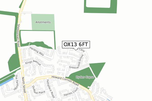
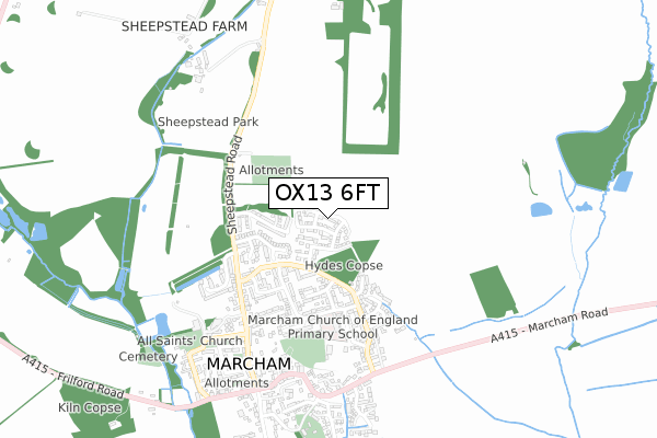
OX13 6FT is located in the Marcham electoral ward, within the local authority district of Vale of White Horse and the English Parliamentary constituency of Wantage. The Sub Integrated Care Board (ICB) Location is NHS Buckinghamshire, Oxfordshire and Berkshire West ICB - 10Q and the police force is Thames Valley. This postcode has been in use since October 2017.


GetTheData
Source: OS Open Zoomstack (Ordnance Survey)
Licence: Open Government Licence (requires attribution)
Attribution: Contains OS data © Crown copyright and database right 2025
Source: Open Postcode Geo
Licence: Open Government Licence (requires attribution)
Attribution: Contains OS data © Crown copyright and database right 2025; Contains Royal Mail data © Royal Mail copyright and database right 2025; Source: Office for National Statistics licensed under the Open Government Licence v.3.0
| Easting | 445759 |
| Northing | 197275 |
| Latitude | 51.672394 |
| Longitude | -1.339667 |
GetTheData
Source: Open Postcode Geo
Licence: Open Government Licence
| Country | England |
| Postcode District | OX13 |
➜ See where OX13 is on a map ➜ Where is Marcham? | |
GetTheData
Source: Land Registry Price Paid Data
Licence: Open Government Licence
| Ward | Marcham |
| Constituency | Wantage |
GetTheData
Source: ONS Postcode Database
Licence: Open Government Licence
2023 30 OCT £690,000 |
2022 16 MAY £675,000 |
2021 29 SEP £732,000 |
2021 12 FEB £599,950 |
1, LEAS LANE, MARCHAM, ABINGDON, OX13 6FT 2018 12 FEB £525,000 |
2, LEAS LANE, MARCHAM, ABINGDON, OX13 6FT 2018 1 FEB £543,000 |
2018 26 JAN £515,000 |
4, LEAS LANE, MARCHAM, ABINGDON, OX13 6FT 2017 19 DEC £515,000 |
5, LEAS LANE, MARCHAM, ABINGDON, OX13 6FT 2017 14 DEC £540,000 |
2017 12 DEC £537,500 |
GetTheData
Source: HM Land Registry Price Paid Data
Licence: Contains HM Land Registry data © Crown copyright and database right 2025. This data is licensed under the Open Government Licence v3.0.
| Longfields (Howard Cornish Road) | Marcham | 200m |
| Longfields (Howard Cornish Road) | Marcham | 208m |
| Duffield Place (Howard Cornish Road) | Marcham | 364m |
| Duffield Place (Howard Cornish Road) | Marcham | 397m |
| Morland Road (Howard Cornish Road) | Marcham | 571m |
GetTheData
Source: NaPTAN
Licence: Open Government Licence
| Percentage of properties with Next Generation Access | 100.0% |
| Percentage of properties with Superfast Broadband | 100.0% |
| Percentage of properties with Ultrafast Broadband | 0.0% |
| Percentage of properties with Full Fibre Broadband | 0.0% |
Superfast Broadband is between 30Mbps and 300Mbps
Ultrafast Broadband is > 300Mbps
| Median download speed | 49.0Mbps |
| Average download speed | 49.1Mbps |
| Maximum download speed | 73.59Mbps |
| Median upload speed | 9.5Mbps |
| Average upload speed | 9.5Mbps |
| Maximum upload speed | 16.11Mbps |
| Percentage of properties unable to receive 2Mbps | 0.0% |
| Percentage of properties unable to receive 5Mbps | 0.0% |
| Percentage of properties unable to receive 10Mbps | 0.0% |
| Percentage of properties unable to receive 30Mbps | 0.0% |
GetTheData
Source: Ofcom
Licence: Ofcom Terms of Use (requires attribution)
GetTheData
Source: ONS Postcode Database
Licence: Open Government Licence


➜ Get more ratings from the Food Standards Agency
GetTheData
Source: Food Standards Agency
Licence: FSA terms & conditions
| Last Collection | |||
|---|---|---|---|
| Location | Mon-Fri | Sat | Distance |
| Tesco Store | 18:00 | 08:30 | 2,188m |
| Areodrome | 17:00 | 09:30 | 2,431m |
| Nuffield Way | 18:00 | 08:30 | 2,438m |
GetTheData
Source: Dracos
Licence: Creative Commons Attribution-ShareAlike
The below table lists the International Territorial Level (ITL) codes (formerly Nomenclature of Territorial Units for Statistics (NUTS) codes) and Local Administrative Units (LAU) codes for OX13 6FT:
| ITL 1 Code | Name |
|---|---|
| TLJ | South East (England) |
| ITL 2 Code | Name |
| TLJ1 | Berkshire, Buckinghamshire and Oxfordshire |
| ITL 3 Code | Name |
| TLJ14 | Oxfordshire CC |
| LAU 1 Code | Name |
| E07000180 | Vale of White Horse |
GetTheData
Source: ONS Postcode Directory
Licence: Open Government Licence
The below table lists the Census Output Area (OA), Lower Layer Super Output Area (LSOA), and Middle Layer Super Output Area (MSOA) for OX13 6FT:
| Code | Name | |
|---|---|---|
| OA | E00146380 | |
| LSOA | E01028739 | Vale of White Horse 003B |
| MSOA | E02005980 | Vale of White Horse 003 |
GetTheData
Source: ONS Postcode Directory
Licence: Open Government Licence
| OX13 6QP | Longfields | 132m |
| OX13 6PW | Howard Cornish Road | 235m |
| OX13 6FJ | Harding Way | 258m |
| OX13 6QA | Kings Avenue | 267m |
| OX13 6PN | Haines Court | 278m |
| OX13 6PT | Hyde Copse | 284m |
| OX13 6PL | Fettiplace Road | 297m |
| OX13 6PR | Elwes Road | 308m |
| OX13 6QB | Chancel Way | 327m |
| OX13 6PS | Orchard Way | 333m |
GetTheData
Source: Open Postcode Geo; Land Registry Price Paid Data
Licence: Open Government Licence