OX10 6FB open data databoard
OX10 6FB is located in the Benson & Crowmarsh electoral ward, within the local authority district of South Oxfordshire and the English Parliamentary constituency of Henley. The Sub Integrated Care Board (ICB) Location is NHS Buckinghamshire, Oxfordshire and Berkshire West ICB - 10Q and the police force is Thames Valley. This postcode has been in use since November 2018.
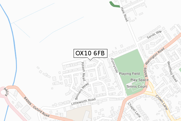
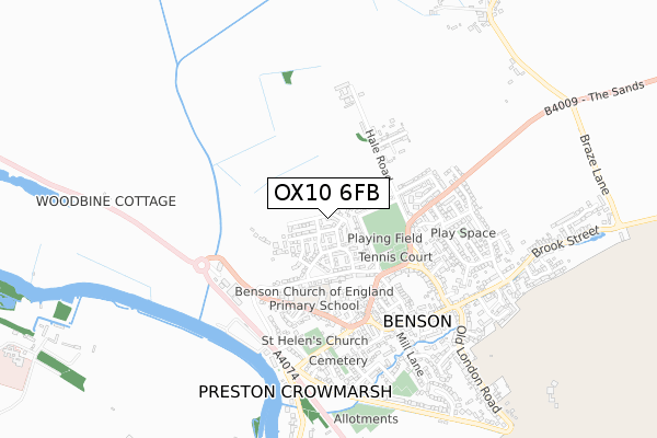
OX10 6FB maps


Licence: Open Government Licence (requires attribution)
Attribution: Contains OS data © Crown copyright and database right 2025
Source: Open Postcode Geo
Licence: Open Government Licence (requires attribution)
Attribution: Contains OS data © Crown copyright and database right 2025; Contains Royal Mail data © Royal Mail copyright and database right 2025; Source: Office for National Statistics licensed under the Open Government Licence v.3.0
OX10 6FB geodata
| Easting | 461560 |
| Northing | 192117 |
| Latitude | 51.624517 |
| Longitude | -1.112100 |
Where is OX10 6FB?
| Country | England |
| Postcode District | OX10 |
Politics
| Ward | Benson & Crowmarsh |
|---|---|
| Constituency | Henley |
House Prices
Sales of detached houses in OX10 6FB
2022 24 JUN £690,000 |
2021 21 JUN £680,000 |
27, LANE NESS, BENSON, WALLINGFORD, OX10 6FB 2020 27 NOV £674,950 |
25, LANE NESS, BENSON, WALLINGFORD, OX10 6FB 2020 24 AUG £599,950 |
37, LANE NESS, BENSON, WALLINGFORD, OX10 6FB 2020 12 JUN £640,000 |
41, LANE NESS, BENSON, WALLINGFORD, OX10 6FB 2020 21 FEB £520,000 |
17, LANE NESS, BENSON, WALLINGFORD, OX10 6FB 2019 30 APR £492,450 |
1, LANE NESS, BENSON, WALLINGFORD, OX10 6FB 2018 30 NOV £400,000 |
7, LANE NESS, BENSON, WALLINGFORD, OX10 6FB 2018 30 NOV £410,000 |
Licence: Contains HM Land Registry data © Crown copyright and database right 2025. This data is licensed under the Open Government Licence v3.0.
Transport
Nearest bus stops to OX10 6FB
| Horseshoes Lane (Oxford Road) | Benson | 366m |
| Horseshoes Lane (Oxford Road) | Benson | 389m |
| Sands Way (Watlington Road) | Benson | 440m |
| Sands Way (Watlington Road) | Benson | 443m |
| High Street | Benson | 523m |
Broadband
Broadband access in OX10 6FB (2020 data)
| Percentage of properties with Next Generation Access | 100.0% |
| Percentage of properties with Superfast Broadband | 100.0% |
| Percentage of properties with Ultrafast Broadband | 94.1% |
| Percentage of properties with Full Fibre Broadband | 94.1% |
Superfast Broadband is between 30Mbps and 300Mbps
Ultrafast Broadband is > 300Mbps
Broadband limitations in OX10 6FB (2020 data)
| Percentage of properties unable to receive 2Mbps | 0.0% |
| Percentage of properties unable to receive 5Mbps | 0.0% |
| Percentage of properties unable to receive 10Mbps | 0.0% |
| Percentage of properties unable to receive 30Mbps | 0.0% |
Deprivation
1.9% of English postcodes are less deprived than OX10 6FB:Food Standards Agency
Three nearest food hygiene ratings to OX10 6FB (metres)


➜ Get more ratings from the Food Standards Agency
Nearest post box to OX10 6FB
| Last Collection | |||
|---|---|---|---|
| Location | Mon-Fri | Sat | Distance |
| Castle Square | 16:45 | 09:00 | 418m |
| Westfield Road | 16:45 | 08:45 | 437m |
| Porthill | 16:45 | 08:45 | 464m |
OX10 6FB ITL and OX10 6FB LAU
The below table lists the International Territorial Level (ITL) codes (formerly Nomenclature of Territorial Units for Statistics (NUTS) codes) and Local Administrative Units (LAU) codes for OX10 6FB:
| ITL 1 Code | Name |
|---|---|
| TLJ | South East (England) |
| ITL 2 Code | Name |
| TLJ1 | Berkshire, Buckinghamshire and Oxfordshire |
| ITL 3 Code | Name |
| TLJ14 | Oxfordshire CC |
| LAU 1 Code | Name |
| E07000179 | South Oxfordshire |
OX10 6FB census areas
The below table lists the Census Output Area (OA), Lower Layer Super Output Area (LSOA), and Middle Layer Super Output Area (MSOA) for OX10 6FB:
| Code | Name | |
|---|---|---|
| OA | E00145695 | |
| LSOA | E01028599 | South Oxfordshire 011A |
| MSOA | E02005968 | South Oxfordshire 011 |
Nearest postcodes to OX10 6FB
| OX10 6LZ | Sunnyside | 146m |
| OX10 6LY | Littleworth Road | 233m |
| OX10 6ND | Hale Road | 321m |
| OX10 6LT | Watlington Road | 323m |
| OX10 6LS | Watlington Road | 335m |
| OX10 6EX | Forge Close | 339m |
| OX10 6LB | Horseshoes Lane | 344m |
| OX10 6LE | Millar Close | 348m |
| OX10 6LX | Oxford Road | 361m |
| OX10 6NQ | Rumbolds Close | 367m |