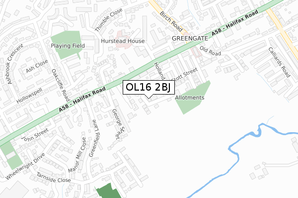
OL16 2BJ is located in the Wardle, Shore & West Littleborough electoral ward, within the metropolitan district of Rochdale and the English Parliamentary constituency of Rochdale. The Sub Integrated Care Board (ICB) Location is NHS Greater Manchester ICB - 01D and the police force is Greater Manchester. This postcode has been in use since January 2018.


GetTheData
Source: OS Open Zoomstack (Ordnance Survey)
Licence: Open Government Licence (requires attribution)
Attribution: Contains OS data © Crown copyright and database right 2025
Source: Open Postcode Geo
Licence: Open Government Licence (requires attribution)
Attribution: Contains OS data © Crown copyright and database right 2025; Contains Royal Mail data © Royal Mail copyright and database right 2025; Source: Office for National Statistics licensed under the Open Government Licence v.3.0
| Easting | 391840 |
| Northing | 415448 |
| Latitude | 53.635504 |
| Longitude | -2.124880 |
GetTheData
Source: Open Postcode Geo
Licence: Open Government Licence
| Country | England |
| Postcode District | OL16 |
➜ See where OL16 is on a map ➜ Where is Rochdale? | |
GetTheData
Source: Land Registry Price Paid Data
Licence: Open Government Licence
| Ward | Wardle, Shore & West Littleborough |
| Constituency | Rochdale |
GetTheData
Source: ONS Postcode Database
Licence: Open Government Licence
2022 22 JUL £427,000 |
2020 14 DEC £405,000 |
7, LAMBS FOLD, ROCHDALE, OL16 2BJ 2020 19 JUN £393,000 |
11, LAMBS FOLD, ROCHDALE, OL16 2BJ 2020 24 APR £350,000 |
7A, LAMBS FOLD, ROCHDALE, OL16 2BJ 2020 31 JAN £275,000 |
9, LAMBS FOLD, ROCHDALE, OL16 2BJ 2019 23 SEP £375,000 |
6, LAMBS FOLD, ROCHDALE, OL16 2BJ 2019 20 JUN £370,000 |
2019 29 MAR £360,000 |
10, LAMBS FOLD, ROCHDALE, OL16 2BJ 2019 6 FEB £390,000 |
3, LAMBS FOLD, ROCHDALE, OL16 2BJ 2019 24 JAN £358,175 |
GetTheData
Source: HM Land Registry Price Paid Data
Licence: Contains HM Land Registry data © Crown copyright and database right 2025. This data is licensed under the Open Government Licence v3.0.
| Halifax Rd/Braddocks Cl (Halifax Rd) | Hurstead | 98m |
| Halifax Rd/Braddocks Cl (Halifax Rd) | Hurstead | 179m |
| Halifax Rd/Oakcliffe Rd (Halifax Rd) | Hurstead | 220m |
| Halifax Rd/Oakcliffe Rd (Halifax Rd) | Hurstead | 265m |
| Birch Rd/Birch Ave (Birch Rd) | Hurstead | 288m |
| Smithy Bridge Station | 0.8km |
| Littleborough Station | 2.2km |
| Rochdale Station | 3.4km |
GetTheData
Source: NaPTAN
Licence: Open Government Licence
| Percentage of properties with Next Generation Access | 100.0% |
| Percentage of properties with Superfast Broadband | 100.0% |
| Percentage of properties with Ultrafast Broadband | 71.4% |
| Percentage of properties with Full Fibre Broadband | 0.0% |
Superfast Broadband is between 30Mbps and 300Mbps
Ultrafast Broadband is > 300Mbps
| Median download speed | 78.1Mbps |
| Average download speed | 64.6Mbps |
| Maximum download speed | 80.00Mbps |
| Median upload speed | 19.5Mbps |
| Average upload speed | 15.7Mbps |
| Maximum upload speed | 20.00Mbps |
| Percentage of properties unable to receive 2Mbps | 0.0% |
| Percentage of properties unable to receive 5Mbps | 0.0% |
| Percentage of properties unable to receive 10Mbps | 0.0% |
| Percentage of properties unable to receive 30Mbps | 0.0% |
GetTheData
Source: Ofcom
Licence: Ofcom Terms of Use (requires attribution)
GetTheData
Source: ONS Postcode Database
Licence: Open Government Licence

➜ Get more ratings from the Food Standards Agency
GetTheData
Source: Food Standards Agency
Licence: FSA terms & conditions
| Last Collection | |||
|---|---|---|---|
| Location | Mon-Fri | Sat | Distance |
| Lightburn | 17:00 | 11:00 | 516m |
| Dearnley P.o. | 18:30 | 11:30 | 728m |
| Smallbridge P.o. | 17:15 | 11:30 | 846m |
GetTheData
Source: Dracos
Licence: Creative Commons Attribution-ShareAlike
The below table lists the International Territorial Level (ITL) codes (formerly Nomenclature of Territorial Units for Statistics (NUTS) codes) and Local Administrative Units (LAU) codes for OL16 2BJ:
| ITL 1 Code | Name |
|---|---|
| TLD | North West (England) |
| ITL 2 Code | Name |
| TLD3 | Greater Manchester |
| ITL 3 Code | Name |
| TLD37 | Greater Manchester North East |
| LAU 1 Code | Name |
| E08000005 | Rochdale |
GetTheData
Source: ONS Postcode Directory
Licence: Open Government Licence
The below table lists the Census Output Area (OA), Lower Layer Super Output Area (LSOA), and Middle Layer Super Output Area (MSOA) for OL16 2BJ:
| Code | Name | |
|---|---|---|
| OA | E00028320 | |
| LSOA | E01005596 | Rochdale 003D |
| MSOA | E02001134 | Rochdale 003 |
GetTheData
Source: ONS Postcode Directory
Licence: Open Government Licence
| OL16 2RS | Springfield Lane | 65m |
| OL16 2SA | Frances Street | 66m |
| OL16 2SB | Stott Street | 85m |
| OL16 2SD | Holland Street | 92m |
| OL16 2RZ | Halifax Road | 109m |
| OL12 9PY | Halifax Road | 120m |
| OL16 2RR | George Street | 137m |
| OL16 2SE | Mary Street | 137m |
| OL16 2SF | William Street | 153m |
| OL12 9UY | Braddocks Close | 160m |
GetTheData
Source: Open Postcode Geo; Land Registry Price Paid Data
Licence: Open Government Licence