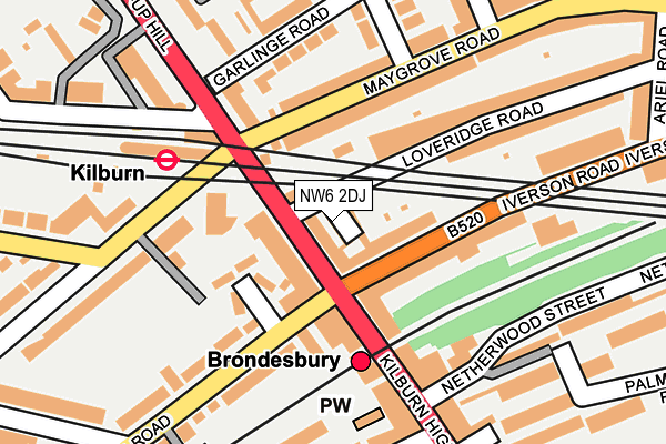
NW6 2DJ is located in the West Hampstead electoral ward, within the London borough of Camden and the English Parliamentary constituency of Hampstead and Kilburn. The Sub Integrated Care Board (ICB) Location is NHS North Central London ICB - 93C and the police force is Metropolitan Police. This postcode has been in use since July 2017.


GetTheData
Source: OS OpenMap – Local (Ordnance Survey)
Source: OS VectorMap District (Ordnance Survey)
Licence: Open Government Licence (requires attribution)
| Easting | 525182 |
| Northing | 184826 |
| Latitude | 51.548451 |
| Longitude | -0.195995 |
GetTheData
Source: Open Postcode Geo
Licence: Open Government Licence
| Country | England |
| Postcode District | NW6 |
➜ See where NW6 is on a map ➜ Where is Hampstead? | |
GetTheData
Source: Land Registry Price Paid Data
Licence: Open Government Licence
| Ward | West Hampstead |
| Constituency | Hampstead And Kilburn |
GetTheData
Source: ONS Postcode Database
Licence: Open Government Licence
| Dennington Park Road | West Hampstead | 335m |
| West Hampstead Thameslink Rail Station | West Hampstead | 340m |
| Dennington Park Road | West Hampstead | 352m |
| West Hampstead Underground Station | West Hampstead | 373m |
| Solent Road (Mill Lane) | West Hampstead | 390m |
| West Hampstead Underground Station | West Hampstead | 399m |
| Kilburn Underground Station | Brondesbury | 590m |
| Finchley Road Underground Station | Finchley Road | 1,136m |
| Kilburn Park Underground Station | Kilburn Park | 1,504m |
| Hampstead Underground Station | Hampstead | 1,519m |
| West Hampstead Thameslink Station | 0.3km |
| West Hampstead Station | 0.4km |
| Brondesbury Station | 0.6km |
GetTheData
Source: NaPTAN
Licence: Open Government Licence
GetTheData
Source: ONS Postcode Database
Licence: Open Government Licence


➜ Get more ratings from the Food Standards Agency
GetTheData
Source: Food Standards Agency
Licence: FSA terms & conditions
| Last Collection | |||
|---|---|---|---|
| Location | Mon-Fri | Sat | Distance |
| Pandora Road | 17:30 | 12:00 | 93m |
| Maygrove Road | 17:30 | 12:00 | 111m |
| Kingdon Road | 17:30 | 12:00 | 310m |
GetTheData
Source: Dracos
Licence: Creative Commons Attribution-ShareAlike
The below table lists the International Territorial Level (ITL) codes (formerly Nomenclature of Territorial Units for Statistics (NUTS) codes) and Local Administrative Units (LAU) codes for NW6 2DJ:
| ITL 1 Code | Name |
|---|---|
| TLI | London |
| ITL 2 Code | Name |
| TLI3 | Inner London - West |
| ITL 3 Code | Name |
| TLI31 | Camden and City of London |
| LAU 1 Code | Name |
| E09000007 | Camden |
GetTheData
Source: ONS Postcode Directory
Licence: Open Government Licence
The below table lists the Census Output Area (OA), Lower Layer Super Output Area (LSOA), and Middle Layer Super Output Area (MSOA) for NW6 2DJ:
| Code | Name | |
|---|---|---|
| OA | E00004833 | |
| LSOA | E01000974 | Camden 013E |
| MSOA | E02000178 | Camden 013 |
GetTheData
Source: ONS Postcode Directory
Licence: Open Government Licence
| NW6 1PL | Sumatra Road | 76m |
| NW6 2EP | Maygrove Road | 91m |
| NW6 1PN | Sumatra Road | 98m |
| NW6 2RA | Iverson Road | 108m |
| NW6 1TR | Pandora Road | 112m |
| NW6 1PP | Sumatra Road | 112m |
| NW6 2EG | Maygrove Road | 155m |
| NW6 2HH | Iverson Road | 162m |
| NW6 1TS | Pandora Road | 166m |
| NW6 2DY | Ariel Road | 171m |
GetTheData
Source: Open Postcode Geo; Land Registry Price Paid Data
Licence: Open Government Licence