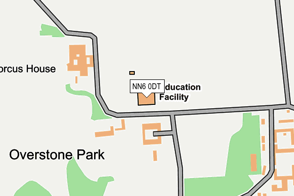
NN6 0DT is located in the Moulton electoral ward, within the unitary authority of West Northamptonshire and the English Parliamentary constituency of Daventry. The Sub Integrated Care Board (ICB) Location is NHS Northamptonshire ICB - 78H and the police force is Northamptonshire. This postcode has been in use since December 1998.


GetTheData
Source: OS OpenMap – Local (Ordnance Survey)
Source: OS VectorMap District (Ordnance Survey)
Licence: Open Government Licence (requires attribution)
| Easting | 480933 |
| Northing | 265555 |
| Latitude | 52.282189 |
| Longitude | -0.815048 |
GetTheData
Source: Open Postcode Geo
Licence: Open Government Licence
| Country | England |
| Postcode District | NN6 |
➜ See where NN6 is on a map | |
GetTheData
Source: Land Registry Price Paid Data
Licence: Open Government Licence
Elevation or altitude of NN6 0DT as distance above sea level:
| Metres | Feet | |
|---|---|---|
| Elevation | 110m | 361ft |
Elevation is measured from the approximate centre of the postcode, to the nearest point on an OS contour line from OS Terrain 50, which has contour spacing of ten vertical metres.
➜ How high above sea level am I? Find the elevation of your current position using your device's GPS.
GetTheData
Source: Open Postcode Elevation
Licence: Open Government Licence
| Ward | Moulton |
| Constituency | Daventry |
GetTheData
Source: ONS Postcode Database
Licence: Open Government Licence
| Overstone Scouts Camp (Off Billing Lane) | Rectory Farm | 867m |
| Bus Shelter (Ash Drive) | Overstone | 894m |
| Post Office (Sywell Road) | Overstone | 1,050m |
| Barley Hill Road Turning Circle (Barley Hill Road) | Southfields | 1,056m |
| Post Office (Sywell Road) | Overstone | 1,094m |
GetTheData
Source: NaPTAN
Licence: Open Government Licence
GetTheData
Source: ONS Postcode Database
Licence: Open Government Licence


➜ Get more ratings from the Food Standards Agency
GetTheData
Source: Food Standards Agency
Licence: FSA terms & conditions
| Last Collection | |||
|---|---|---|---|
| Location | Mon-Fri | Sat | Distance |
| Woodland Walk | 17:30 | 11:45 | 856m |
| Crabtree Drive | 17:30 | 11:45 | 875m |
| Overstone Solarium | 16:00 | 11:30 | 934m |
GetTheData
Source: Dracos
Licence: Creative Commons Attribution-ShareAlike
The below table lists the International Territorial Level (ITL) codes (formerly Nomenclature of Territorial Units for Statistics (NUTS) codes) and Local Administrative Units (LAU) codes for NN6 0DT:
| ITL 1 Code | Name |
|---|---|
| TLF | East Midlands (England) |
| ITL 2 Code | Name |
| TLF2 | Leicestershire, Rutland and Northamptonshire |
| ITL 3 Code | Name |
| TLF24 | West Northamptonshire |
| LAU 1 Code | Name |
| E07000151 | Daventry |
GetTheData
Source: ONS Postcode Directory
Licence: Open Government Licence
The below table lists the Census Output Area (OA), Lower Layer Super Output Area (LSOA), and Middle Layer Super Output Area (MSOA) for NN6 0DT:
| Code | Name | |
|---|---|---|
| OA | E00137423 | |
| LSOA | E01027018 | Daventry 005B |
| MSOA | E02005623 | Daventry 005 |
GetTheData
Source: ONS Postcode Directory
Licence: Open Government Licence
| NN6 0AS | Overstone Park | 108m |
| NN6 0AP | Lakeside | 274m |
| NN6 0QS | Lakeside | 573m |
| NN6 0SR | Crescent Lodge | 759m |
| NN6 0FF | The Roundel | 793m |
| NN6 0AF | The Roundel | 793m |
| NN3 5NS | Woodland Walk | 851m |
| NN3 5JD | Faringdon Court | 872m |
| NN3 5LH | Farmhill Road | 875m |
| NN3 5JG | Oakpark Close | 880m |
GetTheData
Source: Open Postcode Geo; Land Registry Price Paid Data
Licence: Open Government Licence