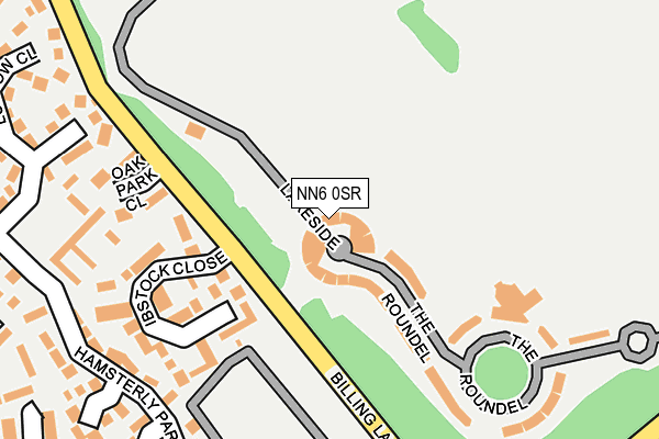
NN6 0SR lies on Crescent Lodge in Overstone Park, Northampton. NN6 0SR is located in the Moulton electoral ward, within the unitary authority of West Northamptonshire and the English Parliamentary constituency of Daventry. The Sub Integrated Care Board (ICB) Location is NHS Northamptonshire ICB - 78H and the police force is Northamptonshire. This postcode has been in use since December 2001.


GetTheData
Source: OS OpenMap – Local (Ordnance Survey)
Source: OS VectorMap District (Ordnance Survey)
Licence: Open Government Licence (requires attribution)
| Easting | 480489 |
| Northing | 264939 |
| Latitude | 52.276717 |
| Longitude | -0.821702 |
GetTheData
Source: Open Postcode Geo
Licence: Open Government Licence
| Street | Crescent Lodge |
| Locality | Overstone Park |
| Town/City | Northampton |
| Country | England |
| Postcode District | NN6 |
➜ See where NN6 is on a map ➜ Where is Northampton? | |
GetTheData
Source: Land Registry Price Paid Data
Licence: Open Government Licence
Elevation or altitude of NN6 0SR as distance above sea level:
| Metres | Feet | |
|---|---|---|
| Elevation | 110m | 361ft |
Elevation is measured from the approximate centre of the postcode, to the nearest point on an OS contour line from OS Terrain 50, which has contour spacing of ten vertical metres.
➜ How high above sea level am I? Find the elevation of your current position using your device's GPS.
GetTheData
Source: Open Postcode Elevation
Licence: Open Government Licence
| Ward | Moulton |
| Constituency | Daventry |
GetTheData
Source: ONS Postcode Database
Licence: Open Government Licence
64, CRESCENT LODGE, OVERSTONE PARK, NORTHAMPTON, NN6 0SR 2007 9 NOV £124,995 |
66, CRESCENT LODGE, OVERSTONE PARK, NORTHAMPTON, NN6 0SR 2006 21 DEC £121,000 |
64, CRESCENT LODGE, OVERSTONE PARK, NORTHAMPTON, NN6 0SR 2005 2 DEC £120,000 |
56, CRESCENT LODGE, OVERSTONE PARK, NORTHAMPTON, NN6 0SR 2005 15 AUG £127,000 |
58, CRESCENT LODGE, OVERSTONE PARK, NORTHAMPTON, NN6 0SR 2000 14 APR £93,000 |
68, CRESCENT LODGE, OVERSTONE PARK, NORTHAMPTON, NN6 0SR 1995 2 NOV £109,900 |
GetTheData
Source: HM Land Registry Price Paid Data
Licence: Contains HM Land Registry data © Crown copyright and database right 2024. This data is licensed under the Open Government Licence v3.0.
| Donellan Green (Barley Hill Road) | Southfields | 491m |
| Barley Hill Road Turning Circle (Barley Hill Road) | Southfields | 542m |
| Overstone Scouts Camp (Off Billing Lane) | Rectory Farm | 558m |
| Donellan Green (Barley Hill Road) | Southfields | 574m |
| Dryleys Court (Goldings Road) | Goldings | 582m |
GetTheData
Source: NaPTAN
Licence: Open Government Licence
| Median download speed | 100.0Mbps |
| Average download speed | 119.3Mbps |
| Maximum download speed | 350.00Mbps |
| Median upload speed | 13.3Mbps |
| Average upload speed | 13.3Mbps |
| Maximum upload speed | 13.33Mbps |
GetTheData
Source: Ofcom
Licence: Ofcom Terms of Use (requires attribution)
GetTheData
Source: ONS Postcode Database
Licence: Open Government Licence


➜ Get more ratings from the Food Standards Agency
GetTheData
Source: Food Standards Agency
Licence: FSA terms & conditions
| Last Collection | |||
|---|---|---|---|
| Location | Mon-Fri | Sat | Distance |
| Broomhill Cres | 17:30 | 12:00 | 404m |
| Woodland Walk | 17:30 | 11:45 | 508m |
| Crabtree Drive | 17:30 | 11:45 | 511m |
GetTheData
Source: Dracos
Licence: Creative Commons Attribution-ShareAlike
The below table lists the International Territorial Level (ITL) codes (formerly Nomenclature of Territorial Units for Statistics (NUTS) codes) and Local Administrative Units (LAU) codes for NN6 0SR:
| ITL 1 Code | Name |
|---|---|
| TLF | East Midlands (England) |
| ITL 2 Code | Name |
| TLF2 | Leicestershire, Rutland and Northamptonshire |
| ITL 3 Code | Name |
| TLF24 | West Northamptonshire |
| LAU 1 Code | Name |
| E07000151 | Daventry |
GetTheData
Source: ONS Postcode Directory
Licence: Open Government Licence
The below table lists the Census Output Area (OA), Lower Layer Super Output Area (LSOA), and Middle Layer Super Output Area (MSOA) for NN6 0SR:
| Code | Name | |
|---|---|---|
| OA | E00137423 | |
| LSOA | E01027018 | Daventry 005B |
| MSOA | E02005623 | Daventry 005 |
GetTheData
Source: ONS Postcode Directory
Licence: Open Government Licence
| NN6 0FF | The Roundel | 156m |
| NN3 5DL | Ibstock Close | 160m |
| NN3 5JG | Oakpark Close | 191m |
| NN3 5DA | Hamsterly Park | 224m |
| NN3 5LH | Farmhill Road | 241m |
| NN3 5DX | Hamsterly Park | 293m |
| NN3 5LJ | Ludlow Close | 315m |
| NN3 5DN | Farmhill Road | 322m |
| NN3 5BD | Moorfield Square | 345m |
| NN3 5NU | Farmhill Road | 359m |
GetTheData
Source: Open Postcode Geo; Land Registry Price Paid Data
Licence: Open Government Licence