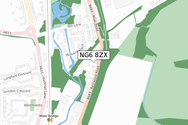
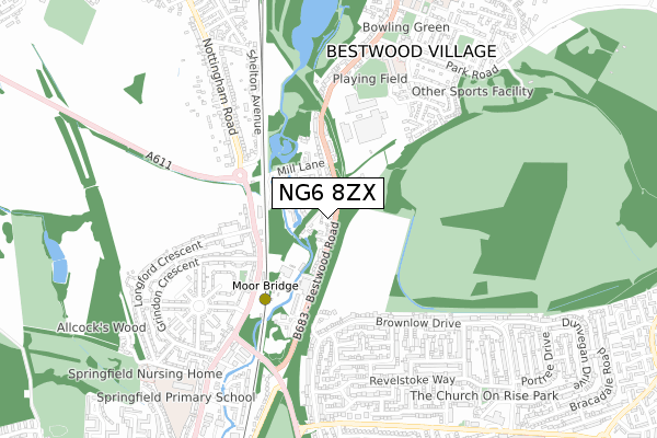
NG6 8ZX is located in the Bulwell electoral ward, within the unitary authority of Nottingham and the English Parliamentary constituency of Nottingham North. The Sub Integrated Care Board (ICB) Location is NHS Nottingham and Nottinghamshire ICB - 52R and the police force is Nottinghamshire. This postcode has been in use since October 2019.


GetTheData
Source: OS Open Zoomstack (Ordnance Survey)
Licence: Open Government Licence (requires attribution)
Attribution: Contains OS data © Crown copyright and database right 2025
Source: Open Postcode Geo
Licence: Open Government Licence (requires attribution)
Attribution: Contains OS data © Crown copyright and database right 2025; Contains Royal Mail data © Royal Mail copyright and database right 2025; Source: Office for National Statistics licensed under the Open Government Licence v.3.0
| Easting | 454883 |
| Northing | 346986 |
| Latitude | 53.017388 |
| Longitude | -1.183332 |
GetTheData
Source: Open Postcode Geo
Licence: Open Government Licence
| Country | England |
| Postcode District | NG6 |
➜ See where NG6 is on a map ➜ Where is Bestwood Village? | |
GetTheData
Source: Land Registry Price Paid Data
Licence: Open Government Licence
| Ward | Bulwell |
| Constituency | Nottingham North |
GetTheData
Source: ONS Postcode Database
Licence: Open Government Licence
2024 23 AUG £275,000 |
2021 4 MAY £300,000 |
19, COUNTRY CRESCENT, NOTTINGHAM, NG6 8ZX 2020 6 MAR £287,500 |
2020 24 FEB £200,000 |
4, COUNTRY CRESCENT, NOTTINGHAM, NG6 8ZX 2020 12 FEB £230,000 |
2019 6 DEC £275,000 |
2019 15 NOV £230,000 |
1, COUNTRY CRESCENT, NOTTINGHAM, NG6 8ZX 2019 4 OCT £270,000 |
3, COUNTRY CRESCENT, NOTTINGHAM, NG6 8ZX 2019 27 SEP £220,000 |
➜ Bestwood Village house prices
GetTheData
Source: HM Land Registry Price Paid Data
Licence: Contains HM Land Registry data © Crown copyright and database right 2025. This data is licensed under the Open Government Licence v3.0.
| Old Mill Close (Moor Road) | Bestwood Village | 260m |
| Old Mill Close (Moor Road) | Bestwood Village | 263m |
| Moorbridge Works (Bestwood Road) | Bulwell | 263m |
| City Boundary (Hucknall Lane) | Bulwell Hall | 280m |
| Grindon Crescent (Hucknall Lane) | Bulwell Hall | 295m |
| Moor Bridge Tram Stop (Hucknall Lane) | Moor Bridge | 406m |
| Butler's Hill Tram Stop (Butlers Hill) | Butlers Hill | 1,316m |
| Bulwell Forest Tram Stop (Bestwood Road) | Bulwell Forest | 1,414m |
| Bulwell Station | 2.1km |
| Hucknall Station | 2.5km |
GetTheData
Source: NaPTAN
Licence: Open Government Licence
GetTheData
Source: ONS Postcode Database
Licence: Open Government Licence


➜ Get more ratings from the Food Standards Agency
GetTheData
Source: Food Standards Agency
Licence: FSA terms & conditions
| Last Collection | |||
|---|---|---|---|
| Location | Mon-Fri | Sat | Distance |
| Moor Road | 17:00 | 11:30 | 325m |
| Hucknall Lane Post Office | 17:00 | 11:30 | 336m |
| Haverhill Crescent | 17:00 | 12:30 | 480m |
GetTheData
Source: Dracos
Licence: Creative Commons Attribution-ShareAlike
The below table lists the International Territorial Level (ITL) codes (formerly Nomenclature of Territorial Units for Statistics (NUTS) codes) and Local Administrative Units (LAU) codes for NG6 8ZX:
| ITL 1 Code | Name |
|---|---|
| TLF | East Midlands (England) |
| ITL 2 Code | Name |
| TLF1 | Derbyshire and Nottinghamshire |
| ITL 3 Code | Name |
| TLF14 | Nottingham |
| LAU 1 Code | Name |
| E06000018 | Nottingham |
GetTheData
Source: ONS Postcode Directory
Licence: Open Government Licence
The below table lists the Census Output Area (OA), Lower Layer Super Output Area (LSOA), and Middle Layer Super Output Area (MSOA) for NG6 8ZX:
| Code | Name | |
|---|---|---|
| OA | E00070052 | |
| LSOA | E01013879 | Nottingham 002A |
| MSOA | E02002869 | Nottingham 002 |
GetTheData
Source: ONS Postcode Directory
Licence: Open Government Licence
| NG6 8EL | Millbank Place | 134m |
| NG6 8TA | Old Mill Close | 156m |
| NG6 8ES | Millbank Place | 160m |
| NG6 8EF | Millbank Place | 162m |
| NG6 8FD | Mill Lane | 215m |
| NG6 8SS | Bestwood Road | 228m |
| NG6 8SW | Mill Lane | 240m |
| NG6 8SZ | Moor Road | 294m |
| NG6 8AD | Hucknall Lane | 301m |
| NG6 8AA | Hucknall Lane | 314m |
GetTheData
Source: Open Postcode Geo; Land Registry Price Paid Data
Licence: Open Government Licence