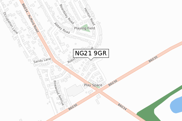
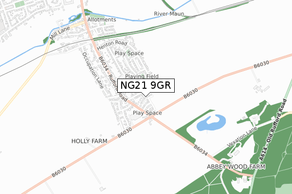
NG21 9GR is located in the Edwinstowe & Clipstone electoral ward, within the local authority district of Newark and Sherwood and the English Parliamentary constituency of Sherwood. The Sub Integrated Care Board (ICB) Location is NHS Nottingham and Nottinghamshire ICB - 52R and the police force is Nottinghamshire. This postcode has been in use since July 2018.


GetTheData
Source: OS Open Zoomstack (Ordnance Survey)
Licence: Open Government Licence (requires attribution)
Attribution: Contains OS data © Crown copyright and database right 2024
Source: Open Postcode Geo
Licence: Open Government Licence (requires attribution)
Attribution: Contains OS data © Crown copyright and database right 2024; Contains Royal Mail data © Royal Mail copyright and database right 2024; Source: Office for National Statistics licensed under the Open Government Licence v.3.0
| Easting | 463257 |
| Northing | 365750 |
| Latitude | 53.185113 |
| Longitude | -1.054835 |
GetTheData
Source: Open Postcode Geo
Licence: Open Government Licence
| Country | England |
| Postcode District | NG21 |
➜ See where NG21 is on a map ➜ Where is Edwinstowe? | |
GetTheData
Source: Land Registry Price Paid Data
Licence: Open Government Licence
| Ward | Edwinstowe & Clipstone |
| Constituency | Sherwood |
GetTheData
Source: ONS Postcode Database
Licence: Open Government Licence
2023 1 FEB £350,000 |
2021 21 APR £291,500 |
17, BEECH AVENUE, EDWINSTOWE, MANSFIELD, NG21 9GR 2021 12 MAR £295,000 |
1, BEECH AVENUE, EDWINSTOWE, MANSFIELD, NG21 9GR 2020 18 DEC £355,000 |
16, BEECH AVENUE, EDWINSTOWE, MANSFIELD, NG21 9GR 2020 18 DEC £295,000 |
18, BEECH AVENUE, EDWINSTOWE, MANSFIELD, NG21 9GR 2020 18 DEC £435,000 |
15, BEECH AVENUE, EDWINSTOWE, MANSFIELD, NG21 9GR 2020 14 DEC £305,000 |
6, BEECH AVENUE, EDWINSTOWE, MANSFIELD, NG21 9GR 2019 7 JUN £279,950 |
7, PEARTREE LANE, EDWINSTOWE, MANSFIELD, NG21 9GR 2018 11 SEP £350,000 |
4, BEECH AVENUE, EDWINSTOWE, MANSFIELD, NG21 9GR 2018 1 AUG £402,000 |
GetTheData
Source: HM Land Registry Price Paid Data
Licence: Contains HM Land Registry data © Crown copyright and database right 2024. This data is licensed under the Open Government Licence v3.0.
| Robin Hood Avenue | Lidgett | 97m |
| Rufford Road | Lidgett | 142m |
| Rufford Road | Lidgett | 150m |
| Robin Hood Avenue | Lidgett | 153m |
| Sandy Lane (Rufford Road) | Lidgett | 248m |
GetTheData
Source: NaPTAN
Licence: Open Government Licence
| Percentage of properties with Next Generation Access | 100.0% |
| Percentage of properties with Superfast Broadband | 100.0% |
| Percentage of properties with Ultrafast Broadband | 50.0% |
| Percentage of properties with Full Fibre Broadband | 50.0% |
Superfast Broadband is between 30Mbps and 300Mbps
Ultrafast Broadband is > 300Mbps
| Percentage of properties unable to receive 2Mbps | 0.0% |
| Percentage of properties unable to receive 5Mbps | 0.0% |
| Percentage of properties unable to receive 10Mbps | 0.0% |
| Percentage of properties unable to receive 30Mbps | 0.0% |
GetTheData
Source: Ofcom
Licence: Ofcom Terms of Use (requires attribution)
GetTheData
Source: ONS Postcode Database
Licence: Open Government Licence


➜ Get more ratings from the Food Standards Agency
GetTheData
Source: Food Standards Agency
Licence: FSA terms & conditions
| Last Collection | |||
|---|---|---|---|
| Location | Mon-Fri | Sat | Distance |
| Lidgetts (Rufford Road) | 17:00 | 11:00 | 158m |
| Mill Lane | 17:00 | 11:00 | 832m |
| Greenwood Avenue | 17:00 | 11:00 | 1,094m |
GetTheData
Source: Dracos
Licence: Creative Commons Attribution-ShareAlike
The below table lists the International Territorial Level (ITL) codes (formerly Nomenclature of Territorial Units for Statistics (NUTS) codes) and Local Administrative Units (LAU) codes for NG21 9GR:
| ITL 1 Code | Name |
|---|---|
| TLF | East Midlands (England) |
| ITL 2 Code | Name |
| TLF1 | Derbyshire and Nottinghamshire |
| ITL 3 Code | Name |
| TLF15 | North Nottinghamshire |
| LAU 1 Code | Name |
| E07000175 | Newark and Sherwood |
GetTheData
Source: ONS Postcode Directory
Licence: Open Government Licence
The below table lists the Census Output Area (OA), Lower Layer Super Output Area (LSOA), and Middle Layer Super Output Area (MSOA) for NG21 9GR:
| Code | Name | |
|---|---|---|
| OA | E00144315 | |
| LSOA | E01028322 | Newark and Sherwood 002D |
| MSOA | E02005894 | Newark and Sherwood 002 |
GetTheData
Source: ONS Postcode Directory
Licence: Open Government Licence
| NG21 9LG | Robin Hood Avenue | 91m |
| NG21 9LH | Abbey Road | 173m |
| NG21 9JA | Clipstone Road | 185m |
| NG21 9LJ | Merryweather Close | 224m |
| NG21 9LE | Henton Road | 242m |
| NG21 9JR | Hawthorne Way | 255m |
| NG21 9JW | Brocklehurst Drive | 259m |
| NG21 9LD | Henton Road | 261m |
| NG21 9JS | Pinewood Avenue | 290m |
| NG21 9JP | Greenfield Close | 318m |
GetTheData
Source: Open Postcode Geo; Land Registry Price Paid Data
Licence: Open Government Licence