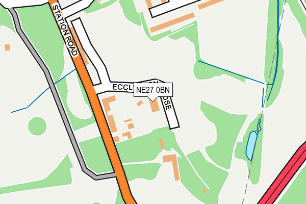
NE27 0BN is located in the Valley electoral ward, within the metropolitan district of North Tyneside and the English Parliamentary constituency of Tynemouth. The Sub Integrated Care Board (ICB) Location is NHS North East and North Cumbria ICB - 99C and the police force is Northumbria. This postcode has been in use since April 1985.


GetTheData
Source: OS OpenMap – Local (Ordnance Survey)
Source: OS VectorMap District (Ordnance Survey)
Licence: Open Government Licence (requires attribution)
| Easting | 430414 |
| Northing | 571843 |
| Latitude | 55.040174 |
| Longitude | -1.525619 |
GetTheData
Source: Open Postcode Geo
Licence: Open Government Licence
| Country | England |
| Postcode District | NE27 |
➜ See where NE27 is on a map ➜ Where is Backworth? | |
GetTheData
Source: Land Registry Price Paid Data
Licence: Open Government Licence
Elevation or altitude of NE27 0BN as distance above sea level:
| Metres | Feet | |
|---|---|---|
| Elevation | 60m | 197ft |
Elevation is measured from the approximate centre of the postcode, to the nearest point on an OS contour line from OS Terrain 50, which has contour spacing of ten vertical metres.
➜ How high above sea level am I? Find the elevation of your current position using your device's GPS.
GetTheData
Source: Open Postcode Elevation
Licence: Open Government Licence
| Ward | Valley |
| Constituency | Tynemouth |
GetTheData
Source: ONS Postcode Database
Licence: Open Government Licence
| Station Road-business Park (Station Road) | Backworth | 105m |
| Station Road-business Park (Station Road) | Backworth | 121m |
| Shrewsbury Drive | Backworth | 208m |
| Station Road-nursery (Station Road) | Holywell | 415m |
| Station Road-nursery (Station Road) | Holywell | 426m |
| Northumberland Park (Tyne & Wear Metro Station) (Station Road) | Northumberland Park | 864m |
| Shiremoor (Tyne And Wear Metro Station) (Park Lane) | Shiremoor | 1,372m |
GetTheData
Source: NaPTAN
Licence: Open Government Licence
GetTheData
Source: ONS Postcode Database
Licence: Open Government Licence


➜ Get more ratings from the Food Standards Agency
GetTheData
Source: Food Standards Agency
Licence: FSA terms & conditions
| Last Collection | |||
|---|---|---|---|
| Location | Mon-Fri | Sat | Distance |
| Backworth Lane | 16:00 | 11:15 | 473m |
| West Allotment Post Office | 16:30 | 11:30 | 663m |
| Cartington Avenue | 16:15 | 11:00 | 669m |
GetTheData
Source: Dracos
Licence: Creative Commons Attribution-ShareAlike
The below table lists the International Territorial Level (ITL) codes (formerly Nomenclature of Territorial Units for Statistics (NUTS) codes) and Local Administrative Units (LAU) codes for NE27 0BN:
| ITL 1 Code | Name |
|---|---|
| TLC | North East (England) |
| ITL 2 Code | Name |
| TLC2 | Northumberland, and Tyne and Wear |
| ITL 3 Code | Name |
| TLC22 | Tyneside |
| LAU 1 Code | Name |
| E08000022 | North Tyneside |
GetTheData
Source: ONS Postcode Directory
Licence: Open Government Licence
The below table lists the Census Output Area (OA), Lower Layer Super Output Area (LSOA), and Middle Layer Super Output Area (MSOA) for NE27 0BN:
| Code | Name | |
|---|---|---|
| OA | E00043483 | |
| LSOA | E01008565 | North Tyneside 007C |
| MSOA | E02001744 | North Tyneside 007 |
GetTheData
Source: ONS Postcode Directory
Licence: Open Government Licence
| NE27 0JH | Shrewsbury Drive | 184m |
| NE27 0JQ | Shrewsbury Drive | 237m |
| NE27 0JT | Telford Close | 282m |
| NE27 0JX | Sandon Close | 306m |
| NE27 0SH | Claverley Drive | 316m |
| NE27 0AB | Station Road | 316m |
| NE27 0SR | Rushbury Court | 333m |
| NE27 0JS | Shrewsbury Drive | 339m |
| NE27 0JY | Sharnford Close | 342m |
| NE27 0JR | Stretton Way | 390m |
GetTheData
Source: Open Postcode Geo; Land Registry Price Paid Data
Licence: Open Government Licence