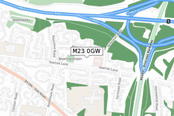
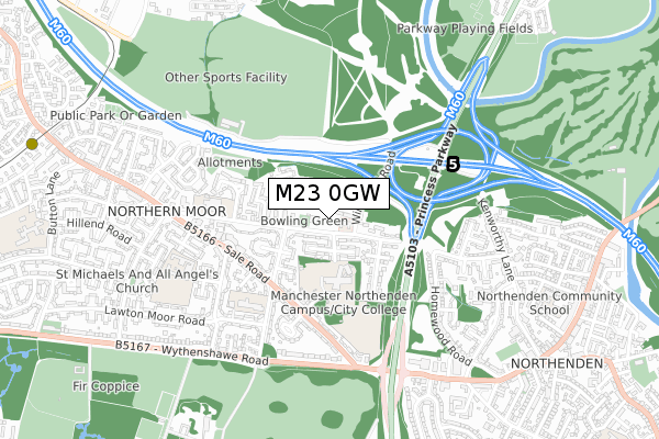
M23 0GW is located in the Northenden electoral ward, within the metropolitan district of Manchester and the English Parliamentary constituency of Wythenshawe and Sale East. The Sub Integrated Care Board (ICB) Location is NHS Greater Manchester ICB - 14L and the police force is Greater Manchester. This postcode has been in use since April 2020.


GetTheData
Source: OS Open Zoomstack (Ordnance Survey)
Licence: Open Government Licence (requires attribution)
Attribution: Contains OS data © Crown copyright and database right 2025
Source: Open Postcode Geo
Licence: Open Government Licence (requires attribution)
Attribution: Contains OS data © Crown copyright and database right 2025; Contains Royal Mail data © Royal Mail copyright and database right 2025; Source: Office for National Statistics licensed under the Open Government Licence v.3.0
| Easting | 382081 |
| Northing | 390603 |
| Latitude | 53.411945 |
| Longitude | -2.271039 |
GetTheData
Source: Open Postcode Geo
Licence: Open Government Licence
| Country | England |
| Postcode District | M23 |
➜ See where M23 is on a map ➜ Where is Wythenshawe? | |
GetTheData
Source: Land Registry Price Paid Data
Licence: Open Government Licence
| Ward | Northenden |
| Constituency | Wythenshawe And Sale East |
GetTheData
Source: ONS Postcode Database
Licence: Open Government Licence
2024 25 OCT £430,000 |
2021 29 MAR £340,000 |
12, CHERRY BLOSSOM CLOSE, MANCHESTER, M23 0GW 2020 17 NOV £335,000 |
7, CHERRY BLOSSOM CLOSE, MANCHESTER, M23 0GW 2020 12 NOV £335,000 |
6, CHERRY BLOSSOM CLOSE, MANCHESTER, M23 0GW 2020 9 NOV £332,500 |
8, CHERRY BLOSSOM CLOSE, MANCHESTER, M23 0GW 2020 9 OCT £332,500 |
10, CHERRY BLOSSOM CLOSE, MANCHESTER, M23 0GW 2020 6 OCT £345,000 |
11, CHERRY BLOSSOM CLOSE, MANCHESTER, M23 0GW 2020 2 OCT £340,000 |
2020 24 SEP £332,500 |
4, CHERRY BLOSSOM CLOSE, MANCHESTER, M23 0GW 2020 17 SEP £330,000 |
GetTheData
Source: HM Land Registry Price Paid Data
Licence: Contains HM Land Registry data © Crown copyright and database right 2025. This data is licensed under the Open Government Licence v3.0.
| Princess Parkway/Yew Tree Ln (Princess Parkwy) | Northenden | 288m |
| Sale Rd/Rackhouse Rd (Sale Rd) | Northern Moor | 329m |
| Sale Rd/Rackhouse Rd (Sale Rd) | Northern Moor | 344m |
| Princess Parkway/Yew Tree Ln (Princess Parkwy) | Northenden | 346m |
| Sale Rd/Shevington Gardens (Sale Rd) | Northern Moor | 357m |
| Northern Moor (Manchester Metrolink) (Sale Road) | Northern Moor | 1,178m |
| East Didsbury Station | 3.3km |
| Gatley Station | 3.4km |
| Burnage Station | 3.8km |
GetTheData
Source: NaPTAN
Licence: Open Government Licence
GetTheData
Source: ONS Postcode Database
Licence: Open Government Licence


➜ Get more ratings from the Food Standards Agency
GetTheData
Source: Food Standards Agency
Licence: FSA terms & conditions
| Last Collection | |||
|---|---|---|---|
| Location | Mon-Fri | Sat | Distance |
| Opp 61 Yewtree Lane | 17:30 | 12:00 | 76m |
| Sale Circle | 17:30 | 12:00 | 387m |
| Mosshey | 17:30 | 12:00 | 403m |
GetTheData
Source: Dracos
Licence: Creative Commons Attribution-ShareAlike
The below table lists the International Territorial Level (ITL) codes (formerly Nomenclature of Territorial Units for Statistics (NUTS) codes) and Local Administrative Units (LAU) codes for M23 0GW:
| ITL 1 Code | Name |
|---|---|
| TLD | North West (England) |
| ITL 2 Code | Name |
| TLD3 | Greater Manchester |
| ITL 3 Code | Name |
| TLD33 | Manchester |
| LAU 1 Code | Name |
| E08000003 | Manchester |
GetTheData
Source: ONS Postcode Directory
Licence: Open Government Licence
The below table lists the Census Output Area (OA), Lower Layer Super Output Area (LSOA), and Middle Layer Super Output Area (MSOA) for M23 0GW:
| Code | Name | |
|---|---|---|
| OA | E00026696 | |
| LSOA | E01005264 | Manchester 044C |
| MSOA | E02001088 | Manchester 044 |
GetTheData
Source: ONS Postcode Directory
Licence: Open Government Licence
| M23 0FA | Barry Road | 74m |
| M23 0EB | Barry Road | 85m |
| M23 0DY | Yew Tree Lane | 101m |
| M23 0DZ | Hollyhey Drive | 105m |
| M23 0DQ | Blyth Avenue | 105m |
| M23 0DT | Willenhall Road | 108m |
| M23 0DU | Yew Tree Lane | 114m |
| M23 0EA | Yew Tree Lane | 139m |
| M23 0DX | Hollyhey Drive | 145m |
| M23 0FB | Milburn Avenue | 180m |
GetTheData
Source: Open Postcode Geo; Land Registry Price Paid Data
Licence: Open Government Licence