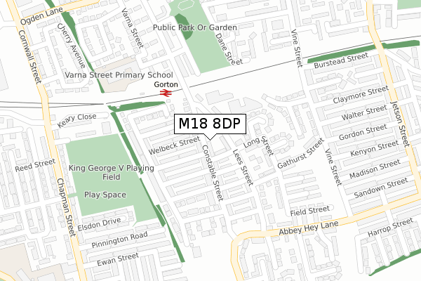
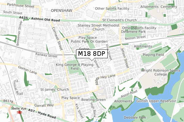
M18 8DP is located in the Gorton & Abbey Hey electoral ward, within the metropolitan district of Manchester and the English Parliamentary constituency of Manchester, Gorton. The Sub Integrated Care Board (ICB) Location is NHS Greater Manchester ICB - 14L and the police force is Greater Manchester. This postcode has been in use since January 2020.


GetTheData
Source: OS Open Zoomstack (Ordnance Survey)
Licence: Open Government Licence (requires attribution)
Attribution: Contains OS data © Crown copyright and database right 2025
Source: Open Postcode Geo
Licence: Open Government Licence (requires attribution)
Attribution: Contains OS data © Crown copyright and database right 2025; Contains Royal Mail data © Royal Mail copyright and database right 2025; Source: Office for National Statistics licensed under the Open Government Licence v.3.0
| Easting | 389122 |
| Northing | 396816 |
| Latitude | 53.467984 |
| Longitude | -2.165330 |
GetTheData
Source: Open Postcode Geo
Licence: Open Government Licence
| Country | England |
| Postcode District | M18 |
➜ See where M18 is on a map ➜ Where is Manchester? | |
GetTheData
Source: Land Registry Price Paid Data
Licence: Open Government Licence
| Ward | Gorton & Abbey Hey |
| Constituency | Manchester, Gorton |
GetTheData
Source: ONS Postcode Database
Licence: Open Government Licence
| Abbey Hey Ln/Lees St (Abbey Hey Ln) | Abbey Hey | 228m |
| Abbey Hey Ln/Lees St (Abbey Hey Ln) | Abbey Hey | 264m |
| Abbey Hey Ln/Vine St (Abbey Hey Ln) | Abbey Hey | 365m |
| Chapman St/Reed St (Chapman St) | Gorton | 371m |
| Chapman Rd/Reed St (Chapman St) | Gorton | 375m |
| Edge Lane (Manchester Metrolink) (Manchester Road) | Droylsden | 1,433m |
| Cemetery Road (Manchester Metrolink) (Manchester Road) | Droylsden | 1,489m |
| Droylsden (Manchester Metrolink) (Ashton Road) | Droylsden | 1,873m |
| Gorton Station | 0.1km |
| Belle Vue Station | 1.2km |
| Fairfield Station | 1.3km |
GetTheData
Source: NaPTAN
Licence: Open Government Licence
GetTheData
Source: ONS Postcode Database
Licence: Open Government Licence


➜ Get more ratings from the Food Standards Agency
GetTheData
Source: Food Standards Agency
Licence: FSA terms & conditions
| Last Collection | |||
|---|---|---|---|
| Location | Mon-Fri | Sat | Distance |
| Constable Street | 17:30 | 12:00 | 111m |
| 428 Abbey Hey Lane | 17:30 | 12:00 | 240m |
| Station | 17:30 | 12:00 | 374m |
GetTheData
Source: Dracos
Licence: Creative Commons Attribution-ShareAlike
The below table lists the International Territorial Level (ITL) codes (formerly Nomenclature of Territorial Units for Statistics (NUTS) codes) and Local Administrative Units (LAU) codes for M18 8DP:
| ITL 1 Code | Name |
|---|---|
| TLD | North West (England) |
| ITL 2 Code | Name |
| TLD3 | Greater Manchester |
| ITL 3 Code | Name |
| TLD33 | Manchester |
| LAU 1 Code | Name |
| E08000003 | Manchester |
GetTheData
Source: ONS Postcode Directory
Licence: Open Government Licence
The below table lists the Census Output Area (OA), Lower Layer Super Output Area (LSOA), and Middle Layer Super Output Area (MSOA) for M18 8DP:
| Code | Name | |
|---|---|---|
| OA | E00026270 | |
| LSOA | E01005190 | Manchester 017E |
| MSOA | E02001061 | Manchester 017 |
GetTheData
Source: ONS Postcode Directory
Licence: Open Government Licence
| M18 8QQ | Constable Street | 30m |
| M18 8GH | Freshwater Street | 55m |
| M18 8GY | Constable Street | 60m |
| M18 8QL | Lees Street | 64m |
| M18 8QJ | Constable Street | 66m |
| M18 8QP | Walmer Street | 86m |
| M18 8GW | Welbeck Street | 90m |
| M18 8GP | Maybury Street | 90m |
| M18 8QH | Rutland Street | 90m |
| M18 8QU | Enterprise Trading Estate | 113m |
GetTheData
Source: Open Postcode Geo; Land Registry Price Paid Data
Licence: Open Government Licence