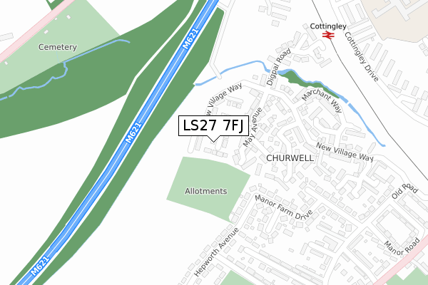
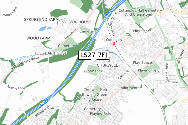
LS27 7FJ maps, stats, and open data
LS27 7FJ is located in the Morley North electoral ward, within the metropolitan district of Leeds and the English Parliamentary constituency of Morley and Outwood. The Sub Integrated Care Board (ICB) Location is NHS West Yorkshire ICB - 15F and the police force is West Yorkshire. This postcode has been in use since April 2019.
LS27 7FJ maps


Licence: Open Government Licence (requires attribution)
Attribution: Contains OS data © Crown copyright and database right 2025
Source: Open Postcode Geo
Licence: Open Government Licence (requires attribution)
Attribution: Contains OS data © Crown copyright and database right 2025; Contains Royal Mail data © Royal Mail copyright and database right 2025; Source: Office for National Statistics licensed under the Open Government Licence v.3.0
LS27 7FJ geodata
| Easting | 427009 |
| Northing | 430000 |
| Latitude | 53.765670 |
| Longitude | -1.591753 |
Where is LS27 7FJ?
| Country | England |
| Postcode District | LS27 |
Politics
| Ward | Morley North |
|---|---|
| Constituency | Morley And Outwood |
House Prices
Sales of detached houses in LS27 7FJ
2022 25 MAR £273,000 |
15, PICCOLO ROW, CHURWELL, LEEDS, LS27 7FJ 2019 20 DEC £289,950 |
18, PICCOLO ROW, CHURWELL, LEEDS, LS27 7FJ 2019 12 DEC £299,950 |
10, PICCOLO ROW, CHURWELL, LEEDS, LS27 7FJ 2019 27 SEP £249,950 |
2019 30 AUG £229,950 |
11, PICCOLO ROW, CHURWELL, LEEDS, LS27 7FJ 2019 30 AUG £294,950 |
2, PICCOLO ROW, CHURWELL, LEEDS, LS27 7FJ 2019 26 APR £244,950 |
3, PICCOLO ROW, CHURWELL, LEEDS, LS27 7FJ 2019 15 MAR £229,950 |
1, PICCOLO ROW, CHURWELL, LEEDS, LS27 7FJ 2019 8 MAR £289,950 |
Licence: Contains HM Land Registry data © Crown copyright and database right 2025. This data is licensed under the Open Government Licence v3.0.
Transport
Nearest bus stops to LS27 7FJ
| Rail Station (Cottingley Drive) | Cottingley | 397m |
| Rail Station (Cottingley Drive) | Cottingley | 402m |
| Cottingley Drive Dulverton Place (Cottingley Drive) | Cottingley | 479m |
| Gelderd Road Cemetery (Gelderd Road) | Beeston Royds | 483m |
| Gelderd Road Cemetery (Gelderd Road ( Wortley End)) | Beeston Royds | 488m |
Nearest railway stations to LS27 7FJ
| Cottingley Station | 0.4km |
| Morley Station | 1.8km |
| Leeds Station | 4.4km |
Broadband
Broadband access in LS27 7FJ (2020 data)
| Percentage of properties with Next Generation Access | 100.0% |
| Percentage of properties with Superfast Broadband | 100.0% |
| Percentage of properties with Ultrafast Broadband | 0.0% |
| Percentage of properties with Full Fibre Broadband | 0.0% |
Superfast Broadband is between 30Mbps and 300Mbps
Ultrafast Broadband is > 300Mbps
Broadband limitations in LS27 7FJ (2020 data)
| Percentage of properties unable to receive 2Mbps | 0.0% |
| Percentage of properties unable to receive 5Mbps | 0.0% |
| Percentage of properties unable to receive 10Mbps | 0.0% |
| Percentage of properties unable to receive 30Mbps | 0.0% |
Deprivation
45.8% of English postcodes are less deprived than LS27 7FJ:Food Standards Agency
Three nearest food hygiene ratings to LS27 7FJ (metres)


➜ Get more ratings from the Food Standards Agency
Nearest post box to LS27 7FJ
| Last Collection | |||
|---|---|---|---|
| Location | Mon-Fri | Sat | Distance |
| Cottingley Drive | 17:30 | 11:30 | 543m |
| Dulverton Gardens | 17:30 | 11:30 | 555m |
| Millshaw Industrial Estate | 17:30 | 11:30 | 868m |
LS27 7FJ ITL and LS27 7FJ LAU
The below table lists the International Territorial Level (ITL) codes (formerly Nomenclature of Territorial Units for Statistics (NUTS) codes) and Local Administrative Units (LAU) codes for LS27 7FJ:
| ITL 1 Code | Name |
|---|---|
| TLE | Yorkshire and The Humber |
| ITL 2 Code | Name |
| TLE4 | West Yorkshire |
| ITL 3 Code | Name |
| TLE42 | Leeds |
| LAU 1 Code | Name |
| E08000035 | Leeds |
LS27 7FJ census areas
The below table lists the Census Output Area (OA), Lower Layer Super Output Area (LSOA), and Middle Layer Super Output Area (MSOA) for LS27 7FJ:
| Code | Name | |
|---|---|---|
| OA | E00170439 | |
| LSOA | E01011518 | Leeds 093A |
| MSOA | E02002422 | Leeds 093 |
Nearest postcodes to LS27 7FJ
| LS27 7GJ | May Avenue | 92m |
| LS27 7LN | Goffee Way | 131m |
| LS27 7GH | May Court | 144m |
| LS27 7GQ | Mozart Way | 171m |
| LS27 7RN | Manor Farm Drive | 182m |
| LS27 7GD | New Village Way | 191m |
| LS27 7BD | New Village Way | 198m |
| LS27 7RW | Manor Farm Crescent | 218m |
| LS27 7GG | Whyment Close | 258m |
| LS27 7GN | Vienna Court | 265m |