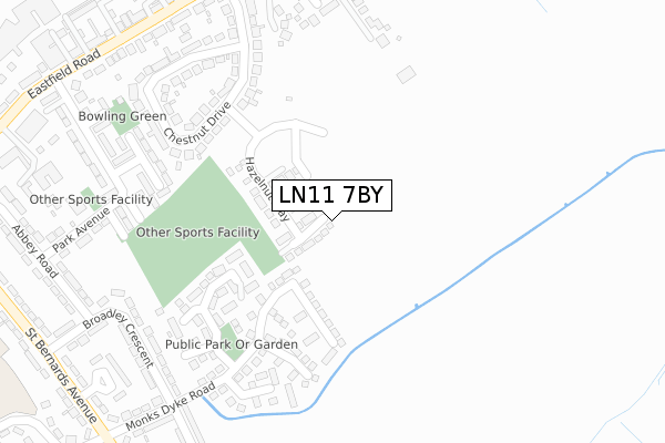
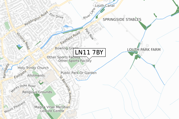
LN11 7BY is located in the Fulstow electoral ward, within the local authority district of East Lindsey and the English Parliamentary constituency of Louth and Horncastle. The Sub Integrated Care Board (ICB) Location is NHS Lincolnshire ICB - 71E and the police force is Lincolnshire. This postcode has been in use since April 2020.


GetTheData
Source: OS Open Zoomstack (Ordnance Survey)
Licence: Open Government Licence (requires attribution)
Attribution: Contains OS data © Crown copyright and database right 2025
Source: Open Postcode Geo
Licence: Open Government Licence (requires attribution)
Attribution: Contains OS data © Crown copyright and database right 2025; Contains Royal Mail data © Royal Mail copyright and database right 2025; Source: Office for National Statistics licensed under the Open Government Licence v.3.0
| Easting | 534417 |
| Northing | 387780 |
| Latitude | 53.369819 |
| Longitude | 0.018824 |
GetTheData
Source: Open Postcode Geo
Licence: Open Government Licence
| Country | England |
| Postcode District | LN11 |
➜ See where LN11 is on a map ➜ Where is Louth? | |
GetTheData
Source: Land Registry Price Paid Data
Licence: Open Government Licence
| Ward | Fulstow |
| Constituency | Louth And Horncastle |
GetTheData
Source: ONS Postcode Database
Licence: Open Government Licence
2022 22 JUL £305,000 |
1, CONKER GROVE, LOUTH, LN11 7BY 2021 26 MAR £252,995 |
2020 18 DEC £252,995 |
20, CONKER GROVE, LOUTH, LN11 7BY 2020 17 DEC £205,000 |
3, CONKER GROVE, LOUTH, LN11 7BY 2020 14 DEC £242,995 |
4, CONKER GROVE, LOUTH, LN11 7BY 2020 9 DEC £242,995 |
17, CONKER GROVE, LOUTH, LN11 7BY 2020 17 NOV £251,495 |
6, CONKER GROVE, LOUTH, LN11 7BY 2020 30 OCT £212,495 |
8, CONKER GROVE, LOUTH, LN11 7BY 2020 16 OCT £236,995 |
5, CONKER GROVE, LOUTH, LN11 7BY 2020 9 OCT £252,995 |
GetTheData
Source: HM Land Registry Price Paid Data
Licence: Contains HM Land Registry data © Crown copyright and database right 2025. This data is licensed under the Open Government Licence v3.0.
| 8 Chestnut Drive (Chestnut Drive) | Louth | 298m |
| 26 Park Avenue (Park Avenue) | Louth | 341m |
| 23 Park Avenue (Park Avenue) | Louth | 345m |
| 75 Chestnut Drive (Chestnut Drive) | Louth | 347m |
| Community Hall (Park Avenue) | Louth | 376m |
GetTheData
Source: NaPTAN
Licence: Open Government Licence
GetTheData
Source: ONS Postcode Database
Licence: Open Government Licence


➜ Get more ratings from the Food Standards Agency
GetTheData
Source: Food Standards Agency
Licence: FSA terms & conditions
| Last Collection | |||
|---|---|---|---|
| Location | Mon-Fri | Sat | Distance |
| Trinity Post Office | 17:15 | 11:30 | 850m |
| Stewton Lane | 17:00 | 12:00 | 1,163m |
| Keddington | 17:00 | 07:00 | 1,188m |
GetTheData
Source: Dracos
Licence: Creative Commons Attribution-ShareAlike
The below table lists the International Territorial Level (ITL) codes (formerly Nomenclature of Territorial Units for Statistics (NUTS) codes) and Local Administrative Units (LAU) codes for LN11 7BY:
| ITL 1 Code | Name |
|---|---|
| TLF | East Midlands (England) |
| ITL 2 Code | Name |
| TLF3 | Lincolnshire |
| ITL 3 Code | Name |
| TLF30 | Lincolnshire CC |
| LAU 1 Code | Name |
| E07000137 | East Lindsey |
GetTheData
Source: ONS Postcode Directory
Licence: Open Government Licence
The below table lists the Census Output Area (OA), Lower Layer Super Output Area (LSOA), and Middle Layer Super Output Area (MSOA) for LN11 7BY:
| Code | Name | |
|---|---|---|
| OA | E00132305 | |
| LSOA | E01026070 | East Lindsey 009C |
| MSOA | E02005432 | East Lindsey 009 |
GetTheData
Source: ONS Postcode Directory
Licence: Open Government Licence
| LN11 8BZ | Somersby Way | 162m |
| LN11 8BP | Harveys Lane | 173m |
| LN11 8BT | Bishops Close | 192m |
| LN11 8BN | Stockwith Drive | 239m |
| LN11 8AR | Monks Dyke Road | 260m |
| LN11 7AX | Chestnut Drive | 267m |
| LN11 8AN | Broadley Crescent | 304m |
| LN11 7XA | Eastfield Rise | 319m |
| LN11 7AY | Chestnut Drive | 320m |
| LN11 8AL | Broadley Crescent | 336m |
GetTheData
Source: Open Postcode Geo; Land Registry Price Paid Data
Licence: Open Government Licence