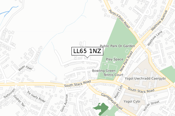
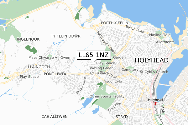
LL65 1NZ is located in the Parc a'r Mynydd electoral ward, within the unitary authority of Isle of Anglesey and the Welsh Parliamentary constituency of Ynys Môn. The Local Health Board is Betsi Cadwaladr University and the police force is North Wales. This postcode has been in use since April 2018.


GetTheData
Source: OS Open Zoomstack (Ordnance Survey)
Licence: Open Government Licence (requires attribution)
Attribution: Contains OS data © Crown copyright and database right 2025
Source: Open Postcode Geo
Licence: Open Government Licence (requires attribution)
Attribution: Contains OS data © Crown copyright and database right 2025; Contains Royal Mail data © Royal Mail copyright and database right 2025; Source: Office for National Statistics licensed under the Open Government Licence v.3.0
| Easting | 223887 |
| Northing | 382715 |
| Latitude | 53.312021 |
| Longitude | -4.644981 |
GetTheData
Source: Open Postcode Geo
Licence: Open Government Licence
| Country | Wales |
| Postcode District | LL65 |
➜ See where LL65 is on a map ➜ Where is Holyhead? | |
GetTheData
Source: Land Registry Price Paid Data
Licence: Open Government Licence
| Ward | Parc A'r Mynydd |
| Constituency | Ynys Môn |
GetTheData
Source: ONS Postcode Database
Licence: Open Government Licence
2024 24 OCT £327,000 |
2024 30 AUG £255,000 |
2023 13 OCT £285,000 |
73, PARC TYDDYN BACH, HOLYHEAD, LL65 1NZ 2022 26 AUG £264,995 |
2022 27 MAY £225,000 |
2022 21 FEB £225,000 |
2021 20 DEC £290,000 |
2021 30 APR £209,995 |
75, PARC TYDDYN BACH, HOLYHEAD, LL65 1NZ 2021 16 APR £267,995 |
76, PARC TYDDYN BACH, HOLYHEAD, LL65 1NZ 2021 9 APR £267,995 |
GetTheData
Source: HM Land Registry Price Paid Data
Licence: Contains HM Land Registry data © Crown copyright and database right 2025. This data is licensed under the Open Government Licence v3.0.
| Bowling Greens (South Stack Road) | Llaingoch | 171m |
| Bowling Greens (South Stack Road) | Llaingoch | 175m |
| Ysgol (South Stack Road) | Llaingoch | 194m |
| Tre Hwfa Road (Fforth Tre Hwfa) | Pont-hwfa | 308m |
| Ysgol (South Stack Road) | Llaingoch | 330m |
| Holyhead Station | 1km |
GetTheData
Source: NaPTAN
Licence: Open Government Licence
| Percentage of properties with Next Generation Access | 100.0% |
| Percentage of properties with Superfast Broadband | 100.0% |
| Percentage of properties with Ultrafast Broadband | 100.0% |
| Percentage of properties with Full Fibre Broadband | 100.0% |
Superfast Broadband is between 30Mbps and 300Mbps
Ultrafast Broadband is > 300Mbps
| Percentage of properties unable to receive 2Mbps | 0.0% |
| Percentage of properties unable to receive 5Mbps | 0.0% |
| Percentage of properties unable to receive 10Mbps | 0.0% |
| Percentage of properties unable to receive 30Mbps | 0.0% |
GetTheData
Source: Ofcom
Licence: Ofcom Terms of Use (requires attribution)
GetTheData
Source: ONS Postcode Database
Licence: Open Government Licence


➜ Get more ratings from the Food Standards Agency
GetTheData
Source: Food Standards Agency
Licence: FSA terms & conditions
| Last Collection | |||
|---|---|---|---|
| Location | Mon-Fri | Sat | Distance |
| Gors | 16:00 | 11:45 | 137m |
| Morrison's | 17:30 | 12:30 | 3,448m |
| Market Street | 17:00 | 11:45 | 4,574m |
GetTheData
Source: Dracos
Licence: Creative Commons Attribution-ShareAlike
The below table lists the International Territorial Level (ITL) codes (formerly Nomenclature of Territorial Units for Statistics (NUTS) codes) and Local Administrative Units (LAU) codes for LL65 1NZ:
| ITL 1 Code | Name |
|---|---|
| TLL | Wales |
| ITL 2 Code | Name |
| TLL1 | West Wales and The Valleys |
| ITL 3 Code | Name |
| TLL11 | Isle of Anglesey |
| LAU 1 Code | Name |
| W06000001 | Isle of Anglesey |
GetTheData
Source: ONS Postcode Directory
Licence: Open Government Licence
The below table lists the Census Output Area (OA), Lower Layer Super Output Area (LSOA), and Middle Layer Super Output Area (MSOA) for LL65 1NZ:
| Code | Name | |
|---|---|---|
| OA | W00000172 | |
| LSOA | W01000034 | Isle of Anglesey 004B |
| MSOA | W02000004 | Isle of Anglesey 004 |
GetTheData
Source: ONS Postcode Directory
Licence: Open Government Licence
| LL65 1QA | Llain Westbury | 141m |
| LL65 1NT | Southstack Road | 152m |
| LL65 1PF | Brighton Terrace | 168m |
| LL65 1PJ | Gwel Y Mynydd | 185m |
| LL65 1PG | Ponthwfa Terrace | 221m |
| LL65 1NS | Garreglwyd Road | 221m |
| LL65 1PQ | Ponthwfa Lane | 234m |
| LL65 1PA | Trehwfa Crescent | 267m |
| LL65 1LT | Waen Fawr Estate | 277m |
| LL65 1PH | New Park Road | 291m |
GetTheData
Source: Open Postcode Geo; Land Registry Price Paid Data
Licence: Open Government Licence