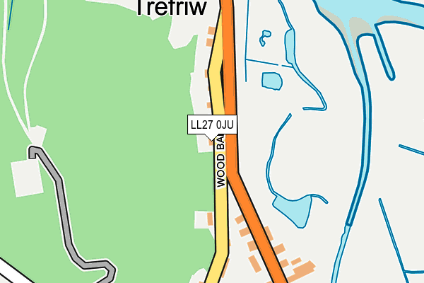
LL27 0JU is in Trefriw. LL27 0JU is located in the Betws-y-Coed and Trefriw electoral ward, within the unitary authority of Conwy and the Welsh Parliamentary constituency of Aberconwy. The Local Health Board is Betsi Cadwaladr University and the police force is North Wales. This postcode has been in use since January 1980.


GetTheData
Source: OS OpenMap – Local (Ordnance Survey)
Source: OS VectorMap District (Ordnance Survey)
Licence: Open Government Licence (requires attribution)
| Easting | 278030 |
| Northing | 363509 |
| Latitude | 53.154702 |
| Longitude | -3.825468 |
GetTheData
Source: Open Postcode Geo
Licence: Open Government Licence
| Town/City | Trefriw |
| Country | Wales |
| Postcode District | LL27 |
➜ See where LL27 is on a map ➜ Where is Trefriw? | |
GetTheData
Source: Land Registry Price Paid Data
Licence: Open Government Licence
Elevation or altitude of LL27 0JU as distance above sea level:
| Metres | Feet | |
|---|---|---|
| Elevation | 20m | 66ft |
Elevation is measured from the approximate centre of the postcode, to the nearest point on an OS contour line from OS Terrain 50, which has contour spacing of ten vertical metres.
➜ How high above sea level am I? Find the elevation of your current position using your device's GPS.
GetTheData
Source: Open Postcode Elevation
Licence: Open Government Licence
| Ward | Betws-y-coed And Trefriw |
| Constituency | Aberconwy |
GetTheData
Source: ONS Postcode Database
Licence: Open Government Licence
RIVERDALE, TREFRIW, LL27 0JU 2022 10 JUN £390,000 |
TANYCOED, TREFRIW, LL27 0JU 2020 17 NOV £320,000 |
GWYNFRYN, TREFRIW, LL27 0JU 2020 2 APR £195,000 |
2019 30 AUG £285,000 |
2018 16 APR £192,000 |
2015 7 AUG £260,000 |
2004 27 OCT £220,000 |
2000 28 JAN £70,000 |
TANYCOED, TREFRIW, LL27 0JU 1998 22 MAY £75,000 |
GetTheData
Source: HM Land Registry Price Paid Data
Licence: Contains HM Land Registry data © Crown copyright and database right 2025. This data is licensed under the Open Government Licence v3.0.
| Alma House (B5106) | Trefriw | 37m |
| Alma House (B5106) | Trefriw | 60m |
| Prince's Arms Hotel (B5106) | Trefriw | 181m |
| Prince's Arms Hotel (B5106) | Trefriw | 205m |
| Fairy Falls Hotel (B5106) | Trefriw | 376m |
| North Llanrwst Station | 1.9km |
| Llanrwst Station | 2.7km |
| Dolgarrog Station | 3.5km |
GetTheData
Source: NaPTAN
Licence: Open Government Licence
| Percentage of properties with Next Generation Access | 100.0% |
| Percentage of properties with Superfast Broadband | 100.0% |
| Percentage of properties with Ultrafast Broadband | 0.0% |
| Percentage of properties with Full Fibre Broadband | 0.0% |
Superfast Broadband is between 30Mbps and 300Mbps
Ultrafast Broadband is > 300Mbps
| Median download speed | 40.0Mbps |
| Average download speed | 42.4Mbps |
| Maximum download speed | 69.65Mbps |
| Median upload speed | 8.6Mbps |
| Average upload speed | 8.9Mbps |
| Maximum upload speed | 16.75Mbps |
| Percentage of properties unable to receive 2Mbps | 0.0% |
| Percentage of properties unable to receive 5Mbps | 0.0% |
| Percentage of properties unable to receive 10Mbps | 0.0% |
| Percentage of properties unable to receive 30Mbps | 0.0% |
GetTheData
Source: Ofcom
Licence: Ofcom Terms of Use (requires attribution)
Estimated total energy consumption in LL27 0JU by fuel type, 2015.
| Consumption (kWh) | 177,133 |
|---|---|
| Meter count | 10 |
| Mean (kWh/meter) | 17,713 |
| Median (kWh/meter) | 17,536 |
| Consumption (kWh) | 34,815 |
|---|---|
| Meter count | 10 |
| Mean (kWh/meter) | 3,482 |
| Median (kWh/meter) | 3,011 |
GetTheData
Source: Postcode level gas estimates: 2015 (experimental)
Source: Postcode level electricity estimates: 2015 (experimental)
Licence: Open Government Licence
GetTheData
Source: ONS Postcode Database
Licence: Open Government Licence


➜ Get more ratings from the Food Standards Agency
GetTheData
Source: Food Standards Agency
Licence: FSA terms & conditions
| Last Collection | |||
|---|---|---|---|
| Location | Mon-Fri | Sat | Distance |
| Trefriw Post Office | 16:00 | 10:30 | 344m |
| Maesypandy | 09:30 | 09:30 | 466m |
| Tai Isa Llanrhychwyn | 09:30 | 09:30 | 1,559m |
GetTheData
Source: Dracos
Licence: Creative Commons Attribution-ShareAlike
The below table lists the International Territorial Level (ITL) codes (formerly Nomenclature of Territorial Units for Statistics (NUTS) codes) and Local Administrative Units (LAU) codes for LL27 0JU:
| ITL 1 Code | Name |
|---|---|
| TLL | Wales |
| ITL 2 Code | Name |
| TLL1 | West Wales and The Valleys |
| ITL 3 Code | Name |
| TLL13 | Conwy and Denbighshire |
| LAU 1 Code | Name |
| W06000003 | Conwy |
GetTheData
Source: ONS Postcode Directory
Licence: Open Government Licence
The below table lists the Census Output Area (OA), Lower Layer Super Output Area (LSOA), and Middle Layer Super Output Area (MSOA) for LL27 0JU:
| Code | Name | |
|---|---|---|
| OA | W00000988 | |
| LSOA | W01000185 | Conwy 015E |
| MSOA | W02000041 | Conwy 015 |
GetTheData
Source: ONS Postcode Directory
Licence: Open Government Licence
| LL27 0JW | 91m | |
| LL27 0JJ | 188m | |
| LL27 0QD | Maes Bodaelog | 239m |
| LL27 0JX | 241m | |
| LL27 0JL | Victoria Terrace | 273m |
| LL27 0JH | 324m | |
| LL27 0JY | Crafnant Road | 329m |
| LL27 0UQ | 333m | |
| LL27 0TZ | 345m | |
| LL27 0JN | 351m |
GetTheData
Source: Open Postcode Geo; Land Registry Price Paid Data
Licence: Open Government Licence