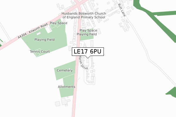
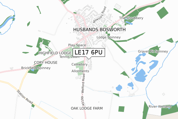
LE17 6PU is located in the Bosworth electoral ward, within the local authority district of Harborough and the English Parliamentary constituency of Harborough. The Sub Integrated Care Board (ICB) Location is NHS Leicester, Leicestershire and Rutland ICB - 03W and the police force is Leicestershire. This postcode has been in use since March 2018.


GetTheData
Source: OS Open Zoomstack (Ordnance Survey)
Licence: Open Government Licence (requires attribution)
Attribution: Contains OS data © Crown copyright and database right 2025
Source: Open Postcode Geo
Licence: Open Government Licence (requires attribution)
Attribution: Contains OS data © Crown copyright and database right 2025; Contains Royal Mail data © Royal Mail copyright and database right 2025; Source: Office for National Statistics licensed under the Open Government Licence v.3.0
| Easting | 464238 |
| Northing | 283930 |
| Latitude | 52.449578 |
| Longitude | -1.056210 |
GetTheData
Source: Open Postcode Geo
Licence: Open Government Licence
| Country | England |
| Postcode District | LE17 |
➜ See where LE17 is on a map ➜ Where is Husbands Bosworth? | |
GetTheData
Source: Land Registry Price Paid Data
Licence: Open Government Licence
| Ward | Bosworth |
| Constituency | Harborough |
GetTheData
Source: ONS Postcode Database
Licence: Open Government Licence
2024 23 AUG £340,000 |
2022 16 DEC £395,000 |
2022 2 SEP £375,000 |
2021 6 SEP £387,000 |
2021 26 MAR £490,000 |
2021 23 MAR £365,000 |
3, MARSH DRIVE, HUSBANDS BOSWORTH, LUTTERWORTH, LE17 6PU 2019 29 OCT £465,000 |
32, MARSH DRIVE, HUSBANDS BOSWORTH, LUTTERWORTH, LE17 6PU 2019 29 MAR £414,995 |
2019 29 MAR £324,995 |
33, MARSH DRIVE, HUSBANDS BOSWORTH, LUTTERWORTH, LE17 6PU 2019 29 MAR £499,995 |
➜ Husbands Bosworth house prices
GetTheData
Source: HM Land Registry Price Paid Data
Licence: Contains HM Land Registry data © Crown copyright and database right 2025. This data is licensed under the Open Government Licence v3.0.
| Primary School (Welford Road) | Husbands Bosworth | 201m |
| Bell Inn (Kilworth Road) | Husbands Bosworth | 280m |
| Bell Inn (Kilworth Road) | Husbands Bosworth | 298m |
| Cherry Tree Close (High Street) | Husbands Bosworth | 319m |
| Cherry Tree Close (High Street) | Husbands Bosworth | 332m |
GetTheData
Source: NaPTAN
Licence: Open Government Licence
| Percentage of properties with Next Generation Access | 100.0% |
| Percentage of properties with Superfast Broadband | 100.0% |
| Percentage of properties with Ultrafast Broadband | 100.0% |
| Percentage of properties with Full Fibre Broadband | 96.9% |
Superfast Broadband is between 30Mbps and 300Mbps
Ultrafast Broadband is > 300Mbps
| Percentage of properties unable to receive 2Mbps | 0.0% |
| Percentage of properties unable to receive 5Mbps | 0.0% |
| Percentage of properties unable to receive 10Mbps | 0.0% |
| Percentage of properties unable to receive 30Mbps | 0.0% |
GetTheData
Source: Ofcom
Licence: Ofcom Terms of Use (requires attribution)
GetTheData
Source: ONS Postcode Database
Licence: Open Government Licence


➜ Get more ratings from the Food Standards Agency
GetTheData
Source: Food Standards Agency
Licence: FSA terms & conditions
| Last Collection | |||
|---|---|---|---|
| Location | Mon-Fri | Sat | Distance |
| Husbands Bosworth Rso | 16:00 | 10:45 | 306m |
| Theddingworth | 15:45 | 08:00 | 3,237m |
| High Street | 16:30 | 10:30 | 3,483m |
GetTheData
Source: Dracos
Licence: Creative Commons Attribution-ShareAlike
The below table lists the International Territorial Level (ITL) codes (formerly Nomenclature of Territorial Units for Statistics (NUTS) codes) and Local Administrative Units (LAU) codes for LE17 6PU:
| ITL 1 Code | Name |
|---|---|
| TLF | East Midlands (England) |
| ITL 2 Code | Name |
| TLF2 | Leicestershire, Rutland and Northamptonshire |
| ITL 3 Code | Name |
| TLF22 | Leicestershire CC and Rutland |
| LAU 1 Code | Name |
| E07000131 | Harborough |
GetTheData
Source: ONS Postcode Directory
Licence: Open Government Licence
The below table lists the Census Output Area (OA), Lower Layer Super Output Area (LSOA), and Middle Layer Super Output Area (MSOA) for LE17 6PU:
| Code | Name | |
|---|---|---|
| OA | E00130754 | |
| LSOA | E01025771 | Harborough 005A |
| MSOA | E02005371 | Harborough 005 |
GetTheData
Source: ONS Postcode Directory
Licence: Open Government Licence
| LE17 6JX | Welford Road | 179m |
| LE17 6PT | Holly Mews | 184m |
| LE17 6JU | School Lane | 225m |
| LE17 6JY | Kilworth Road | 254m |
| LE17 6NB | Cherry Tree Close | 265m |
| LE17 6LL | Lammas Close | 269m |
| LE17 6JT | The Green | 289m |
| LE17 6JZ | Kilworth Road | 298m |
| LE17 6LX | Cheney Court | 346m |
| LE17 6LH | High Street | 356m |
GetTheData
Source: Open Postcode Geo; Land Registry Price Paid Data
Licence: Open Government Licence