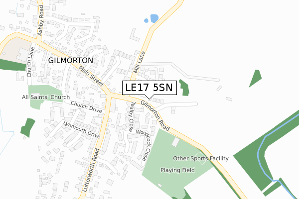
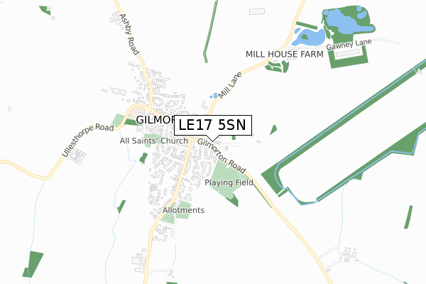
LE17 5SN is located in the Misterton electoral ward, within the local authority district of Harborough and the English Parliamentary constituency of South Leicestershire. The Sub Integrated Care Board (ICB) Location is NHS Leicester, Leicestershire and Rutland ICB - 03W and the police force is Leicestershire. This postcode has been in use since October 2019.


GetTheData
Source: OS Open Zoomstack (Ordnance Survey)
Licence: Open Government Licence (requires attribution)
Attribution: Contains OS data © Crown copyright and database right 2025
Source: Open Postcode Geo
Licence: Open Government Licence (requires attribution)
Attribution: Contains OS data © Crown copyright and database right 2025; Contains Royal Mail data © Royal Mail copyright and database right 2025; Source: Office for National Statistics licensed under the Open Government Licence v.3.0
| Easting | 457522 |
| Northing | 287827 |
| Latitude | 52.485357 |
| Longitude | -1.154348 |
GetTheData
Source: Open Postcode Geo
Licence: Open Government Licence
| Country | England |
| Postcode District | LE17 |
➜ See where LE17 is on a map ➜ Where is Gilmorton? | |
GetTheData
Source: Land Registry Price Paid Data
Licence: Open Government Licence
| Ward | Misterton |
| Constituency | South Leicestershire |
GetTheData
Source: ONS Postcode Database
Licence: Open Government Licence
2024 12 JUL £482,500 |
17, HILLY HOLLOW, GILMORTON, LUTTERWORTH, LE17 5SN 2021 30 SEP £342,995 |
2021 30 JUN £459,995 |
11, HILLY HOLLOW, GILMORTON, LUTTERWORTH, LE17 5SN 2021 30 JUN £459,995 |
19, HILLY HOLLOW, GILMORTON, LUTTERWORTH, LE17 5SN 2021 28 JUN £343,995 |
9, HILLY HOLLOW, GILMORTON, LUTTERWORTH, LE17 5SN 2021 28 JUN £459,995 |
23, HILLY HOLLOW, GILMORTON, LUTTERWORTH, LE17 5SN 2021 23 JUN £349,995 |
2, HILLY HOLLOW, GILMORTON, LUTTERWORTH, LE17 5SN 2021 9 JUN £575,000 |
13, HILLY HOLLOW, GILMORTON, LUTTERWORTH, LE17 5SN 2021 29 APR £339,995 |
1, HILLY HOLLOW, GILMORTON, LUTTERWORTH, LE17 5SN 2021 9 APR £394,995 |
GetTheData
Source: HM Land Registry Price Paid Data
Licence: Contains HM Land Registry data © Crown copyright and database right 2025. This data is licensed under the Open Government Licence v3.0.
| Crown Inn (Lutterworth Road) | Gilmorton | 271m |
| Ashby Road (Turville Road) | Gilmorton | 435m |
| Main Street | Gilmorton | 442m |
| Recreation Ground (Lutterworth Road) | Gilmorton | 488m |
| Turville Road (Ashby Road) | Gilmorton | 549m |
GetTheData
Source: NaPTAN
Licence: Open Government Licence
GetTheData
Source: ONS Postcode Database
Licence: Open Government Licence


➜ Get more ratings from the Food Standards Agency
GetTheData
Source: Food Standards Agency
Licence: FSA terms & conditions
| Last Collection | |||
|---|---|---|---|
| Location | Mon-Fri | Sat | Distance |
| Bruntingthorpe | 17:30 | 09:15 | 3,447m |
| Gilmorton Post Office, Main St | 16:20 | 10:00 | 3,536m |
| Leicester Road | 17:30 | 11:30 | 3,861m |
GetTheData
Source: Dracos
Licence: Creative Commons Attribution-ShareAlike
The below table lists the International Territorial Level (ITL) codes (formerly Nomenclature of Territorial Units for Statistics (NUTS) codes) and Local Administrative Units (LAU) codes for LE17 5SN:
| ITL 1 Code | Name |
|---|---|
| TLF | East Midlands (England) |
| ITL 2 Code | Name |
| TLF2 | Leicestershire, Rutland and Northamptonshire |
| ITL 3 Code | Name |
| TLF22 | Leicestershire CC and Rutland |
| LAU 1 Code | Name |
| E07000131 | Harborough |
GetTheData
Source: ONS Postcode Directory
Licence: Open Government Licence
The below table lists the Census Output Area (OA), Lower Layer Super Output Area (LSOA), and Middle Layer Super Output Area (MSOA) for LE17 5SN:
| Code | Name | |
|---|---|---|
| OA | E00130946 | |
| LSOA | E01025808 | Harborough 006B |
| MSOA | E02005372 | Harborough 006 |
GetTheData
Source: ONS Postcode Directory
Licence: Open Government Licence
| LE17 5SE | Woodcock Close | 184m |
| LE17 5PB | Mill Lane | 198m |
| LE17 5PT | Tealby Close | 217m |
| LE17 5NY | Lutterworth Road | 228m |
| LE17 5PS | Orchard Close | 238m |
| LE17 5PE | Porlock Drive | 258m |
| LE17 5PA | Main Street | 264m |
| LE17 5NZ | Lutterworth Road | 276m |
| LE17 5QD | Nether Farm Close | 284m |
| LE17 5NX | Main Street | 312m |
GetTheData
Source: Open Postcode Geo; Land Registry Price Paid Data
Licence: Open Government Licence