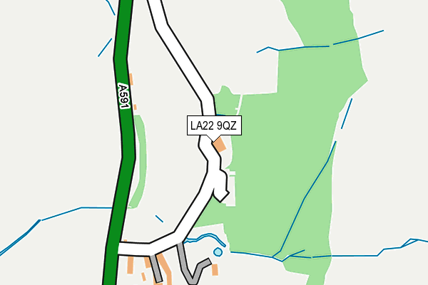
LA22 9QZ is in Grasmere, Ambleside. LA22 9QZ is located in the Windermere and Ambleside electoral ward, within the unitary authority of Westmorland and Furness and the English Parliamentary constituency of Westmorland and Lonsdale. The Sub Integrated Care Board (ICB) Location is NHS Lancashire and South Cumbria ICB - 01K and the police force is Cumbria. This postcode has been in use since January 1980.


GetTheData
Source: OS OpenMap – Local (Ordnance Survey)
Source: OS VectorMap District (Ordnance Survey)
Licence: Open Government Licence (requires attribution)
| Easting | 334300 |
| Northing | 507604 |
| Latitude | 54.459548 |
| Longitude | -3.014987 |
GetTheData
Source: Open Postcode Geo
Licence: Open Government Licence
| Locality | Grasmere |
| Town/City | Ambleside |
| Country | England |
| Postcode District | LA22 |
➜ See where LA22 is on a map ➜ Where is Grasmere? | |
GetTheData
Source: Land Registry Price Paid Data
Licence: Open Government Licence
Elevation or altitude of LA22 9QZ as distance above sea level:
| Metres | Feet | |
|---|---|---|
| Elevation | 90m | 295ft |
Elevation is measured from the approximate centre of the postcode, to the nearest point on an OS contour line from OS Terrain 50, which has contour spacing of ten vertical metres.
➜ How high above sea level am I? Find the elevation of your current position using your device's GPS.
GetTheData
Source: Open Postcode Elevation
Licence: Open Government Licence
| Ward | Windermere And Ambleside |
| Constituency | Westmorland And Lonsdale |
GetTheData
Source: ONS Postcode Database
Licence: Open Government Licence
| Stock Lane Car Park (Stock Lane) | Grasmere | 515m |
| School (Stock Lane) | Grasmere | 523m |
| Village Hall (Broadgate) | Grasmere | 525m |
| School (Stock Lane) | Grasmere | 526m |
| Village Hall (Broadgate) | Grasmere | 547m |
GetTheData
Source: NaPTAN
Licence: Open Government Licence
Estimated total energy consumption in LA22 9QZ by fuel type, 2015.
| Consumption (kWh) | 18,283 |
|---|---|
| Meter count | 6 |
| Mean (kWh/meter) | 3,047 |
| Median (kWh/meter) | 2,308 |
GetTheData
Source: Postcode level gas estimates: 2015 (experimental)
Source: Postcode level electricity estimates: 2015 (experimental)
Licence: Open Government Licence
GetTheData
Source: ONS Postcode Database
Licence: Open Government Licence


➜ Get more ratings from the Food Standards Agency
GetTheData
Source: Food Standards Agency
Licence: FSA terms & conditions
| Last Collection | |||
|---|---|---|---|
| Location | Mon-Fri | Sat | Distance |
| Grasmere Post Office | 16:45 | 12:00 | 633m |
| Town End | 16:45 | 12:00 | 645m |
| White Bridge | 16:30 | 09:00 | 668m |
GetTheData
Source: Dracos
Licence: Creative Commons Attribution-ShareAlike
The below table lists the International Territorial Level (ITL) codes (formerly Nomenclature of Territorial Units for Statistics (NUTS) codes) and Local Administrative Units (LAU) codes for LA22 9QZ:
| ITL 1 Code | Name |
|---|---|
| TLD | North West (England) |
| ITL 2 Code | Name |
| TLD1 | Cumbria |
| ITL 3 Code | Name |
| TLD12 | East Cumbria |
| LAU 1 Code | Name |
| E07000031 | South Lakeland |
GetTheData
Source: ONS Postcode Directory
Licence: Open Government Licence
The below table lists the Census Output Area (OA), Lower Layer Super Output Area (LSOA), and Middle Layer Super Output Area (MSOA) for LA22 9QZ:
| Code | Name | |
|---|---|---|
| OA | E00097961 | |
| LSOA | E01019376 | South Lakeland 001C |
| MSOA | E02004015 | South Lakeland 001 |
GetTheData
Source: ONS Postcode Directory
Licence: Open Government Licence
| LA22 9QF | 195m | |
| LA22 9QY | 258m | |
| LA22 9RB | 318m | |
| LA22 9SL | Stock Lane | 533m |
| LA22 9SJ | Stock Lane | 542m |
| LA22 9TA | Broadgate | 560m |
| LA22 9TB | Field Foot | 561m |
| LA22 9SH | 563m | |
| LA22 9SZ | College Street | 581m |
| LA22 9SY | Beck Steps | 584m |
GetTheData
Source: Open Postcode Geo; Land Registry Price Paid Data
Licence: Open Government Licence