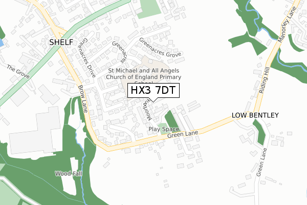
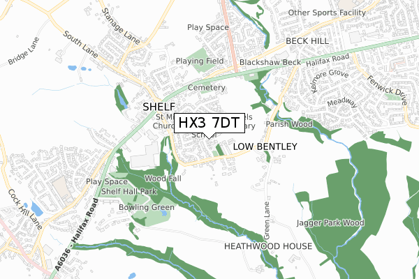
HX3 7DT is located in the Northowram and Shelf electoral ward, within the metropolitan district of Calderdale and the English Parliamentary constituency of Halifax. The Sub Integrated Care Board (ICB) Location is NHS West Yorkshire ICB - 02T and the police force is West Yorkshire. This postcode has been in use since January 2018.


GetTheData
Source: OS Open Zoomstack (Ordnance Survey)
Licence: Open Government Licence (requires attribution)
Attribution: Contains OS data © Crown copyright and database right 2025
Source: Open Postcode Geo
Licence: Open Government Licence (requires attribution)
Attribution: Contains OS data © Crown copyright and database right 2025; Contains Royal Mail data © Royal Mail copyright and database right 2025; Source: Office for National Statistics licensed under the Open Government Licence v.3.0
| Easting | 412806 |
| Northing | 428615 |
| Latitude | 53.753760 |
| Longitude | -1.807268 |
GetTheData
Source: Open Postcode Geo
Licence: Open Government Licence
| Country | England |
| Postcode District | HX3 |
➜ See where HX3 is on a map ➜ Where is Shelf? | |
GetTheData
Source: Land Registry Price Paid Data
Licence: Open Government Licence
| Ward | Northowram And Shelf |
| Constituency | Halifax |
GetTheData
Source: ONS Postcode Database
Licence: Open Government Licence
2024 30 SEP £500,000 |
2021 23 JUL £481,000 |
2021 31 MAR £490,000 |
13, MOORBANK DRIVE, SHELF, HALIFAX, HX3 7DT 2019 18 DEC £459,995 |
7, MOORBANK DRIVE, SHELF, HALIFAX, HX3 7DT 2019 29 NOV £409,995 |
11, MOORBANK DRIVE, SHELF, HALIFAX, HX3 7DT 2019 8 NOV £414,995 |
1, MOORBANK DRIVE, SHELF, HALIFAX, HX3 7DT 2019 8 NOV £409,995 |
9, MOORBANK DRIVE, SHELF, HALIFAX, HX3 7DT 2019 13 SEP £519,995 |
3, MOORBANK DRIVE, SHELF, HALIFAX, HX3 7DT 2019 26 JUL £529,995 |
2019 28 JUN £389,496 |
GetTheData
Source: HM Land Registry Price Paid Data
Licence: Contains HM Land Registry data © Crown copyright and database right 2025. This data is licensed under the Open Government Licence v3.0.
| Witchfield Hill Carr House Lane (Witchfield Hill) | Shelf | 334m |
| Witchfield Hill Carr House Lane (Witchfield Hill) | Shelf | 351m |
| Wade House Rd Brow Lane (Wade House Road) | Shelf | 367m |
| Carr House Rd Cooper Lane (Carr House Road) | Shelf | 391m |
| Wade House Rd Brow Lane (Wade House Road) | Shelf | 399m |
| Low Moor Station | 3.6km |
| Halifax Station | 4.8km |
| Bradford Interchange Station | 5.6km |
GetTheData
Source: NaPTAN
Licence: Open Government Licence
| Percentage of properties with Next Generation Access | 100.0% |
| Percentage of properties with Superfast Broadband | 100.0% |
| Percentage of properties with Ultrafast Broadband | 88.2% |
| Percentage of properties with Full Fibre Broadband | 88.2% |
Superfast Broadband is between 30Mbps and 300Mbps
Ultrafast Broadband is > 300Mbps
| Percentage of properties unable to receive 2Mbps | 0.0% |
| Percentage of properties unable to receive 5Mbps | 0.0% |
| Percentage of properties unable to receive 10Mbps | 0.0% |
| Percentage of properties unable to receive 30Mbps | 0.0% |
GetTheData
Source: Ofcom
Licence: Ofcom Terms of Use (requires attribution)
GetTheData
Source: ONS Postcode Database
Licence: Open Government Licence


➜ Get more ratings from the Food Standards Agency
GetTheData
Source: Food Standards Agency
Licence: FSA terms & conditions
| Last Collection | |||
|---|---|---|---|
| Location | Mon-Fri | Sat | Distance |
| Buttershaw P.o. Box | 17:15 | 11:45 | 964m |
| 39 Shelf Moor Road | 17:15 | 11:00 | 1,357m |
| 1 Cemetery Road | 17:15 | 12:45 | 1,970m |
GetTheData
Source: Dracos
Licence: Creative Commons Attribution-ShareAlike
The below table lists the International Territorial Level (ITL) codes (formerly Nomenclature of Territorial Units for Statistics (NUTS) codes) and Local Administrative Units (LAU) codes for HX3 7DT:
| ITL 1 Code | Name |
|---|---|
| TLE | Yorkshire and The Humber |
| ITL 2 Code | Name |
| TLE4 | West Yorkshire |
| ITL 3 Code | Name |
| TLE44 | Calderdale and Kirklees |
| LAU 1 Code | Name |
| E08000033 | Calderdale |
GetTheData
Source: ONS Postcode Directory
Licence: Open Government Licence
The below table lists the Census Output Area (OA), Lower Layer Super Output Area (LSOA), and Middle Layer Super Output Area (MSOA) for HX3 7DT:
| Code | Name | |
|---|---|---|
| OA | E00055129 | |
| LSOA | E01010933 | Calderdale 003C |
| MSOA | E02002246 | Calderdale 003 |
GetTheData
Source: ONS Postcode Directory
Licence: Open Government Licence
| HX3 7JW | Villa Gardens | 117m |
| HX3 7TZ | Willow Park Drive | 118m |
| HX3 7QP | Elm Grove | 120m |
| HX3 7TR | Green Lane | 131m |
| HX3 7QR | Beech Close | 135m |
| HX3 7QU | Meadow Close | 156m |
| HX3 7QW | Brow Wood Road | 179m |
| HX3 7RN | Green Acres Grove | 180m |
| HX3 7PZ | Green Hall Park | 187m |
| HX3 7QN | Brow Wood Rise | 213m |
GetTheData
Source: Open Postcode Geo; Land Registry Price Paid Data
Licence: Open Government Licence