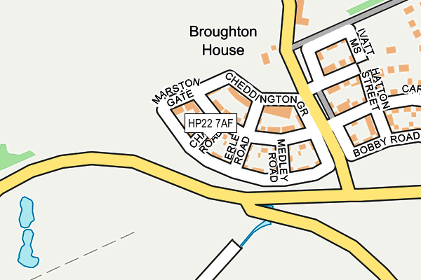
HP22 7AF is located in the Aston Clinton and Bierton electoral ward, within the unitary authority of Buckinghamshire and the English Parliamentary constituency of Buckingham. The Sub Integrated Care Board (ICB) Location is NHS Buckinghamshire, Oxfordshire and Berkshire West ICB - 14Y and the police force is Thames Valley. This postcode has been in use since February 2017.


GetTheData
Source: OS OpenMap – Local (Ordnance Survey)
Source: OS VectorMap District (Ordnance Survey)
Licence: Open Government Licence (requires attribution)
| Easting | 483893 |
| Northing | 214506 |
| Latitude | 51.822896 |
| Longitude | -0.784163 |
GetTheData
Source: Open Postcode Geo
Licence: Open Government Licence
| Country | England |
| Postcode District | HP22 |
➜ See where HP22 is on a map ➜ Where is Broughton? | |
GetTheData
Source: Land Registry Price Paid Data
Licence: Open Government Licence
| Ward | Aston Clinton And Bierton |
| Constituency | Buckingham |
GetTheData
Source: ONS Postcode Database
Licence: Open Government Licence
2017 12 OCT £490,000 |
2017 27 APR £480,000 |
GetTheData
Source: HM Land Registry Price Paid Data
Licence: Contains HM Land Registry data © Crown copyright and database right 2025. This data is licensed under the Open Government Licence v3.0.
| Broughton Crossing (Broughton Lane) | Broughton Village | 192m |
| Fieldway | Aylesbury | 464m |
| Meadow Way | Aylesbury | 534m |
| Southfield Road (Narbeth Drive) | Aylesbury | 623m |
| Southfield Road (Narbeth Drive) | Aylesbury | 633m |
| Aylesbury Station | 2.4km |
| Stoke Mandeville Station | 3.9km |
GetTheData
Source: NaPTAN
Licence: Open Government Licence
| Percentage of properties with Next Generation Access | 100.0% |
| Percentage of properties with Superfast Broadband | 100.0% |
| Percentage of properties with Ultrafast Broadband | 100.0% |
| Percentage of properties with Full Fibre Broadband | 100.0% |
Superfast Broadband is between 30Mbps and 300Mbps
Ultrafast Broadband is > 300Mbps
| Percentage of properties unable to receive 2Mbps | 0.0% |
| Percentage of properties unable to receive 5Mbps | 0.0% |
| Percentage of properties unable to receive 10Mbps | 0.0% |
| Percentage of properties unable to receive 30Mbps | 0.0% |
GetTheData
Source: Ofcom
Licence: Ofcom Terms of Use (requires attribution)
GetTheData
Source: ONS Postcode Database
Licence: Open Government Licence


➜ Get more ratings from the Food Standards Agency
GetTheData
Source: Food Standards Agency
Licence: FSA terms & conditions
| Last Collection | |||
|---|---|---|---|
| Location | Mon-Fri | Sat | Distance |
| Narbeth Drive | 17:15 | 12:00 | 662m |
| Eastfield Road | 17:15 | 12:00 | 668m |
| Douglas Road | 17:15 | 12:00 | 727m |
GetTheData
Source: Dracos
Licence: Creative Commons Attribution-ShareAlike
The below table lists the International Territorial Level (ITL) codes (formerly Nomenclature of Territorial Units for Statistics (NUTS) codes) and Local Administrative Units (LAU) codes for HP22 7AF:
| ITL 1 Code | Name |
|---|---|
| TLJ | South East (England) |
| ITL 2 Code | Name |
| TLJ1 | Berkshire, Buckinghamshire and Oxfordshire |
| ITL 3 Code | Name |
| TLJ13 | Buckinghamshire |
| LAU 1 Code | Name |
| E06000060 | Buckinghamshire |
GetTheData
Source: ONS Postcode Directory
Licence: Open Government Licence
The below table lists the Census Output Area (OA), Lower Layer Super Output Area (LSOA), and Middle Layer Super Output Area (MSOA) for HP22 7AF:
| Code | Name | |
|---|---|---|
| OA | E00089046 | |
| LSOA | E01017641 | Aylesbury Vale 007A |
| MSOA | E02003658 | Aylesbury Vale 007 |
GetTheData
Source: ONS Postcode Directory
Licence: Open Government Licence
| HP22 5AR | Broughton Crossing | 239m |
| HP20 1XL | The Pastures | 366m |
| HP20 1AQ | Provis Wharf | 422m |
| HP20 1QH | Northfield Road | 440m |
| HP20 1XP | Green View | 490m |
| HP20 1XS | Meadow Way | 497m |
| HP20 1PB | Northfield Road | 513m |
| HP20 1PD | Northfield Road | 514m |
| HP20 1YP | The Dell | 519m |
| HP20 1XJ | Field Way | 528m |
GetTheData
Source: Open Postcode Geo; Land Registry Price Paid Data
Licence: Open Government Licence