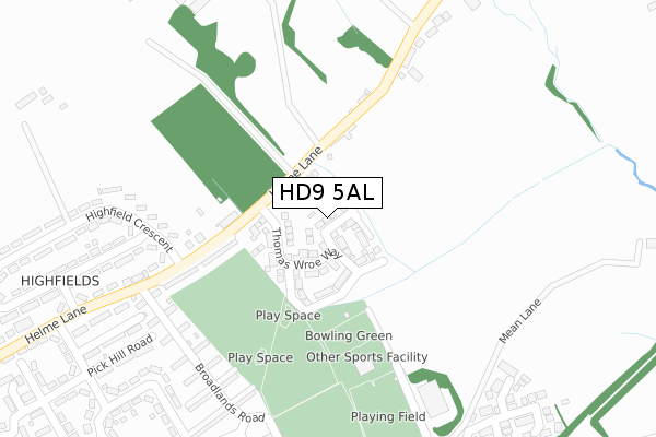
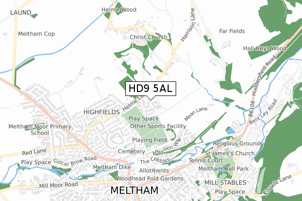
HD9 5AL is located in the Holme Valley North electoral ward, within the metropolitan district of Kirklees and the English Parliamentary constituency of Colne Valley. The Sub Integrated Care Board (ICB) Location is NHS West Yorkshire ICB - X2C4Y and the police force is West Yorkshire. This postcode has been in use since June 2018.


GetTheData
Source: OS Open Zoomstack (Ordnance Survey)
Licence: Open Government Licence (requires attribution)
Attribution: Contains OS data © Crown copyright and database right 2025
Source: Open Postcode Geo
Licence: Open Government Licence (requires attribution)
Attribution: Contains OS data © Crown copyright and database right 2025; Contains Royal Mail data © Royal Mail copyright and database right 2025; Source: Office for National Statistics licensed under the Open Government Licence v.3.0
| Easting | 410123 |
| Northing | 411341 |
| Latitude | 53.598558 |
| Longitude | -1.848512 |
GetTheData
Source: Open Postcode Geo
Licence: Open Government Licence
| Country | England |
| Postcode District | HD9 |
➜ See where HD9 is on a map ➜ Where is Meltham? | |
GetTheData
Source: Land Registry Price Paid Data
Licence: Open Government Licence
| Ward | Holme Valley North |
| Constituency | Colne Valley |
GetTheData
Source: ONS Postcode Database
Licence: Open Government Licence
2024 11 JUL £320,000 |
2022 7 NOV £297,000 |
37, COP HILL VIEW, MELTHAM, HOLMFIRTH, HD9 5AL 2020 18 DEC £267,716 |
2020 14 SEP £285,000 |
33, COP HILL VIEW, MELTHAM, HOLMFIRTH, HD9 5AL 2020 13 MAR £239,995 |
31, COP HILL VIEW, MELTHAM, HOLMFIRTH, HD9 5AL 2020 31 JAN £349,995 |
35, COP HILL VIEW, MELTHAM, HOLMFIRTH, HD9 5AL 2020 16 JAN £299,995 |
4A, COP HILL VIEW, MELTHAM, HOLMFIRTH, HD9 5AL 2019 26 JUL £319,995 |
29, COP HILL VIEW, MELTHAM, HOLMFIRTH, HD9 5AL 2019 28 JUN £249,995 |
10, COP HILL VIEW, MELTHAM, HOLMFIRTH, HD9 5AL 2019 28 JUN £247,995 |
GetTheData
Source: HM Land Registry Price Paid Data
Licence: Contains HM Land Registry data © Crown copyright and database right 2025. This data is licensed under the Open Government Licence v3.0.
| Helme Lane Slades Ln (Helme Lane) | Helme | 126m |
| Helme Lane Slades Ln (Helme Lane) | Helme | 133m |
| Helme Lane Broadlands Rd (Helme Lane) | Meltham | 266m |
| Broadlands Rd Helme Lane (Broadlands Road) | Meltham | 289m |
| Broadlands Rd Helme Lane (Broadlands Road) | Meltham | 298m |
| Slaithwaite Station | 3.6km |
| Berry Brow Station | 4.4km |
| Honley Station | 4.6km |
GetTheData
Source: NaPTAN
Licence: Open Government Licence
| Percentage of properties with Next Generation Access | 100.0% |
| Percentage of properties with Superfast Broadband | 100.0% |
| Percentage of properties with Ultrafast Broadband | 100.0% |
| Percentage of properties with Full Fibre Broadband | 55.0% |
Superfast Broadband is between 30Mbps and 300Mbps
Ultrafast Broadband is > 300Mbps
| Percentage of properties unable to receive 2Mbps | 0.0% |
| Percentage of properties unable to receive 5Mbps | 0.0% |
| Percentage of properties unable to receive 10Mbps | 0.0% |
| Percentage of properties unable to receive 30Mbps | 0.0% |
GetTheData
Source: Ofcom
Licence: Ofcom Terms of Use (requires attribution)
GetTheData
Source: ONS Postcode Database
Licence: Open Government Licence


➜ Get more ratings from the Food Standards Agency
GetTheData
Source: Food Standards Agency
Licence: FSA terms & conditions
| Last Collection | |||
|---|---|---|---|
| Location | Mon-Fri | Sat | Distance |
| 10 Broadlands Meltham | 17:00 | 10:15 | 310m |
| Scarr Green Close Meltham | 17:00 | 10:15 | 344m |
| 29 Helme Meltham | 17:00 | 10:15 | 615m |
GetTheData
Source: Dracos
Licence: Creative Commons Attribution-ShareAlike
The below table lists the International Territorial Level (ITL) codes (formerly Nomenclature of Territorial Units for Statistics (NUTS) codes) and Local Administrative Units (LAU) codes for HD9 5AL:
| ITL 1 Code | Name |
|---|---|
| TLE | Yorkshire and The Humber |
| ITL 2 Code | Name |
| TLE4 | West Yorkshire |
| ITL 3 Code | Name |
| TLE44 | Calderdale and Kirklees |
| LAU 1 Code | Name |
| E08000034 | Kirklees |
GetTheData
Source: ONS Postcode Directory
Licence: Open Government Licence
The below table lists the Census Output Area (OA), Lower Layer Super Output Area (LSOA), and Middle Layer Super Output Area (MSOA) for HD9 5AL:
| Code | Name | |
|---|---|---|
| OA | E00056320 | |
| LSOA | E01011175 | Kirklees 055C |
| MSOA | E02002325 | Kirklees 055 |
GetTheData
Source: ONS Postcode Directory
Licence: Open Government Licence
| HD9 5RJ | Helme Lane | 186m |
| HD9 5RL | Helme Lane | 189m |
| HD9 5RB | Broadlands | 287m |
| HD9 5QY | Broadlands | 310m |
| HD9 5RD | Helme Lane | 324m |
| HD9 5RQ | Highfield Crescent | 339m |
| HD9 5QN | Pavilion Way | 376m |
| HD9 5RA | Helme Lane | 380m |
| HD9 5RN | Helme | 386m |
| HD9 5PZ | Scarr Green Close | 401m |
GetTheData
Source: Open Postcode Geo; Land Registry Price Paid Data
Licence: Open Government Licence