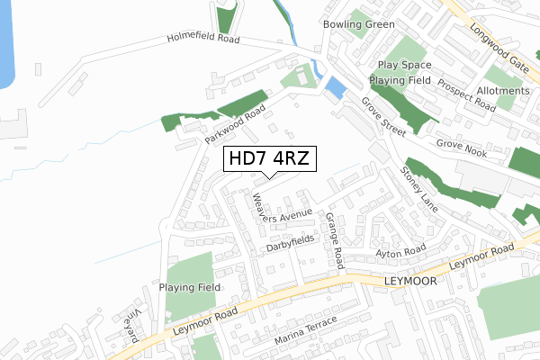
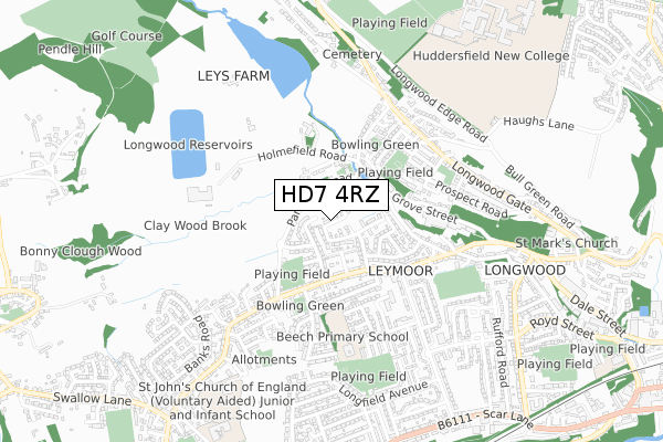
HD7 4RZ is located in the Golcar electoral ward, within the metropolitan district of Kirklees and the English Parliamentary constituency of Colne Valley. The Sub Integrated Care Board (ICB) Location is NHS West Yorkshire ICB - X2C4Y and the police force is West Yorkshire. This postcode has been in use since April 2020.


GetTheData
Source: OS Open Zoomstack (Ordnance Survey)
Licence: Open Government Licence (requires attribution)
Attribution: Contains OS data © Crown copyright and database right 2025
Source: Open Postcode Geo
Licence: Open Government Licence (requires attribution)
Attribution: Contains OS data © Crown copyright and database right 2025; Contains Royal Mail data © Royal Mail copyright and database right 2025; Source: Office for National Statistics licensed under the Open Government Licence v.3.0
| Easting | 410273 |
| Northing | 416750 |
| Latitude | 53.647172 |
| Longitude | -1.846070 |
GetTheData
Source: Open Postcode Geo
Licence: Open Government Licence
| Country | England |
| Postcode District | HD7 |
➜ See where HD7 is on a map ➜ Where is Huddersfield? | |
GetTheData
Source: Land Registry Price Paid Data
Licence: Open Government Licence
| Ward | Golcar |
| Constituency | Colne Valley |
GetTheData
Source: ONS Postcode Database
Licence: Open Government Licence
2024 18 SEP £288,000 |
2023 27 JUL £347,500 |
15, GRAHAM SHAW WAY, GOLCAR, HUDDERSFIELD, HD7 4RZ 2020 28 AUG £277,995 |
2020 14 AUG £264,995 |
6, GRAHAM SHAW WAY, GOLCAR, HUDDERSFIELD, HD7 4RZ 2020 7 AUG £259,995 |
5, GRAHAM SHAW WAY, GOLCAR, HUDDERSFIELD, HD7 4RZ 2020 24 JUL £329,995 |
3, GRAHAM SHAW WAY, GOLCAR, HUDDERSFIELD, HD7 4RZ 2020 27 MAR £339,995 |
2020 13 MAR £284,996 |
GetTheData
Source: HM Land Registry Price Paid Data
Licence: Contains HM Land Registry data © Crown copyright and database right 2025. This data is licensed under the Open Government Licence v3.0.
| Leymoor Road Darbyfields (Leymoor Road) | Golcar | 224m |
| Leymoor Road Darbyfields (Leymoor Road) | Golcar | 234m |
| Sycamore Ave Elmfield Avenue (Sycamore Avenue) | Golcar | 342m |
| Sycamore Ave Elmfield Avenue (Sycamore Avenue) | Golcar | 395m |
| Leymoor Rd Parkwood Road (Leymoor Road) | Golcar | 405m |
| Lockwood Station | 3.3km |
| Slaithwaite Station | 3.5km |
| Huddersfield Station | 4.1km |
GetTheData
Source: NaPTAN
Licence: Open Government Licence
GetTheData
Source: ONS Postcode Database
Licence: Open Government Licence


➜ Get more ratings from the Food Standards Agency
GetTheData
Source: Food Standards Agency
Licence: FSA terms & conditions
| Last Collection | |||
|---|---|---|---|
| Location | Mon-Fri | Sat | Distance |
| Taylor Street | 17:30 | 12:00 | 919m |
| West Street | 17:30 | 12:00 | 1,048m |
| Rufford Road | 17:00 | 12:00 | 1,050m |
GetTheData
Source: Dracos
Licence: Creative Commons Attribution-ShareAlike
The below table lists the International Territorial Level (ITL) codes (formerly Nomenclature of Territorial Units for Statistics (NUTS) codes) and Local Administrative Units (LAU) codes for HD7 4RZ:
| ITL 1 Code | Name |
|---|---|
| TLE | Yorkshire and The Humber |
| ITL 2 Code | Name |
| TLE4 | West Yorkshire |
| ITL 3 Code | Name |
| TLE44 | Calderdale and Kirklees |
| LAU 1 Code | Name |
| E08000034 | Kirklees |
GetTheData
Source: ONS Postcode Directory
Licence: Open Government Licence
The below table lists the Census Output Area (OA), Lower Layer Super Output Area (LSOA), and Middle Layer Super Output Area (MSOA) for HD7 4RZ:
| Code | Name | |
|---|---|---|
| OA | E00056151 | |
| LSOA | E01011155 | Kirklees 038B |
| MSOA | E02002308 | Kirklees 038 |
GetTheData
Source: ONS Postcode Directory
Licence: Open Government Licence
| HD3 4TT | Parkwood Road | 137m |
| HD7 4QU | Thorpe Green Drive | 141m |
| HD3 4ZN | Parkwood Road | 147m |
| HD7 4QZ | Grange Road | 148m |
| HD3 4ZW | Stoney Lane | 150m |
| HD7 4QY | Darbyfields | 154m |
| HD3 4ZQ | Stoney Lane | 175m |
| HD3 4TU | Royles Head Lane | 184m |
| HD3 4TR | Leafield Bank | 184m |
| HD7 4QT | Thorpe Green Drive | 187m |
GetTheData
Source: Open Postcode Geo; Land Registry Price Paid Data
Licence: Open Government Licence