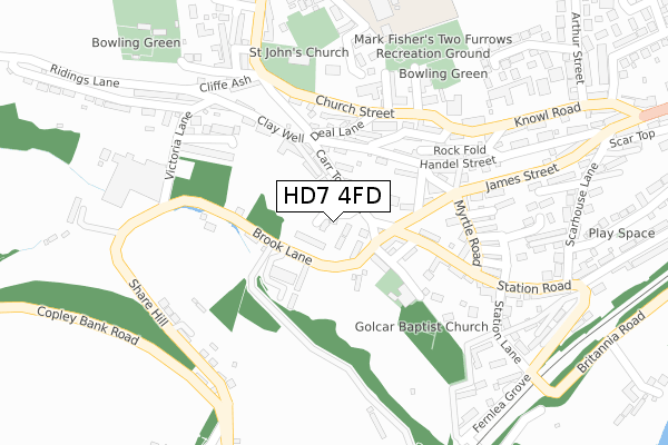
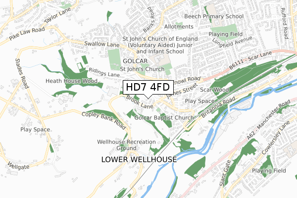
HD7 4FD is located in the Golcar electoral ward, within the metropolitan district of Kirklees and the English Parliamentary constituency of Colne Valley. The Sub Integrated Care Board (ICB) Location is NHS West Yorkshire ICB - X2C4Y and the police force is West Yorkshire. This postcode has been in use since August 2019.


GetTheData
Source: OS Open Zoomstack (Ordnance Survey)
Licence: Open Government Licence (requires attribution)
Attribution: Contains OS data © Crown copyright and database right 2025
Source: Open Postcode Geo
Licence: Open Government Licence (requires attribution)
Attribution: Contains OS data © Crown copyright and database right 2025; Contains Royal Mail data © Royal Mail copyright and database right 2025; Source: Office for National Statistics licensed under the Open Government Licence v.3.0
| Easting | 409689 |
| Northing | 415601 |
| Latitude | 53.636855 |
| Longitude | -1.854940 |
GetTheData
Source: Open Postcode Geo
Licence: Open Government Licence
| Country | England |
| Postcode District | HD7 |
➜ See where HD7 is on a map ➜ Where is Huddersfield? | |
GetTheData
Source: Land Registry Price Paid Data
Licence: Open Government Licence
| Ward | Golcar |
| Constituency | Colne Valley |
GetTheData
Source: ONS Postcode Database
Licence: Open Government Licence
26, HILLCREST VIEW, GOLCAR, HUDDERSFIELD, HD7 4FD 2023 7 NOV £520,000 |
25, HILLCREST VIEW, GOLCAR, HUDDERSFIELD, HD7 4FD 2023 22 SEP £515,000 |
23, HILLCREST VIEW, GOLCAR, HUDDERSFIELD, HD7 4FD 2023 22 SEP £515,000 |
24, HILLCREST VIEW, GOLCAR, HUDDERSFIELD, HD7 4FD 2023 14 APR £475,000 |
21, HILLCREST VIEW, GOLCAR, HUDDERSFIELD, HD7 4FD 2023 10 MAR £521,000 |
2023 17 FEB £465,000 |
2020 20 NOV £254,950 |
17, HILLCREST VIEW, GOLCAR, HUDDERSFIELD, HD7 4FD 2020 13 OCT £389,950 |
15, HILLCREST VIEW, GOLCAR, HUDDERSFIELD, HD7 4FD 2020 7 OCT £339,995 |
9, HILLCREST VIEW, GOLCAR, HUDDERSFIELD, HD7 4FD 2020 21 AUG £346,995 |
GetTheData
Source: HM Land Registry Price Paid Data
Licence: Contains HM Land Registry data © Crown copyright and database right 2025. This data is licensed under the Open Government Licence v3.0.
| Brook Lane Victoria Ln (Brook Lane) | Golcar | 116m |
| Brook Lane Victoria Ln (Brook Lane) | Golcar | 118m |
| Station Road James St (Station Road) | Golcar | 155m |
| Station Road James St (Station Road) | Golcar | 157m |
| Church Street Manor Rd (Church Street) | Golcar | 158m |
| Slaithwaite Station | 2.3km |
| Lockwood Station | 3.6km |
| Berry Brow Station | 4.4km |
GetTheData
Source: NaPTAN
Licence: Open Government Licence
GetTheData
Source: ONS Postcode Database
Licence: Open Government Licence


➜ Get more ratings from the Food Standards Agency
GetTheData
Source: Food Standards Agency
Licence: FSA terms & conditions
| Last Collection | |||
|---|---|---|---|
| Location | Mon-Fri | Sat | Distance |
| West Street | 17:30 | 12:00 | 330m |
| Taylor Street | 17:30 | 12:00 | 707m |
| Rufford Road | 17:00 | 12:00 | 1,428m |
GetTheData
Source: Dracos
Licence: Creative Commons Attribution-ShareAlike
The below table lists the International Territorial Level (ITL) codes (formerly Nomenclature of Territorial Units for Statistics (NUTS) codes) and Local Administrative Units (LAU) codes for HD7 4FD:
| ITL 1 Code | Name |
|---|---|
| TLE | Yorkshire and The Humber |
| ITL 2 Code | Name |
| TLE4 | West Yorkshire |
| ITL 3 Code | Name |
| TLE44 | Calderdale and Kirklees |
| LAU 1 Code | Name |
| E08000034 | Kirklees |
GetTheData
Source: ONS Postcode Directory
Licence: Open Government Licence
The below table lists the Census Output Area (OA), Lower Layer Super Output Area (LSOA), and Middle Layer Super Output Area (MSOA) for HD7 4FD:
| Code | Name | |
|---|---|---|
| OA | E00056183 | |
| LSOA | E01011152 | Kirklees 041D |
| MSOA | E02002311 | Kirklees 041 |
GetTheData
Source: ONS Postcode Directory
Licence: Open Government Licence
| HD7 4JB | Carr Top Lane | 57m |
| HD7 4JA | Brook Lane | 90m |
| HD7 4HG | Brook Lane | 97m |
| HD7 4JD | Clay Well | 99m |
| HD7 4HX | Station Road | 147m |
| HD7 4AF | Stanley Place | 148m |
| HD7 4PX | Church Street | 152m |
| HD7 4HY | Chapel Terrace | 159m |
| HD7 4HU | Park Lane | 167m |
| HD7 4JH | Fullwood Drive | 173m |
GetTheData
Source: Open Postcode Geo; Land Registry Price Paid Data
Licence: Open Government Licence