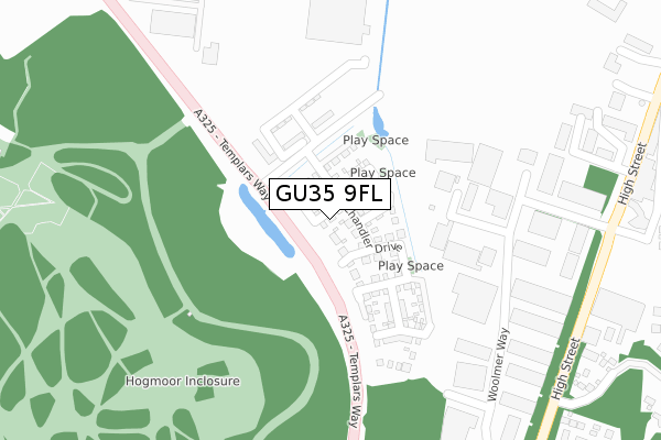
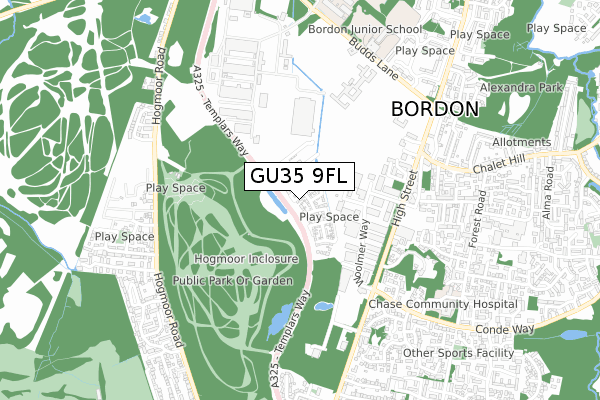
GU35 9FL is located in the Whitehill Hogmoor & Greatham electoral ward, within the local authority district of East Hampshire and the English Parliamentary constituency of East Hampshire. The Sub Integrated Care Board (ICB) Location is NHS Hampshire and Isle of Wight ICB - D9Y0V and the police force is Hampshire. This postcode has been in use since September 2018.


GetTheData
Source: OS Open Zoomstack (Ordnance Survey)
Licence: Open Government Licence (requires attribution)
Attribution: Contains OS data © Crown copyright and database right 2025
Source: Open Postcode Geo
Licence: Open Government Licence (requires attribution)
Attribution: Contains OS data © Crown copyright and database right 2025; Contains Royal Mail data © Royal Mail copyright and database right 2025; Source: Office for National Statistics licensed under the Open Government Licence v.3.0
| Easting | 479165 |
| Northing | 135164 |
| Latitude | 51.110309 |
| Longitude | -0.870500 |
GetTheData
Source: Open Postcode Geo
Licence: Open Government Licence
| Country | England |
| Postcode District | GU35 |
➜ See where GU35 is on a map ➜ Where is Bordon? | |
GetTheData
Source: Land Registry Price Paid Data
Licence: Open Government Licence
| Ward | Whitehill Hogmoor & Greatham |
| Constituency | East Hampshire |
GetTheData
Source: ONS Postcode Database
Licence: Open Government Licence
2023 20 DEC £471,000 |
10, WELLS CLOSE, BORDON, GU35 9FL 2019 28 JUN £399,950 |
8, WELLS CLOSE, BORDON, GU35 9FL 2019 23 MAY £424,950 |
2019 19 MAR £382,950 |
3, WELLS CLOSE, BORDON, GU35 9FL 2019 15 MAR £374,950 |
2, WELLS CLOSE, BORDON, GU35 9FL 2019 16 JAN £370,000 |
GetTheData
Source: HM Land Registry Price Paid Data
Licence: Contains HM Land Registry data © Crown copyright and database right 2025. This data is licensed under the Open Government Licence v3.0.
| Whitehill Chase (High Street) | Bordon | 430m |
| Whitehill Chase (High Street) | Bordon | 456m |
| Highview Business Centre (High Street) | Bordon | 485m |
| Tesco (Woolmer Road) | Bordon | 490m |
| Highview Business Centre (High Street) | Bordon | 504m |
| Liphook Station | 6.6km |
GetTheData
Source: NaPTAN
Licence: Open Government Licence
| Percentage of properties with Next Generation Access | 100.0% |
| Percentage of properties with Superfast Broadband | 100.0% |
| Percentage of properties with Ultrafast Broadband | 0.0% |
| Percentage of properties with Full Fibre Broadband | 0.0% |
Superfast Broadband is between 30Mbps and 300Mbps
Ultrafast Broadband is > 300Mbps
| Percentage of properties unable to receive 2Mbps | 0.0% |
| Percentage of properties unable to receive 5Mbps | 0.0% |
| Percentage of properties unable to receive 10Mbps | 0.0% |
| Percentage of properties unable to receive 30Mbps | 0.0% |
GetTheData
Source: Ofcom
Licence: Ofcom Terms of Use (requires attribution)
GetTheData
Source: ONS Postcode Database
Licence: Open Government Licence


➜ Get more ratings from the Food Standards Agency
GetTheData
Source: Food Standards Agency
Licence: FSA terms & conditions
| Last Collection | |||
|---|---|---|---|
| Location | Mon-Fri | Sat | Distance |
| Tesco | 16:45 | 12:00 | 448m |
| Budds Lane | 17:15 | 11:30 | 661m |
| Chalet Hill | 17:15 | 12:00 | 820m |
GetTheData
Source: Dracos
Licence: Creative Commons Attribution-ShareAlike
The below table lists the International Territorial Level (ITL) codes (formerly Nomenclature of Territorial Units for Statistics (NUTS) codes) and Local Administrative Units (LAU) codes for GU35 9FL:
| ITL 1 Code | Name |
|---|---|
| TLJ | South East (England) |
| ITL 2 Code | Name |
| TLJ3 | Hampshire and Isle of Wight |
| ITL 3 Code | Name |
| TLJ36 | Central Hampshire |
| LAU 1 Code | Name |
| E07000085 | East Hampshire |
GetTheData
Source: ONS Postcode Directory
Licence: Open Government Licence
The below table lists the Census Output Area (OA), Lower Layer Super Output Area (LSOA), and Middle Layer Super Output Area (MSOA) for GU35 9FL:
| Code | Name | |
|---|---|---|
| OA | E00115085 | |
| LSOA | E01032663 | East Hampshire 008E |
| MSOA | E02004704 | East Hampshire 008 |
GetTheData
Source: ONS Postcode Directory
Licence: Open Government Licence
| GU35 9QE | Woolmer Way | 247m |
| GU35 0AX | High Street | 429m |
| GU35 0FD | Oldfield Close | 450m |
| GU35 0AY | High Street | 495m |
| GU35 0BA | Lynton Road | 505m |
| GU35 0BU | Manica Close | 517m |
| GU35 0UR | Woodpecker Close | 521m |
| GU35 0BB | Devon Road | 545m |
| GU35 0TG | Chalet Court | 570m |
| GU35 0HF | Woodside Park | 582m |
GetTheData
Source: Open Postcode Geo; Land Registry Price Paid Data
Licence: Open Government Licence