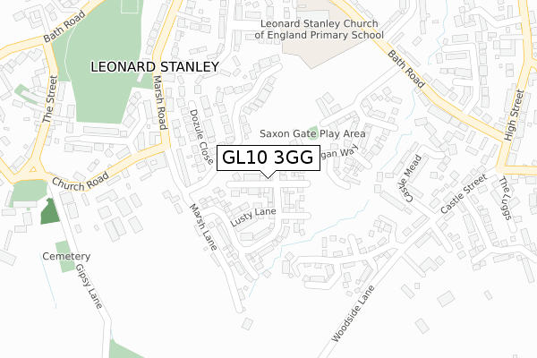
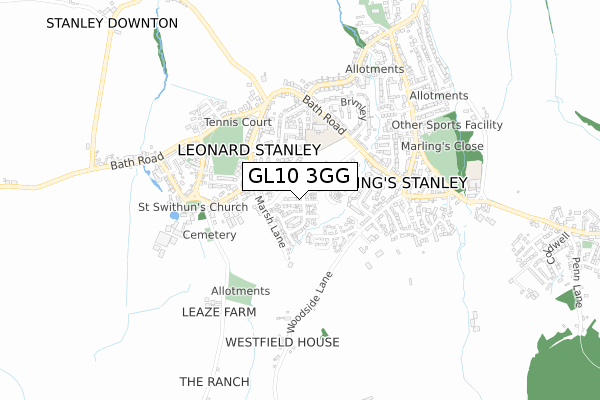
GL10 3GG is located in the The Stanleys electoral ward, within the local authority district of Stroud and the English Parliamentary constituency of Stroud. The Sub Integrated Care Board (ICB) Location is NHS Gloucestershire ICB - 11M and the police force is Gloucestershire. This postcode has been in use since December 2017.


GetTheData
Source: OS Open Zoomstack (Ordnance Survey)
Licence: Open Government Licence (requires attribution)
Attribution: Contains OS data © Crown copyright and database right 2025
Source: Open Postcode Geo
Licence: Open Government Licence (requires attribution)
Attribution: Contains OS data © Crown copyright and database right 2025; Contains Royal Mail data © Royal Mail copyright and database right 2025; Source: Office for National Statistics licensed under the Open Government Licence v.3.0
| Easting | 380686 |
| Northing | 203308 |
| Latitude | 51.728156 |
| Longitude | -2.281037 |
GetTheData
Source: Open Postcode Geo
Licence: Open Government Licence
| Country | England |
| Postcode District | GL10 |
➜ See where GL10 is on a map ➜ Where is Leonard Stanley? | |
GetTheData
Source: Land Registry Price Paid Data
Licence: Open Government Licence
| Ward | The Stanleys |
| Constituency | Stroud |
GetTheData
Source: ONS Postcode Database
Licence: Open Government Licence
2024 15 AUG £480,000 |
2023 10 MAR £580,000 |
2022 7 NOV £501,000 |
2022 28 SEP £575,000 |
2022 10 MAY £558,000 |
2021 28 SEP £510,000 |
2021 3 SEP £495,000 |
2020 10 NOV £580,000 |
36, LYNDON MORGAN WAY, LEONARD STANLEY, STONEHOUSE, GL10 3GG 2019 19 DEC £384,995 |
34, LYNDON MORGAN WAY, LEONARD STANLEY, STONEHOUSE, GL10 3GG 2019 30 OCT £348,995 |
➜ Leonard Stanley house prices
GetTheData
Source: HM Land Registry Price Paid Data
Licence: Contains HM Land Registry data © Crown copyright and database right 2025. This data is licensed under the Open Government Licence v3.0.
| Village Hall (Marsh Road) | Leonard Stanley | 234m |
| Village Hall (Marsh Road) | Leonard Stanley | 238m |
| Demand Responsive Area | Leonard Stanley | 303m |
| Bathleaze (Bath Road) | King's Stanley | 331m |
| Bathleaze (Bath Road) | King's Stanley | 333m |
| Stonehouse Station | 2km |
| Stroud (Glos) Station | 4.6km |
GetTheData
Source: NaPTAN
Licence: Open Government Licence
| Percentage of properties with Next Generation Access | 100.0% |
| Percentage of properties with Superfast Broadband | 100.0% |
| Percentage of properties with Ultrafast Broadband | 100.0% |
| Percentage of properties with Full Fibre Broadband | 100.0% |
Superfast Broadband is between 30Mbps and 300Mbps
Ultrafast Broadband is > 300Mbps
| Percentage of properties unable to receive 2Mbps | 0.0% |
| Percentage of properties unable to receive 5Mbps | 0.0% |
| Percentage of properties unable to receive 10Mbps | 0.0% |
| Percentage of properties unable to receive 30Mbps | 0.0% |
GetTheData
Source: Ofcom
Licence: Ofcom Terms of Use (requires attribution)
GetTheData
Source: ONS Postcode Database
Licence: Open Government Licence


➜ Get more ratings from the Food Standards Agency
GetTheData
Source: Food Standards Agency
Licence: FSA terms & conditions
| Last Collection | |||
|---|---|---|---|
| Location | Mon-Fri | Sat | Distance |
| Marsh Lane | 17:00 | 09:30 | 234m |
| Brimley | 17:00 | 09:25 | 427m |
| Leonard Stanley P.o. | 17:15 | 09:25 | 624m |
GetTheData
Source: Dracos
Licence: Creative Commons Attribution-ShareAlike
The below table lists the International Territorial Level (ITL) codes (formerly Nomenclature of Territorial Units for Statistics (NUTS) codes) and Local Administrative Units (LAU) codes for GL10 3GG:
| ITL 1 Code | Name |
|---|---|
| TLK | South West (England) |
| ITL 2 Code | Name |
| TLK1 | Gloucestershire, Wiltshire and Bath/Bristol area |
| ITL 3 Code | Name |
| TLK13 | Gloucestershire CC |
| LAU 1 Code | Name |
| E07000082 | Stroud |
GetTheData
Source: ONS Postcode Directory
Licence: Open Government Licence
The below table lists the Census Output Area (OA), Lower Layer Super Output Area (LSOA), and Middle Layer Super Output Area (MSOA) for GL10 3GG:
| Code | Name | |
|---|---|---|
| OA | E00113903 | |
| LSOA | E01022405 | Stroud 009C |
| MSOA | E02004659 | Stroud 009 |
GetTheData
Source: ONS Postcode Directory
Licence: Open Government Licence
| GL10 3NL | Dozule Close | 141m |
| GL10 3NJ | Marsh Lane | 178m |
| GL10 3NH | Marsh Road | 205m |
| GL10 3NN | Fairview | 221m |
| GL10 3LB | Castle Mead | 241m |
| GL10 3NQ | Marsh Road | 268m |
| GL10 3LX | Mankley Road | 283m |
| GL10 3LD | Castle Mead | 294m |
| GL10 3NG | Marsh Road | 299m |
| GL10 3NW | The Woodlands | 302m |
GetTheData
Source: Open Postcode Geo; Land Registry Price Paid Data
Licence: Open Government Licence