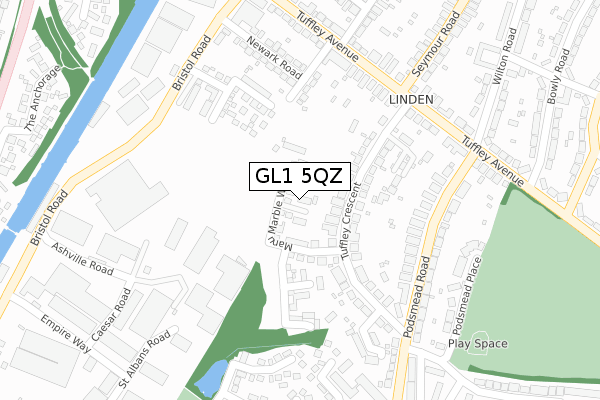
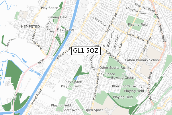
GL1 5QZ is located in the Podsmead electoral ward, within the local authority district of Gloucester and the English Parliamentary constituency of Gloucester. The Sub Integrated Care Board (ICB) Location is NHS Gloucestershire ICB - 11M and the police force is Gloucestershire. This postcode has been in use since April 2018.


GetTheData
Source: OS Open Zoomstack (Ordnance Survey)
Licence: Open Government Licence (requires attribution)
Attribution: Contains OS data © Crown copyright and database right 2025
Source: Open Postcode Geo
Licence: Open Government Licence (requires attribution)
Attribution: Contains OS data © Crown copyright and database right 2025; Contains Royal Mail data © Royal Mail copyright and database right 2025; Source: Office for National Statistics licensed under the Open Government Licence v.3.0
| Easting | 382393 |
| Northing | 216456 |
| Latitude | 51.846428 |
| Longitude | -2.256993 |
GetTheData
Source: Open Postcode Geo
Licence: Open Government Licence
| Country | England |
| Postcode District | GL1 |
➜ See where GL1 is on a map ➜ Where is Gloucester? | |
GetTheData
Source: Land Registry Price Paid Data
Licence: Open Government Licence
| Ward | Podsmead |
| Constituency | Gloucester |
GetTheData
Source: ONS Postcode Database
Licence: Open Government Licence
2022 2 MAR £361,500 |
17, MANU MARBLE WAY, GLOUCESTER, GL1 5QZ 2021 22 DEC £340,000 |
19, MANU MARBLE WAY, GLOUCESTER, GL1 5QZ 2021 17 AUG £340,000 |
56, MANU MARBLE WAY, GLOUCESTER, GL1 5QZ 2019 21 AUG £232,500 |
42, MANU MARBLE WAY, GLOUCESTER, GL1 5QZ 2019 16 AUG £365,000 |
68, MANU MARBLE WAY, GLOUCESTER, GL1 5QZ 2019 10 JUL £320,000 |
29, MANU MARBLE WAY, GLOUCESTER, GL1 5QZ 2019 10 JUN £320,000 |
48, MANU MARBLE WAY, GLOUCESTER, GL1 5QZ 2019 28 MAY £320,000 |
50, MANU MARBLE WAY, GLOUCESTER, GL1 5QZ 2019 5 APR £305,000 |
20, MANU MARBLE WAY, GLOUCESTER, GL1 5QZ 2019 10 JAN £325,000 |
GetTheData
Source: HM Land Registry Price Paid Data
Licence: Contains HM Land Registry data © Crown copyright and database right 2025. This data is licensed under the Open Government Licence v3.0.
| Tuffley Crescent (Podsmead Road) | Podsmead | 252m |
| Tuffley Crescent (Podsmead Road) | Podsmead | 258m |
| Podsmead Road (Tuffley Avenue) | Linden | 273m |
| Podsmead Avenue South (Podsmead Road) | Linden | 282m |
| Tuffley Avenue (Seymour Road) | Linden | 282m |
| Gloucester Station | 2.5km |
GetTheData
Source: NaPTAN
Licence: Open Government Licence
| Percentage of properties with Next Generation Access | 0.0% |
| Percentage of properties with Superfast Broadband | 0.0% |
| Percentage of properties with Ultrafast Broadband | 0.0% |
| Percentage of properties with Full Fibre Broadband | 0.0% |
Superfast Broadband is between 30Mbps and 300Mbps
Ultrafast Broadband is > 300Mbps
| Median download speed | 5.4Mbps |
| Average download speed | 6.5Mbps |
| Maximum download speed | 39.06Mbps |
| Median upload speed | 0.8Mbps |
| Average upload speed | 1.1Mbps |
| Maximum upload speed | 9.76Mbps |
| Percentage of properties unable to receive 2Mbps | 0.0% |
| Percentage of properties unable to receive 5Mbps | 40.0% |
| Percentage of properties unable to receive 10Mbps | 100.0% |
| Percentage of properties unable to receive 30Mbps | 100.0% |
GetTheData
Source: Ofcom
Licence: Ofcom Terms of Use (requires attribution)
GetTheData
Source: ONS Postcode Database
Licence: Open Government Licence


➜ Get more ratings from the Food Standards Agency
GetTheData
Source: Food Standards Agency
Licence: FSA terms & conditions
| Last Collection | |||
|---|---|---|---|
| Location | Mon-Fri | Sat | Distance |
| Tuffley Avenue | 17:30 | 12:45 | 245m |
| Bristol Road | 17:45 | 12:30 | 328m |
| Sports Ground | 17:30 | 12:45 | 562m |
GetTheData
Source: Dracos
Licence: Creative Commons Attribution-ShareAlike
The below table lists the International Territorial Level (ITL) codes (formerly Nomenclature of Territorial Units for Statistics (NUTS) codes) and Local Administrative Units (LAU) codes for GL1 5QZ:
| ITL 1 Code | Name |
|---|---|
| TLK | South West (England) |
| ITL 2 Code | Name |
| TLK1 | Gloucestershire, Wiltshire and Bath/Bristol area |
| ITL 3 Code | Name |
| TLK13 | Gloucestershire CC |
| LAU 1 Code | Name |
| E07000081 | Gloucester |
GetTheData
Source: ONS Postcode Directory
Licence: Open Government Licence
The below table lists the Census Output Area (OA), Lower Layer Super Output Area (LSOA), and Middle Layer Super Output Area (MSOA) for GL1 5QZ:
| Code | Name | |
|---|---|---|
| OA | E00113522 | |
| LSOA | E01022334 | Gloucester 009F |
| MSOA | E02004644 | Gloucester 009 |
GetTheData
Source: ONS Postcode Directory
Licence: Open Government Licence
| GL1 5NE | Tuffley Crescent | 71m |
| GL1 5ND | Tuffley Crescent | 99m |
| GL1 5NU | The Greenway | 182m |
| GL1 5PA | Podsmead Road | 206m |
| GL1 5TW | Newark Road | 229m |
| GL1 5LX | Tuffley Avenue | 233m |
| GL1 5PB | Podsmead Road | 246m |
| GL1 5LZ | Tuffley Avenue | 253m |
| GL1 5LU | Tuffley Avenue | 268m |
| GL1 5NQ | Thornhill Close | 271m |
GetTheData
Source: Open Postcode Geo; Land Registry Price Paid Data
Licence: Open Government Licence