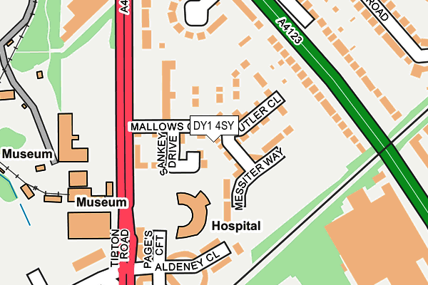
DY1 4SY is located in the Castle and Priory electoral ward, within the metropolitan district of Dudley and the English Parliamentary constituency of Dudley North. The Sub Integrated Care Board (ICB) Location is NHS Black Country ICB - D2P2L and the police force is West Midlands. This postcode has been in use since July 2017.


GetTheData
Source: OS OpenMap – Local (Ordnance Survey)
Source: OS VectorMap District (Ordnance Survey)
Licence: Open Government Licence (requires attribution)
| Easting | 395232 |
| Northing | 291333 |
| Latitude | 52.519871 |
| Longitude | -2.071693 |
GetTheData
Source: Open Postcode Geo
Licence: Open Government Licence
| Country | England |
| Postcode District | DY1 |
➜ See where DY1 is on a map ➜ Where is Dudley? | |
GetTheData
Source: Land Registry Price Paid Data
Licence: Open Government Licence
| Ward | Castle And Priory |
| Constituency | Dudley North |
GetTheData
Source: ONS Postcode Database
Licence: Open Government Licence
2024 4 OCT £306,000 |
2024 7 AUG £330,000 |
2022 4 NOV £304,500 |
2022 14 OCT £278,000 |
2021 30 JUN £280,000 |
2020 25 SEP £247,000 |
2019 6 SEP £275,000 |
2018 10 AUG £205,950 |
2018 27 JUL £235,000 |
2018 25 MAY £230,000 |
GetTheData
Source: HM Land Registry Price Paid Data
Licence: Contains HM Land Registry data © Crown copyright and database right 2025. This data is licensed under the Open Government Licence v3.0.
| Black Country Museum (Tipton Rd) | Dudley | 151m |
| Black Country Museum (Tipton Rd) | Dudley | 173m |
| Tipton Cross Rds (Tipton Rd) | Tipton | 339m |
| Tipton Cross Roads (Birmingham New Rd) | Tipton | 468m |
| Tipton Cross Roads (Dudley Rd) | Tipton | 499m |
| Tipton Station | 1.2km |
| Dudley Port Station | 1.6km |
| Coseley Station | 3km |
GetTheData
Source: NaPTAN
Licence: Open Government Licence
| Percentage of properties with Next Generation Access | 0.0% |
| Percentage of properties with Superfast Broadband | 0.0% |
| Percentage of properties with Ultrafast Broadband | 0.0% |
| Percentage of properties with Full Fibre Broadband | 0.0% |
Superfast Broadband is between 30Mbps and 300Mbps
Ultrafast Broadband is > 300Mbps
| Median download speed | 8.1Mbps |
| Average download speed | 7.8Mbps |
| Maximum download speed | 10.33Mbps |
| Median upload speed | 1.0Mbps |
| Average upload speed | 0.9Mbps |
| Maximum upload speed | 1.15Mbps |
| Percentage of properties unable to receive 2Mbps | 0.0% |
| Percentage of properties unable to receive 5Mbps | 0.0% |
| Percentage of properties unable to receive 10Mbps | 0.0% |
| Percentage of properties unable to receive 30Mbps | 100.0% |
GetTheData
Source: Ofcom
Licence: Ofcom Terms of Use (requires attribution)
GetTheData
Source: ONS Postcode Database
Licence: Open Government Licence


➜ Get more ratings from the Food Standards Agency
GetTheData
Source: Food Standards Agency
Licence: FSA terms & conditions
| Last Collection | |||
|---|---|---|---|
| Location | Mon-Fri | Sat | Distance |
| Tipton Arms | 17:30 | 11:00 | 295m |
| Park Lane | 17:30 | 11:00 | 615m |
| High Street | 18:30 | 11:00 | 1,009m |
GetTheData
Source: Dracos
Licence: Creative Commons Attribution-ShareAlike
The below table lists the International Territorial Level (ITL) codes (formerly Nomenclature of Territorial Units for Statistics (NUTS) codes) and Local Administrative Units (LAU) codes for DY1 4SY:
| ITL 1 Code | Name |
|---|---|
| TLG | West Midlands (England) |
| ITL 2 Code | Name |
| TLG3 | West Midlands |
| ITL 3 Code | Name |
| TLG36 | Dudley |
| LAU 1 Code | Name |
| E08000027 | Dudley |
GetTheData
Source: ONS Postcode Directory
Licence: Open Government Licence
The below table lists the Census Output Area (OA), Lower Layer Super Output Area (LSOA), and Middle Layer Super Output Area (MSOA) for DY1 4SY:
| Code | Name | |
|---|---|---|
| OA | E00049371 | |
| LSOA | E01009757 | Dudley 006C |
| MSOA | E02002005 | Dudley 006 |
GetTheData
Source: ONS Postcode Directory
Licence: Open Government Licence
| DY1 4SJ | Birmingham New Road | 151m |
| DY1 4SL | The Crescent | 178m |
| DY1 4AJ | Aldeney Close | 190m |
| DY4 8JP | Birmingham New Road | 198m |
| DY1 4AE | Page's Croft | 208m |
| DY1 4SQ | Tipton Road | 234m |
| DY1 4AH | Park Moor Gardens | 250m |
| DY1 4SH | Tipton Road | 261m |
| DY4 8JT | Madin Road | 268m |
| DY4 8JS | Madin Road | 298m |
GetTheData
Source: Open Postcode Geo; Land Registry Price Paid Data
Licence: Open Government Licence