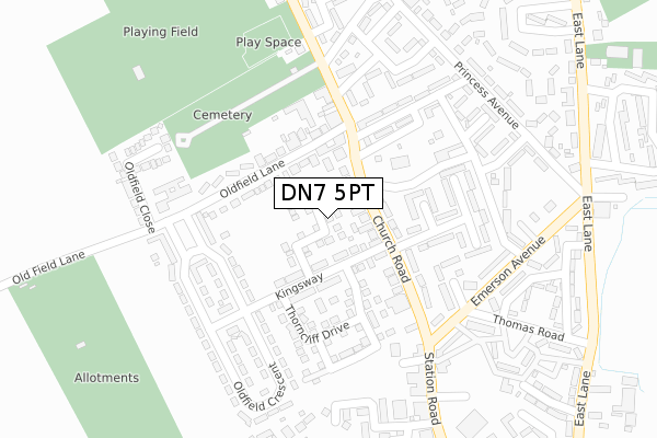
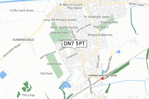
DN7 5PT is located in the Stainforth & Barnby Dun electoral ward, within the metropolitan district of Doncaster and the English Parliamentary constituency of Doncaster North. The Sub Integrated Care Board (ICB) Location is NHS South Yorkshire ICB - 02X and the police force is South Yorkshire. This postcode has been in use since June 2019.


GetTheData
Source: OS Open Zoomstack (Ordnance Survey)
Licence: Open Government Licence (requires attribution)
Attribution: Contains OS data © Crown copyright and database right 2025
Source: Open Postcode Geo
Licence: Open Government Licence (requires attribution)
Attribution: Contains OS data © Crown copyright and database right 2025; Contains Royal Mail data © Royal Mail copyright and database right 2025; Source: Office for National Statistics licensed under the Open Government Licence v.3.0
| Easting | 464244 |
| Northing | 411181 |
| Latitude | 53.593298 |
| Longitude | -1.030846 |
GetTheData
Source: Open Postcode Geo
Licence: Open Government Licence
| Country | England |
| Postcode District | DN7 |
➜ See where DN7 is on a map ➜ Where is Stainforth? | |
GetTheData
Source: Land Registry Price Paid Data
Licence: Open Government Licence
| Ward | Stainforth & Barnby Dun |
| Constituency | Doncaster North |
GetTheData
Source: ONS Postcode Database
Licence: Open Government Licence
2024 13 DEC £152,500 |
2022 14 FEB £175,000 |
2021 16 SEP £148,500 |
9, BARRIER MEWS, STAINFORTH, DONCASTER, DN7 5PT 2020 20 NOV £161,995 |
40, BARRIER MEWS, STAINFORTH, DONCASTER, DN7 5PT 2020 30 SEP £161,995 |
2020 30 SEP £140,995 |
15, BARRIER MEWS, STAINFORTH, DONCASTER, DN7 5PT 2020 30 SEP £126,995 |
36, BARRIER MEWS, STAINFORTH, DONCASTER, DN7 5PT 2020 27 JUL £139,995 |
2020 20 JAN £131,995 |
2019 28 JUN £152,995 |
GetTheData
Source: HM Land Registry Price Paid Data
Licence: Contains HM Land Registry data © Crown copyright and database right 2025. This data is licensed under the Open Government Licence v3.0.
| Kingsway (Church Road) | Stainforth | 106m |
| Junction Road (Church Road) | Stainforth | 192m |
| Stanley Gardens (Station Road) | Stainforth | 194m |
| Junction Road (Church Road) | Stainforth | 261m |
| Station Road (Emerson Avenue) | Stainforth | 273m |
| Hatfield & Stainforth Station | 0.7km |
| Kirk Sandall Station | 4.3km |
| Thorne North Station | 4.6km |
GetTheData
Source: NaPTAN
Licence: Open Government Licence
| Percentage of properties with Next Generation Access | 100.0% |
| Percentage of properties with Superfast Broadband | 100.0% |
| Percentage of properties with Ultrafast Broadband | 0.0% |
| Percentage of properties with Full Fibre Broadband | 0.0% |
Superfast Broadband is between 30Mbps and 300Mbps
Ultrafast Broadband is > 300Mbps
| Percentage of properties unable to receive 2Mbps | 0.0% |
| Percentage of properties unable to receive 5Mbps | 0.0% |
| Percentage of properties unable to receive 10Mbps | 0.0% |
| Percentage of properties unable to receive 30Mbps | 0.0% |
GetTheData
Source: Ofcom
Licence: Ofcom Terms of Use (requires attribution)
GetTheData
Source: ONS Postcode Database
Licence: Open Government Licence


➜ Get more ratings from the Food Standards Agency
GetTheData
Source: Food Standards Agency
Licence: FSA terms & conditions
| Last Collection | |||
|---|---|---|---|
| Location | Mon-Fri | Sat | Distance |
| Stainforth P.o. | 17:15 | 11:30 | 101m |
| East Lane | 16:30 | 10:00 | 657m |
| West End | 16:45 | 10:00 | 708m |
GetTheData
Source: Dracos
Licence: Creative Commons Attribution-ShareAlike
The below table lists the International Territorial Level (ITL) codes (formerly Nomenclature of Territorial Units for Statistics (NUTS) codes) and Local Administrative Units (LAU) codes for DN7 5PT:
| ITL 1 Code | Name |
|---|---|
| TLE | Yorkshire and The Humber |
| ITL 2 Code | Name |
| TLE3 | South Yorkshire |
| ITL 3 Code | Name |
| TLE31 | Barnsley, Doncaster and Rotherham |
| LAU 1 Code | Name |
| E08000017 | Doncaster |
GetTheData
Source: ONS Postcode Directory
Licence: Open Government Licence
The below table lists the Census Output Area (OA), Lower Layer Super Output Area (LSOA), and Middle Layer Super Output Area (MSOA) for DN7 5PT:
| Code | Name | |
|---|---|---|
| OA | E00038641 | |
| LSOA | E01007626 | Doncaster 004B |
| MSOA | E02001542 | Doncaster 004 |
GetTheData
Source: ONS Postcode Directory
Licence: Open Government Licence
| DN7 5PW | Church Road | 68m |
| DN7 5NF | Oldfield Lane | 90m |
| DN7 5ND | Oldfield Lane | 97m |
| DN7 5NJ | Church Road | 103m |
| DN7 5NU | Kingsway | 129m |
| DN7 5PQ | Oldfield Crescent | 144m |
| DN7 5NS | Church Road | 160m |
| DN7 5NL | Mill View | 183m |
| DN7 5NR | Church Road | 197m |
| DN7 5PG | Oldfield Crescent | 203m |
GetTheData
Source: Open Postcode Geo; Land Registry Price Paid Data
Licence: Open Government Licence