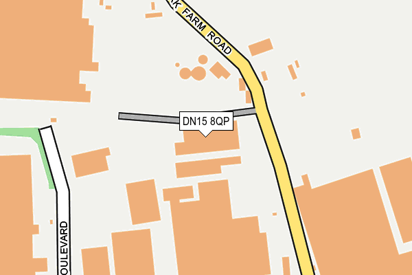
DN15 8QP lies on Park Farm Road in Scunthorpe. DN15 8QP is located in the Crosby & Park electoral ward, within the unitary authority of North Lincolnshire and the English Parliamentary constituency of Scunthorpe. The Sub Integrated Care Board (ICB) Location is NHS Humber and North Yorkshire ICB - 03K and the police force is Humberside. This postcode has been in use since January 1980.


GetTheData
Source: OS OpenMap – Local (Ordnance Survey)
Source: OS VectorMap District (Ordnance Survey)
Licence: Open Government Licence (requires attribution)
| Easting | 488638 |
| Northing | 413521 |
| Latitude | 53.610753 |
| Longitude | -0.661715 |
GetTheData
Source: Open Postcode Geo
Licence: Open Government Licence
| Street | Park Farm Road |
| Town/City | Scunthorpe |
| Country | England |
| Postcode District | DN15 |
➜ See where DN15 is on a map ➜ Where is Scunthorpe? | |
GetTheData
Source: Land Registry Price Paid Data
Licence: Open Government Licence
Elevation or altitude of DN15 8QP as distance above sea level:
| Metres | Feet | |
|---|---|---|
| Elevation | 50m | 164ft |
Elevation is measured from the approximate centre of the postcode, to the nearest point on an OS contour line from OS Terrain 50, which has contour spacing of ten vertical metres.
➜ How high above sea level am I? Find the elevation of your current position using your device's GPS.
GetTheData
Source: Open Postcode Elevation
Licence: Open Government Licence
| Ward | Crosby & Park |
| Constituency | Scunthorpe |
GetTheData
Source: ONS Postcode Database
Licence: Open Government Licence
THE SNACK SHACK, PARK FARM ROAD, SCUNTHORPE, DN15 8QP 2006 20 OCT £135,000 |
GetTheData
Source: HM Land Registry Price Paid Data
Licence: Contains HM Land Registry data © Crown copyright and database right 2025. This data is licensed under the Open Government Licence v3.0.
| Two Sisters (Ram Boulevard) | Foxhills Industrial Park | 234m |
| Clayfield Road (Atkinsons Way) | Foxhills Industrial Park | 445m |
| Park Farm Road | Foxhills Industrial Park | 457m |
| Clayfield Road | Foxhills Industrial Park | 491m |
| Cupola Way (Normanby Road) | Normanby Enterprise Park | 512m |
| Scunthorpe Station | 2.8km |
| Althorpe Station | 5.5km |
GetTheData
Source: NaPTAN
Licence: Open Government Licence
Estimated total energy consumption in DN15 8QP by fuel type, 2015.
| Consumption (kWh) | 26,690 |
|---|---|
| Meter count | 8 |
| Mean (kWh/meter) | 3,336 |
| Median (kWh/meter) | 1 |
GetTheData
Source: Postcode level gas estimates: 2015 (experimental)
Source: Postcode level electricity estimates: 2015 (experimental)
Licence: Open Government Licence
GetTheData
Source: ONS Postcode Database
Licence: Open Government Licence


➜ Get more ratings from the Food Standards Agency
GetTheData
Source: Food Standards Agency
Licence: FSA terms & conditions
| Last Collection | |||
|---|---|---|---|
| Location | Mon-Fri | Sat | Distance |
| Atkinson Way | 18:30 | 09:30 | 427m |
| Normanby Road | 16:45 | 09:30 | 515m |
| Foxhills Road | 17:30 | 12:15 | 1,087m |
GetTheData
Source: Dracos
Licence: Creative Commons Attribution-ShareAlike
The below table lists the International Territorial Level (ITL) codes (formerly Nomenclature of Territorial Units for Statistics (NUTS) codes) and Local Administrative Units (LAU) codes for DN15 8QP:
| ITL 1 Code | Name |
|---|---|
| TLE | Yorkshire and The Humber |
| ITL 2 Code | Name |
| TLE1 | East Yorkshire and Northern Lincolnshire |
| ITL 3 Code | Name |
| TLE13 | North and North East Lincolnshire |
| LAU 1 Code | Name |
| E06000013 | North Lincolnshire |
GetTheData
Source: ONS Postcode Directory
Licence: Open Government Licence
The below table lists the Census Output Area (OA), Lower Layer Super Output Area (LSOA), and Middle Layer Super Output Area (MSOA) for DN15 8QP:
| Code | Name | |
|---|---|---|
| OA | E00067111 | |
| LSOA | E01013297 | North Lincolnshire 007A |
| MSOA | E02002755 | North Lincolnshire 007 |
GetTheData
Source: ONS Postcode Directory
Licence: Open Government Licence
| DN15 8QW | Ram Boulevard | 211m |
| DN15 8RE | Mercia Way | 264m |
| DN15 9YJ | Cupola Way | 384m |
| DN15 8QJ | Atkinsons Way | 455m |
| DN15 8QY | Orb Lane | 810m |
| DN15 8NT | Crosby Avenue | 814m |
| DN15 8NU | Skippingdale Road | 858m |
| DN15 8NS | Buckingham Avenue | 880m |
| DN15 8QU | St Vincents Avenue | 885m |
| DN15 8NJ | Exmoor Avenue | 897m |
GetTheData
Source: Open Postcode Geo; Land Registry Price Paid Data
Licence: Open Government Licence