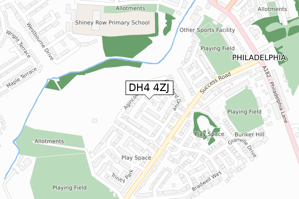
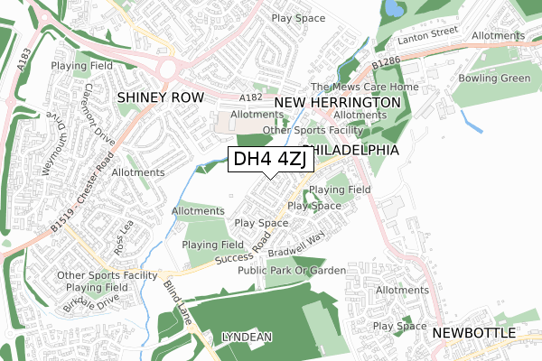
DH4 4ZJ is located in the Copt Hill electoral ward, within the metropolitan district of Sunderland and the English Parliamentary constituency of Houghton and Sunderland South. The Sub Integrated Care Board (ICB) Location is NHS North East and North Cumbria ICB - 00P and the police force is Northumbria. This postcode has been in use since February 2018.


GetTheData
Source: OS Open Zoomstack (Ordnance Survey)
Licence: Open Government Licence (requires attribution)
Attribution: Contains OS data © Crown copyright and database right 2024
Source: Open Postcode Geo
Licence: Open Government Licence (requires attribution)
Attribution: Contains OS data © Crown copyright and database right 2024; Contains Royal Mail data © Royal Mail copyright and database right 2024; Source: Office for National Statistics licensed under the Open Government Licence v.3.0
| Easting | 432910 |
| Northing | 552223 |
| Latitude | 54.863722 |
| Longitude | -1.488818 |
GetTheData
Source: Open Postcode Geo
Licence: Open Government Licence
| Country | England |
| Postcode District | DH4 |
➜ See where DH4 is on a map ➜ Where is Philadelphia? | |
GetTheData
Source: Land Registry Price Paid Data
Licence: Open Government Licence
| Ward | Copt Hill |
| Constituency | Houghton And Sunderland South |
GetTheData
Source: ONS Postcode Database
Licence: Open Government Licence
2021 21 DEC £276,000 |
2020 9 OCT £310,000 |
29, AGINCOURT, HOUGHTON LE SPRING, DH4 4ZJ 2018 23 NOV £209,950 |
30, AGINCOURT, HOUGHTON LE SPRING, DH4 4ZJ 2018 23 NOV £309,950 |
28, AGINCOURT, HOUGHTON LE SPRING, DH4 4ZJ 2018 16 NOV £209,950 |
27, AGINCOURT, HOUGHTON LE SPRING, DH4 4ZJ 2018 26 OCT £287,950 |
22, AGINCOURT, HOUGHTON LE SPRING, DH4 4ZJ 2018 28 SEP £259,950 |
24, AGINCOURT, HOUGHTON LE SPRING, DH4 4ZJ 2018 28 SEP £287,950 |
23, AGINCOURT, HOUGHTON LE SPRING, DH4 4ZJ 2018 28 SEP £257,950 |
26, AGINCOURT, HOUGHTON LE SPRING, DH4 4ZJ 2018 28 SEP £209,950 |
GetTheData
Source: HM Land Registry Price Paid Data
Licence: Contains HM Land Registry data © Crown copyright and database right 2024. This data is licensed under the Open Government Licence v3.0.
| Success Road | Success | 124m |
| Success Road | Success | 131m |
| Success Road-trinity Park (Success Road) | Success | 251m |
| Success Road-trinity Park (Success Road) | Success | 276m |
| Success Road-shop Row (Success Road) | Philadelphia | 308m |
GetTheData
Source: NaPTAN
Licence: Open Government Licence
| Percentage of properties with Next Generation Access | 100.0% |
| Percentage of properties with Superfast Broadband | 100.0% |
| Percentage of properties with Ultrafast Broadband | 100.0% |
| Percentage of properties with Full Fibre Broadband | 100.0% |
Superfast Broadband is between 30Mbps and 300Mbps
Ultrafast Broadband is > 300Mbps
| Percentage of properties unable to receive 2Mbps | 0.0% |
| Percentage of properties unable to receive 5Mbps | 0.0% |
| Percentage of properties unable to receive 10Mbps | 0.0% |
| Percentage of properties unable to receive 30Mbps | 0.0% |
GetTheData
Source: Ofcom
Licence: Ofcom Terms of Use (requires attribution)
GetTheData
Source: ONS Postcode Database
Licence: Open Government Licence


➜ Get more ratings from the Food Standards Agency
GetTheData
Source: Food Standards Agency
Licence: FSA terms & conditions
| Last Collection | |||
|---|---|---|---|
| Location | Mon-Fri | Sat | Distance |
| Philadelphia Lane | 17:30 | 11:45 | 497m |
| Biddick Wood | 16:45 | 11:30 | 1,137m |
| Chester Road | 16:45 | 11:30 | 1,894m |
GetTheData
Source: Dracos
Licence: Creative Commons Attribution-ShareAlike
The below table lists the International Territorial Level (ITL) codes (formerly Nomenclature of Territorial Units for Statistics (NUTS) codes) and Local Administrative Units (LAU) codes for DH4 4ZJ:
| ITL 1 Code | Name |
|---|---|
| TLC | North East (England) |
| ITL 2 Code | Name |
| TLC2 | Northumberland, and Tyne and Wear |
| ITL 3 Code | Name |
| TLC23 | Sunderland |
| LAU 1 Code | Name |
| E08000024 | Sunderland |
GetTheData
Source: ONS Postcode Directory
Licence: Open Government Licence
The below table lists the Census Output Area (OA), Lower Layer Super Output Area (LSOA), and Middle Layer Super Output Area (MSOA) for DH4 4ZJ:
| Code | Name | |
|---|---|---|
| OA | E00044651 | |
| LSOA | E01008796 | Sunderland 032D |
| MSOA | E02001822 | Sunderland 032 |
GetTheData
Source: ONS Postcode Directory
Licence: Open Government Licence
| DH4 4XD | Tilbury Close | 153m |
| DH4 4UW | Kingston Mews | 183m |
| DH4 4UN | Trinity Park | 195m |
| DH4 4XE | Beaufort Close | 213m |
| DH4 4TJ | Success Road | 228m |
| DH4 4TW | Clover Avenue | 246m |
| DH4 4TR | Blossom Grove | 261m |
| DH4 4UL | Trinity Park | 265m |
| DH4 4XJ | Goodrich Close | 282m |
| DH4 4XG | Fowler Close | 283m |
GetTheData
Source: Open Postcode Geo; Land Registry Price Paid Data
Licence: Open Government Licence