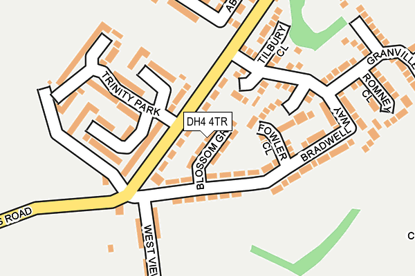
DH4 4TR lies on Blossom Grove in Houghton Le Spring. DH4 4TR is located in the Copt Hill electoral ward, within the metropolitan district of Sunderland and the English Parliamentary constituency of Houghton and Sunderland South. The Sub Integrated Care Board (ICB) Location is NHS North East and North Cumbria ICB - 00P and the police force is Northumbria. This postcode has been in use since January 1980.


GetTheData
Source: OS OpenMap – Local (Ordnance Survey)
Source: OS VectorMap District (Ordnance Survey)
Licence: Open Government Licence (requires attribution)
| Easting | 432941 |
| Northing | 551964 |
| Latitude | 54.861384 |
| Longitude | -1.488351 |
GetTheData
Source: Open Postcode Geo
Licence: Open Government Licence
| Street | Blossom Grove |
| Town/City | Houghton Le Spring |
| Country | England |
| Postcode District | DH4 |
➜ See where DH4 is on a map ➜ Where is Philadelphia? | |
GetTheData
Source: Land Registry Price Paid Data
Licence: Open Government Licence
Elevation or altitude of DH4 4TR as distance above sea level:
| Metres | Feet | |
|---|---|---|
| Elevation | 60m | 197ft |
Elevation is measured from the approximate centre of the postcode, to the nearest point on an OS contour line from OS Terrain 50, which has contour spacing of ten vertical metres.
➜ How high above sea level am I? Find the elevation of your current position using your device's GPS.
GetTheData
Source: Open Postcode Elevation
Licence: Open Government Licence
| Ward | Copt Hill |
| Constituency | Houghton And Sunderland South |
GetTheData
Source: ONS Postcode Database
Licence: Open Government Licence
| Success Road-trinity Park (Success Road) | Success | 48m |
| Success Road-trinity Park (Success Road) | Success | 72m |
| Success Road | Success | 191m |
| Success Road | Success | 201m |
| Success Road-shop Row (Success Road) | Philadelphia | 443m |
GetTheData
Source: NaPTAN
Licence: Open Government Licence
| Percentage of properties with Next Generation Access | 100.0% |
| Percentage of properties with Superfast Broadband | 100.0% |
| Percentage of properties with Ultrafast Broadband | 0.0% |
| Percentage of properties with Full Fibre Broadband | 0.0% |
Superfast Broadband is between 30Mbps and 300Mbps
Ultrafast Broadband is > 300Mbps
| Median download speed | 39.1Mbps |
| Average download speed | 37.4Mbps |
| Maximum download speed | 69.89Mbps |
| Median upload speed | 9.8Mbps |
| Average upload speed | 10.0Mbps |
| Maximum upload speed | 19.53Mbps |
| Percentage of properties unable to receive 2Mbps | 0.0% |
| Percentage of properties unable to receive 5Mbps | 0.0% |
| Percentage of properties unable to receive 10Mbps | 0.0% |
| Percentage of properties unable to receive 30Mbps | 0.0% |
GetTheData
Source: Ofcom
Licence: Ofcom Terms of Use (requires attribution)
Estimated total energy consumption in DH4 4TR by fuel type, 2015.
| Consumption (kWh) | 192,890 |
|---|---|
| Meter count | 16 |
| Mean (kWh/meter) | 12,056 |
| Median (kWh/meter) | 11,826 |
| Consumption (kWh) | 48,220 |
|---|---|
| Meter count | 15 |
| Mean (kWh/meter) | 3,215 |
| Median (kWh/meter) | 2,718 |
GetTheData
Source: Postcode level gas estimates: 2015 (experimental)
Source: Postcode level electricity estimates: 2015 (experimental)
Licence: Open Government Licence
GetTheData
Source: ONS Postcode Database
Licence: Open Government Licence


➜ Get more ratings from the Food Standards Agency
GetTheData
Source: Food Standards Agency
Licence: FSA terms & conditions
| Last Collection | |||
|---|---|---|---|
| Location | Mon-Fri | Sat | Distance |
| Philadelphia Lane | 17:30 | 11:45 | 465m |
| Biddick Wood | 16:45 | 11:30 | 1,263m |
| Chester Road | 16:45 | 11:30 | 1,865m |
GetTheData
Source: Dracos
Licence: Creative Commons Attribution-ShareAlike
The below table lists the International Territorial Level (ITL) codes (formerly Nomenclature of Territorial Units for Statistics (NUTS) codes) and Local Administrative Units (LAU) codes for DH4 4TR:
| ITL 1 Code | Name |
|---|---|
| TLC | North East (England) |
| ITL 2 Code | Name |
| TLC2 | Northumberland, and Tyne and Wear |
| ITL 3 Code | Name |
| TLC23 | Sunderland |
| LAU 1 Code | Name |
| E08000024 | Sunderland |
GetTheData
Source: ONS Postcode Directory
Licence: Open Government Licence
The below table lists the Census Output Area (OA), Lower Layer Super Output Area (LSOA), and Middle Layer Super Output Area (MSOA) for DH4 4TR:
| Code | Name | |
|---|---|---|
| OA | E00044677 | |
| LSOA | E01008796 | Sunderland 032D |
| MSOA | E02001822 | Sunderland 032 |
GetTheData
Source: ONS Postcode Directory
Licence: Open Government Licence
| DH4 4TW | Clover Avenue | 28m |
| DH4 4XE | Beaufort Close | 76m |
| DH4 4TP | Aster Terrace | 86m |
| DH4 4XG | Fowler Close | 104m |
| DH4 4XJ | Goodrich Close | 131m |
| DH4 4UL | Trinity Park | 151m |
| DH4 4XA | Bradwell Way | 155m |
| DH4 4UN | Trinity Park | 164m |
| DH4 4XD | Tilbury Close | 181m |
| DH4 4TS | West View | 185m |
GetTheData
Source: Open Postcode Geo; Land Registry Price Paid Data
Licence: Open Government Licence