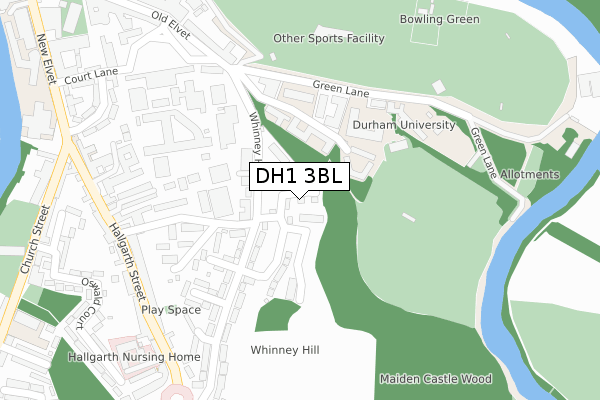
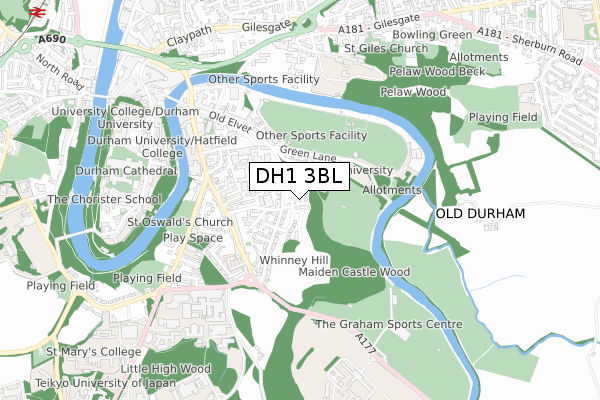
DH1 3BL is located in the Elvet and Gilesgate electoral ward, within the unitary authority of County Durham and the English Parliamentary constituency of City of Durham. The Sub Integrated Care Board (ICB) Location is NHS North East and North Cumbria ICB - 84H and the police force is Durham. This postcode has been in use since January 2019.


GetTheData
Source: OS Open Zoomstack (Ordnance Survey)
Licence: Open Government Licence (requires attribution)
Attribution: Contains OS data © Crown copyright and database right 2025
Source: Open Postcode Geo
Licence: Open Government Licence (requires attribution)
Attribution: Contains OS data © Crown copyright and database right 2025; Contains Royal Mail data © Royal Mail copyright and database right 2025; Source: Office for National Statistics licensed under the Open Government Licence v.3.0
| Easting | 428064 |
| Northing | 541935 |
| Latitude | 54.771567 |
| Longitude | -1.565304 |
GetTheData
Source: Open Postcode Geo
Licence: Open Government Licence
| Country | England |
| Postcode District | DH1 |
➜ See where DH1 is on a map ➜ Where is Durham? | |
GetTheData
Source: Land Registry Price Paid Data
Licence: Open Government Licence
| Ward | Elvet And Gilesgate |
| Constituency | City Of Durham |
GetTheData
Source: ONS Postcode Database
Licence: Open Government Licence
2024 30 SEP £385,000 |
2024 19 MAR £426,000 |
42, ILLINGWORTH GROVE, DURHAM, DH1 3BL 2021 19 OCT £359,950 |
48, ILLINGWORTH GROVE, DURHAM, DH1 3BL 2021 8 SEP £284,952 |
47, ILLINGWORTH GROVE, DURHAM, DH1 3BL 2021 16 JUL £299,950 |
2021 30 JUN £299,950 |
43, ILLINGWORTH GROVE, DURHAM, DH1 3BL 2021 30 JUN £350,000 |
45, ILLINGWORTH GROVE, DURHAM, DH1 3BL 2021 29 JUN £289,950 |
44, ILLINGWORTH GROVE, DURHAM, DH1 3BL 2021 18 JUN £289,950 |
46, ILLINGWORTH GROVE, DURHAM, DH1 3BL 2021 28 MAY £446,453 |
GetTheData
Source: HM Land Registry Price Paid Data
Licence: Contains HM Land Registry data © Crown copyright and database right 2025. This data is licensed under the Open Government Licence v3.0.
| Whinney Hill | Durham | 70m |
| Whinney Hill | Durham | 90m |
| Whinney Hill - Pine Tree House (Whinney Hill) | Durham | 270m |
| Magistrates Court (Whinney Hall) | Durham | 285m |
| Whinney Hill - Pine Tree House (Whinney Hill) | Durham | 291m |
| Durham Station | 1.4km |
GetTheData
Source: NaPTAN
Licence: Open Government Licence
| Percentage of properties with Next Generation Access | 100.0% |
| Percentage of properties with Superfast Broadband | 100.0% |
| Percentage of properties with Ultrafast Broadband | 0.0% |
| Percentage of properties with Full Fibre Broadband | 0.0% |
Superfast Broadband is between 30Mbps and 300Mbps
Ultrafast Broadband is > 300Mbps
| Percentage of properties unable to receive 2Mbps | 0.0% |
| Percentage of properties unable to receive 5Mbps | 0.0% |
| Percentage of properties unable to receive 10Mbps | 0.0% |
| Percentage of properties unable to receive 30Mbps | 0.0% |
GetTheData
Source: Ofcom
Licence: Ofcom Terms of Use (requires attribution)
GetTheData
Source: ONS Postcode Database
Licence: Open Government Licence


➜ Get more ratings from the Food Standards Agency
GetTheData
Source: Food Standards Agency
Licence: FSA terms & conditions
| Last Collection | |||
|---|---|---|---|
| Location | Mon-Fri | Sat | Distance |
| Whinney Hill | 17:30 | 11:45 | 98m |
| Hallgarth Street | 17:30 | 11:30 | 295m |
| New Elvet P.o. | 18:30 | 12:00 | 432m |
GetTheData
Source: Dracos
Licence: Creative Commons Attribution-ShareAlike
The below table lists the International Territorial Level (ITL) codes (formerly Nomenclature of Territorial Units for Statistics (NUTS) codes) and Local Administrative Units (LAU) codes for DH1 3BL:
| ITL 1 Code | Name |
|---|---|
| TLC | North East (England) |
| ITL 2 Code | Name |
| TLC1 | Tees Valley and Durham |
| ITL 3 Code | Name |
| TLC14 | Durham |
| LAU 1 Code | Name |
| E06000047 | County Durham |
GetTheData
Source: ONS Postcode Directory
Licence: Open Government Licence
The below table lists the Census Output Area (OA), Lower Layer Super Output Area (LSOA), and Middle Layer Super Output Area (MSOA) for DH1 3BL:
| Code | Name | |
|---|---|---|
| OA | E00105077 | |
| LSOA | E01033197 | County Durham 030F |
| MSOA | E02004314 | County Durham 030 |
GetTheData
Source: ONS Postcode Directory
Licence: Open Government Licence
| DH1 3BG | Whinney Hill | 89m |
| DH1 3BJ | The Hallgarth | 170m |
| DH1 3BD | Whinney Hill | 188m |
| DH1 3BE | Whinney Hill | 202m |
| DH1 3BH | Hallgarth View | 234m |
| DH1 3UA | Green Lane | 234m |
| DH1 3AT | Hallgarth Street | 256m |
| DH1 3AU | Mavin Street | 277m |
| DH1 3AY | Hallgarth Street | 285m |
| DH1 3HW | Old Elvet | 316m |
GetTheData
Source: Open Postcode Geo; Land Registry Price Paid Data
Licence: Open Government Licence