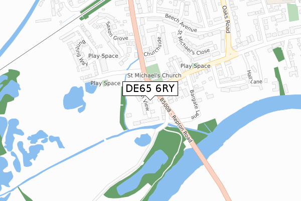
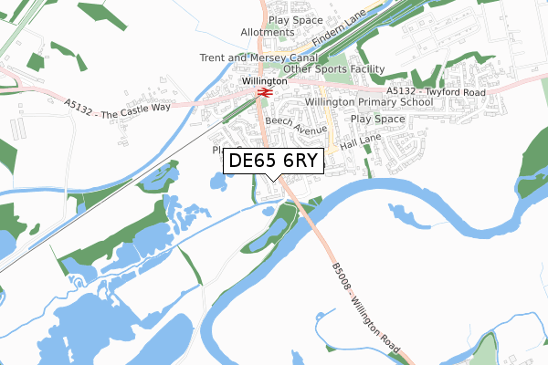
DE65 6RY is located in the Willington and Findern electoral ward, within the local authority district of South Derbyshire and the English Parliamentary constituency of South Derbyshire. The Sub Integrated Care Board (ICB) Location is NHS Derby and Derbyshire ICB - 15M and the police force is Derbyshire. This postcode has been in use since October 2018.


GetTheData
Source: OS Open Zoomstack (Ordnance Survey)
Licence: Open Government Licence (requires attribution)
Attribution: Contains OS data © Crown copyright and database right 2024
Source: Open Postcode Geo
Licence: Open Government Licence (requires attribution)
Attribution: Contains OS data © Crown copyright and database right 2024; Contains Royal Mail data © Royal Mail copyright and database right 2024; Source: Office for National Statistics licensed under the Open Government Licence v.3.0
| Easting | 429447 |
| Northing | 328066 |
| Latitude | 52.849313 |
| Longitude | -1.564187 |
GetTheData
Source: Open Postcode Geo
Licence: Open Government Licence
| Country | England |
| Postcode District | DE65 |
➜ See where DE65 is on a map ➜ Where is Willington? | |
GetTheData
Source: Land Registry Price Paid Data
Licence: Open Government Licence
| Ward | Willington And Findern |
| Constituency | South Derbyshire |
GetTheData
Source: ONS Postcode Database
Licence: Open Government Licence
2023 30 JUN £300,000 |
2023 27 JAN £260,000 |
2022 24 NOV £360,000 |
2022 18 NOV £456,500 |
41, BITTERN VIEW, WILLINGTON, DERBY, DE65 6RY 2022 30 SEP £625,000 |
26, BITTERN VIEW, WILLINGTON, DERBY, DE65 6RY 2022 29 APR £570,000 |
24, BITTERN VIEW, WILLINGTON, DERBY, DE65 6RY 2021 5 OCT £600,000 |
43, BITTERN VIEW, WILLINGTON, DERBY, DE65 6RY 2021 27 SEP £510,000 |
45, BITTERN VIEW, WILLINGTON, DERBY, DE65 6RY 2021 31 MAR £545,000 |
39, BITTERN VIEW, WILLINGTON, DERBY, DE65 6RY 2021 19 FEB £540,000 |
GetTheData
Source: HM Land Registry Price Paid Data
Licence: Contains HM Land Registry data © Crown copyright and database right 2024. This data is licensed under the Open Government Licence v3.0.
| Willington Road (Repton Road) | Willington | 69m |
| Willington Road (Repton Road) | Willington | 76m |
| Repton Road | Willington | 264m |
| Repton Road | Willington | 278m |
| Old Hall Drive (Hall Lane) | Willington | 421m |
| Willington Station | 0.5km |
GetTheData
Source: NaPTAN
Licence: Open Government Licence
| Percentage of properties with Next Generation Access | 94.1% |
| Percentage of properties with Superfast Broadband | 94.1% |
| Percentage of properties with Ultrafast Broadband | 94.1% |
| Percentage of properties with Full Fibre Broadband | 94.1% |
Superfast Broadband is between 30Mbps and 300Mbps
Ultrafast Broadband is > 300Mbps
| Percentage of properties unable to receive 2Mbps | 0.0% |
| Percentage of properties unable to receive 5Mbps | 0.0% |
| Percentage of properties unable to receive 10Mbps | 0.0% |
| Percentage of properties unable to receive 30Mbps | 0.0% |
GetTheData
Source: Ofcom
Licence: Ofcom Terms of Use (requires attribution)
GetTheData
Source: ONS Postcode Database
Licence: Open Government Licence


➜ Get more ratings from the Food Standards Agency
GetTheData
Source: Food Standards Agency
Licence: FSA terms & conditions
| Last Collection | |||
|---|---|---|---|
| Location | Mon-Fri | Sat | Distance |
| Oaks Road | 17:00 | 10:30 | 382m |
| Willington Post Office | 17:15 | 10:30 | 452m |
| Twyford Road | 17:00 | 10:30 | 903m |
GetTheData
Source: Dracos
Licence: Creative Commons Attribution-ShareAlike
| Risk of DE65 6RY flooding from rivers and sea | Medium |
| ➜ DE65 6RY flood map | |
GetTheData
Source: Open Flood Risk by Postcode
Licence: Open Government Licence
The below table lists the International Territorial Level (ITL) codes (formerly Nomenclature of Territorial Units for Statistics (NUTS) codes) and Local Administrative Units (LAU) codes for DE65 6RY:
| ITL 1 Code | Name |
|---|---|
| TLF | East Midlands (England) |
| ITL 2 Code | Name |
| TLF1 | Derbyshire and Nottinghamshire |
| ITL 3 Code | Name |
| TLF13 | South and West Derbyshire |
| LAU 1 Code | Name |
| E07000039 | South Derbyshire |
GetTheData
Source: ONS Postcode Directory
Licence: Open Government Licence
The below table lists the Census Output Area (OA), Lower Layer Super Output Area (LSOA), and Middle Layer Super Output Area (MSOA) for DE65 6RY:
| Code | Name | |
|---|---|---|
| OA | E00100606 | |
| LSOA | E01019880 | South Derbyshire 005D |
| MSOA | E02004122 | South Derbyshire 005 |
GetTheData
Source: ONS Postcode Directory
Licence: Open Government Licence
| DE65 6PD | Sycamore Court | 121m |
| DE65 6BY | Bargate Lane | 192m |
| DE65 6EN | Church Close | 197m |
| DE65 6YB | Tailby Drive | 198m |
| DE65 6QT | Kingfisher Lane | 209m |
| DE65 6BZ | Hall Lane | 214m |
| DE65 6TB | Churchside | 226m |
| DE65 6EB | St Michaels Close | 263m |
| DE65 6QX | Bunting Way | 273m |
| DE65 6BX | Repton Road | 273m |
GetTheData
Source: Open Postcode Geo; Land Registry Price Paid Data
Licence: Open Government Licence