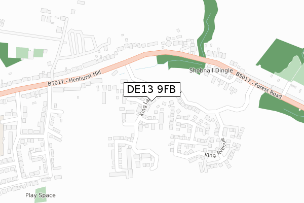
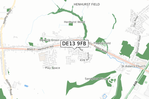
DE13 9FB is located in the Branston electoral ward, within the local authority district of East Staffordshire and the English Parliamentary constituency of Burton. The Sub Integrated Care Board (ICB) Location is NHS Staffordshire and Stoke-on-Trent ICB - 05D and the police force is Staffordshire. This postcode has been in use since June 2019.


GetTheData
Source: OS Open Zoomstack (Ordnance Survey)
Licence: Open Government Licence (requires attribution)
Attribution: Contains OS data © Crown copyright and database right 2025
Source: Open Postcode Geo
Licence: Open Government Licence (requires attribution)
Attribution: Contains OS data © Crown copyright and database right 2025; Contains Royal Mail data © Royal Mail copyright and database right 2025; Source: Office for National Statistics licensed under the Open Government Licence v.3.0
| Easting | 421835 |
| Northing | 323739 |
| Latitude | 52.810777 |
| Longitude | -1.677501 |
GetTheData
Source: Open Postcode Geo
Licence: Open Government Licence
| Country | England |
| Postcode District | DE13 |
➜ See where DE13 is on a map ➜ Where is Burton upon Trent? | |
GetTheData
Source: Land Registry Price Paid Data
Licence: Open Government Licence
| Ward | Branston |
| Constituency | Burton |
GetTheData
Source: ONS Postcode Database
Licence: Open Government Licence
2023 19 JUL £317,500 |
3, ROOK AVENUE, BURTON-ON-TRENT, DE13 9FB 2021 23 JUN £449,995 |
1, ROOK AVENUE, BURTON-ON-TRENT, DE13 9FB 2021 26 MAR £302,995 |
5, ROOK AVENUE, BURTON-ON-TRENT, DE13 9FB 2021 25 MAR £344,995 |
19, ROOK AVENUE, BURTON-ON-TRENT, DE13 9FB 2020 27 MAR £299,995 |
15, ROOK AVENUE, BURTON-ON-TRENT, DE13 9FB 2020 28 FEB £338,995 |
17, ROOK AVENUE, BURTON-ON-TRENT, DE13 9FB 2019 13 DEC £334,995 |
9, ROOK AVENUE, BURTON-ON-TRENT, DE13 9FB 2019 13 DEC £414,995 |
2, ROOK AVENUE, BURTON-ON-TRENT, DE13 9FB 2019 13 DEC £319,995 |
7, ROOK AVENUE, BURTON-ON-TRENT, DE13 9FB 2019 12 DEC £414,995 |
➜ Burton upon Trent house prices
GetTheData
Source: HM Land Registry Price Paid Data
Licence: Contains HM Land Registry data © Crown copyright and database right 2025. This data is licensed under the Open Government Licence v3.0.
| Shobnall Dingle (Forest Road) | Henhurst Hill | 290m |
| Shobnall Dingle (Forest Road) | Henhurst Hill | 308m |
| No. 41 (Henhurst Hill) | Henhurst Hill | 364m |
| No. 41 (Henhurst Hill) | Henhurst Hill | 366m |
| No. 48a (Forest Rd) | Henhurst Hill | 450m |
| Burton-on-Trent Station | 2.4km |
GetTheData
Source: NaPTAN
Licence: Open Government Licence
| Percentage of properties with Next Generation Access | 100.0% |
| Percentage of properties with Superfast Broadband | 100.0% |
| Percentage of properties with Ultrafast Broadband | 100.0% |
| Percentage of properties with Full Fibre Broadband | 100.0% |
Superfast Broadband is between 30Mbps and 300Mbps
Ultrafast Broadband is > 300Mbps
| Percentage of properties unable to receive 2Mbps | 0.0% |
| Percentage of properties unable to receive 5Mbps | 0.0% |
| Percentage of properties unable to receive 10Mbps | 0.0% |
| Percentage of properties unable to receive 30Mbps | 0.0% |
GetTheData
Source: Ofcom
Licence: Ofcom Terms of Use (requires attribution)
GetTheData
Source: ONS Postcode Database
Licence: Open Government Licence


➜ Get more ratings from the Food Standards Agency
GetTheData
Source: Food Standards Agency
Licence: FSA terms & conditions
| Last Collection | |||
|---|---|---|---|
| Location | Mon-Fri | Sat | Distance |
| Forest Road | 16:00 | 11:15 | 458m |
| Henhurst Hill | 16:00 | 10:30 | 472m |
| Reservoir Road | 17:30 | 11:15 | 848m |
GetTheData
Source: Dracos
Licence: Creative Commons Attribution-ShareAlike
The below table lists the International Territorial Level (ITL) codes (formerly Nomenclature of Territorial Units for Statistics (NUTS) codes) and Local Administrative Units (LAU) codes for DE13 9FB:
| ITL 1 Code | Name |
|---|---|
| TLG | West Midlands (England) |
| ITL 2 Code | Name |
| TLG2 | Shropshire and Staffordshire |
| ITL 3 Code | Name |
| TLG24 | Staffordshire CC |
| LAU 1 Code | Name |
| E07000193 | East Staffordshire |
GetTheData
Source: ONS Postcode Directory
Licence: Open Government Licence
The below table lists the Census Output Area (OA), Lower Layer Super Output Area (LSOA), and Middle Layer Super Output Area (MSOA) for DE13 9FB:
| Code | Name | |
|---|---|---|
| OA | E00149875 | |
| LSOA | E01029417 | East Staffordshire 013E |
| MSOA | E02006143 | East Staffordshire 013 |
GetTheData
Source: ONS Postcode Directory
Licence: Open Government Licence
| DE13 9TR | Oakley Grange | 233m |
| DE13 9TP | Forest Road | 317m |
| DE13 9TE | Henhurst Farm | 334m |
| DE13 9TD | Henhurst Hill | 408m |
| DE13 9TB | Henhurst Hill | 415m |
| DE13 9TL | Aviation Lane | 463m |
| DE13 9TJ | Aviation Lane | 491m |
| DE13 9TW | Forest Road | 522m |
| DE13 9TN | Forest Road | 531m |
| DE13 9TA | Henhurst Hill | 549m |
GetTheData
Source: Open Postcode Geo; Land Registry Price Paid Data
Licence: Open Government Licence