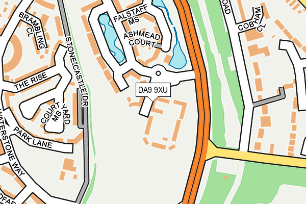
DA9 9XU is located in the Stone Castle electoral ward, within the local authority district of Dartford and the English Parliamentary constituency of Dartford. The Sub Integrated Care Board (ICB) Location is NHS Kent and Medway ICB - 91Q and the police force is Kent. This postcode has been in use since July 2017.


GetTheData
Source: OS OpenMap – Local (Ordnance Survey)
Source: OS VectorMap District (Ordnance Survey)
Licence: Open Government Licence (requires attribution)
| Easting | 558549 |
| Northing | 174079 |
| Latitude | 51.443513 |
| Longitude | 0.280034 |
GetTheData
Source: Open Postcode Geo
Licence: Open Government Licence
| Country | England |
| Postcode District | DA9 |
➜ See where DA9 is on a map ➜ Where is Swanscombe? | |
GetTheData
Source: Land Registry Price Paid Data
Licence: Open Government Licence
| Ward | Stone Castle |
| Constituency | Dartford |
GetTheData
Source: ONS Postcode Database
Licence: Open Government Licence
2023 10 JAN £370,000 |
2020 19 NOV £475,000 |
42, HAVELOCK DRIVE, GREENHITHE, DA9 9XU 2018 9 MAR £294,995 |
2018 26 JAN £394,995 |
2018 12 JAN £404,995 |
74, HAVELOCK DRIVE, GREENHITHE, DA9 9XU 2017 29 SEP £499,995 |
76, HAVELOCK DRIVE, GREENHITHE, DA9 9XU 2017 15 AUG £499,995 |
24, HAVELOCK DRIVE, GREENHITHE, DA9 9XU 2017 11 AUG £499,995 |
22, HAVELOCK DRIVE, GREENHITHE, DA9 9XU 2017 1 AUG £499,995 |
GetTheData
Source: HM Land Registry Price Paid Data
Licence: Contains HM Land Registry data © Crown copyright and database right 2024. This data is licensed under the Open Government Licence v3.0.
| Bean Road (Mounts Road) | Greenhithe | 155m |
| Bean Road (Mounts Road) | Greenhithe | 216m |
| St Clements Lakes (St Clements Way) | Greenhithe | 224m |
| St Clements Lakes (St Clements Way) | Greenhithe | 239m |
| Waterstone Park (London Road) | Stone | 559m |
| Greenhithe for Bluewater Station | 0.8km |
| Stone Crossing Station | 1.4km |
| Swanscombe Station | 2.1km |
GetTheData
Source: NaPTAN
Licence: Open Government Licence
| Percentage of properties with Next Generation Access | 100.0% |
| Percentage of properties with Superfast Broadband | 100.0% |
| Percentage of properties with Ultrafast Broadband | 100.0% |
| Percentage of properties with Full Fibre Broadband | 100.0% |
Superfast Broadband is between 30Mbps and 300Mbps
Ultrafast Broadband is > 300Mbps
| Percentage of properties unable to receive 2Mbps | 0.0% |
| Percentage of properties unable to receive 5Mbps | 0.0% |
| Percentage of properties unable to receive 10Mbps | 0.0% |
| Percentage of properties unable to receive 30Mbps | 0.0% |
GetTheData
Source: Ofcom
Licence: Ofcom Terms of Use (requires attribution)
GetTheData
Source: ONS Postcode Database
Licence: Open Government Licence


➜ Get more ratings from the Food Standards Agency
GetTheData
Source: Food Standards Agency
Licence: FSA terms & conditions
| Last Collection | |||
|---|---|---|---|
| Location | Mon-Fri | Sat | Distance |
| Mounts Road | 17:30 | 11:15 | 462m |
| Johnson Way | 17:30 | 11:00 | 557m |
| Cowley Avenue | 17:30 | 11:00 | 805m |
GetTheData
Source: Dracos
Licence: Creative Commons Attribution-ShareAlike
The below table lists the International Territorial Level (ITL) codes (formerly Nomenclature of Territorial Units for Statistics (NUTS) codes) and Local Administrative Units (LAU) codes for DA9 9XU:
| ITL 1 Code | Name |
|---|---|
| TLJ | South East (England) |
| ITL 2 Code | Name |
| TLJ4 | Kent |
| ITL 3 Code | Name |
| TLJ43 | Kent Thames Gateway |
| LAU 1 Code | Name |
| E07000107 | Dartford |
GetTheData
Source: ONS Postcode Directory
Licence: Open Government Licence
The below table lists the Census Output Area (OA), Lower Layer Super Output Area (LSOA), and Middle Layer Super Output Area (MSOA) for DA9 9XU:
| Code | Name | |
|---|---|---|
| OA | E00167436 | |
| LSOA | E01024140 | Dartford 002A |
| MSOA | E02005029 | Dartford 002 |
GetTheData
Source: ONS Postcode Directory
Licence: Open Government Licence
| DA9 9XL | Stone Castle Drive | 148m |
| DA9 9RG | Northwood Drive | 169m |
| DA9 9RZ | Park Lane | 210m |
| DA9 9JP | Valley Gardens | 216m |
| DA9 9TR | Courtyard Mews | 228m |
| DA9 9JH | Bean Road | 228m |
| DA9 9UP | Fieldfare Lane | 239m |
| DA9 9JB | Bean Road | 246m |
| DA9 9LL | Bean Road | 247m |
| DA9 9TG | Wolsey Crescent | 253m |
GetTheData
Source: Open Postcode Geo; Land Registry Price Paid Data
Licence: Open Government Licence