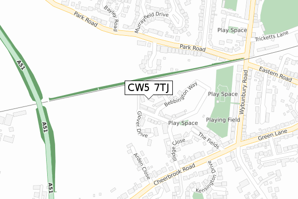
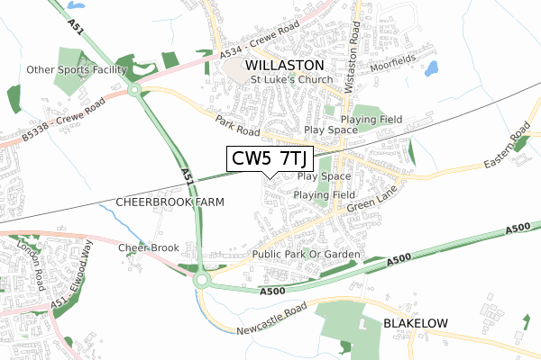
CW5 7TJ is located in the Willaston and Rope electoral ward, within the unitary authority of Cheshire East and the English Parliamentary constituency of Crewe and Nantwich. The Sub Integrated Care Board (ICB) Location is NHS Cheshire and Merseyside ICB - 27D and the police force is Cheshire. This postcode has been in use since July 2019.


GetTheData
Source: OS Open Zoomstack (Ordnance Survey)
Licence: Open Government Licence (requires attribution)
Attribution: Contains OS data © Crown copyright and database right 2025
Source: Open Postcode Geo
Licence: Open Government Licence (requires attribution)
Attribution: Contains OS data © Crown copyright and database right 2025; Contains Royal Mail data © Royal Mail copyright and database right 2025; Source: Office for National Statistics licensed under the Open Government Licence v.3.0
| Easting | 367688 |
| Northing | 352201 |
| Latitude | 53.066082 |
| Longitude | -2.483650 |
GetTheData
Source: Open Postcode Geo
Licence: Open Government Licence
| Country | England |
| Postcode District | CW5 |
➜ See where CW5 is on a map ➜ Where is Willaston? | |
GetTheData
Source: Land Registry Price Paid Data
Licence: Open Government Licence
| Ward | Willaston And Rope |
| Constituency | Crewe And Nantwich |
GetTheData
Source: ONS Postcode Database
Licence: Open Government Licence
2024 15 AUG £370,000 |
2021 4 FEB £329,950 |
13, HOWELLS PLACE, WILLASTON, NANTWICH, CW5 7TJ 2021 29 JAN £329,950 |
16, HOWELLS PLACE, WILLASTON, NANTWICH, CW5 7TJ 2020 11 DEC £399,950 |
15, HOWELLS PLACE, WILLASTON, NANTWICH, CW5 7TJ 2020 25 SEP £399,950 |
14, HOWELLS PLACE, WILLASTON, NANTWICH, CW5 7TJ 2020 18 SEP £324,950 |
12, HOWELLS PLACE, WILLASTON, NANTWICH, CW5 7TJ 2020 19 JUN £269,950 |
11, HOWELLS PLACE, WILLASTON, NANTWICH, CW5 7TJ 2020 31 MAR £209,950 |
3, HOWELLS PLACE, WILLASTON, NANTWICH, CW5 7TJ 2020 27 MAR £374,950 |
2, HOWELLS PLACE, WILLASTON, NANTWICH, CW5 7TJ 2020 23 MAR £319,950 |
GetTheData
Source: HM Land Registry Price Paid Data
Licence: Contains HM Land Registry data © Crown copyright and database right 2025. This data is licensed under the Open Government Licence v3.0.
| Bayley Road (Park Road) | Willaston | 253m |
| Hollybush Crescent (Park Road) | Willaston | 259m |
| Wybunbury Road | Willaston | 277m |
| Circle Avenue (Eastern Road) | Willaston | 365m |
| Circle Avenue (Eastern Road) | Willaston | 395m |
| Nantwich Station | 2.4km |
| Crewe Station | 4.3km |
GetTheData
Source: NaPTAN
Licence: Open Government Licence
GetTheData
Source: ONS Postcode Database
Licence: Open Government Licence


➜ Get more ratings from the Food Standards Agency
GetTheData
Source: Food Standards Agency
Licence: FSA terms & conditions
| Last Collection | |||
|---|---|---|---|
| Location | Mon-Fri | Sat | Distance |
| Park Road | 17:00 | 08:30 | 240m |
| Wybunbury Road | 17:00 | 08:30 | 279m |
| Cheerbrook Road | 17:15 | 08:30 | 448m |
GetTheData
Source: Dracos
Licence: Creative Commons Attribution-ShareAlike
The below table lists the International Territorial Level (ITL) codes (formerly Nomenclature of Territorial Units for Statistics (NUTS) codes) and Local Administrative Units (LAU) codes for CW5 7TJ:
| ITL 1 Code | Name |
|---|---|
| TLD | North West (England) |
| ITL 2 Code | Name |
| TLD6 | Cheshire |
| ITL 3 Code | Name |
| TLD62 | Cheshire East |
| LAU 1 Code | Name |
| E06000049 | Cheshire East |
GetTheData
Source: ONS Postcode Directory
Licence: Open Government Licence
The below table lists the Census Output Area (OA), Lower Layer Super Output Area (LSOA), and Middle Layer Super Output Area (MSOA) for CW5 7TJ:
| Code | Name | |
|---|---|---|
| OA | E00093395 | |
| LSOA | E01018508 | Cheshire East 048D |
| MSOA | E02003838 | Cheshire East 048 |
GetTheData
Source: ONS Postcode Directory
Licence: Open Government Licence
| CW5 6PR | Beech Tree Close | 98m |
| CW5 6PN | Park Road | 140m |
| CW5 7EW | The Fields | 216m |
| CW5 6PW | Park Road | 218m |
| CW5 6LG | Amys Meadow | 262m |
| CW5 6QF | Murrayfield Drive | 290m |
| CW5 6PP | Hollybush Crescent | 290m |
| CW5 7JF | Wybunbury Road | 301m |
| CW5 7EN | Cheerbrook Road | 306m |
| CW5 7JE | Wybunbury Road | 309m |
GetTheData
Source: Open Postcode Geo; Land Registry Price Paid Data
Licence: Open Government Licence