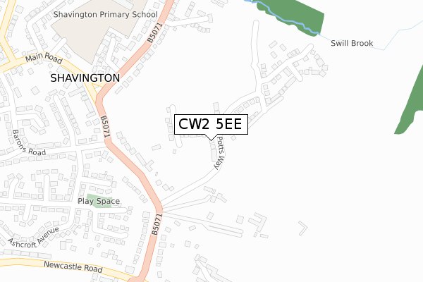
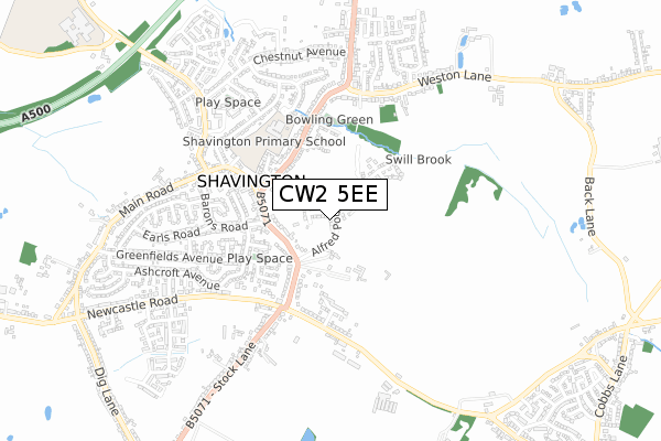
CW2 5EE is located in the Shavington electoral ward, within the unitary authority of Cheshire East and the English Parliamentary constituency of Crewe and Nantwich. The Sub Integrated Care Board (ICB) Location is NHS Cheshire and Merseyside ICB - 27D and the police force is Cheshire. This postcode has been in use since November 2018.


GetTheData
Source: OS Open Zoomstack (Ordnance Survey)
Licence: Open Government Licence (requires attribution)
Attribution: Contains OS data © Crown copyright and database right 2025
Source: Open Postcode Geo
Licence: Open Government Licence (requires attribution)
Attribution: Contains OS data © Crown copyright and database right 2025; Contains Royal Mail data © Royal Mail copyright and database right 2025; Source: Office for National Statistics licensed under the Open Government Licence v.3.0
| Easting | 370391 |
| Northing | 351689 |
| Latitude | 53.061637 |
| Longitude | -2.443267 |
GetTheData
Source: Open Postcode Geo
Licence: Open Government Licence
| Country | England |
| Postcode District | CW2 |
➜ See where CW2 is on a map ➜ Where is Shavington? | |
GetTheData
Source: Land Registry Price Paid Data
Licence: Open Government Licence
| Ward | Shavington |
| Constituency | Crewe And Nantwich |
GetTheData
Source: ONS Postcode Database
Licence: Open Government Licence
75, ALFRED POTTS WAY, SHAVINGTON, CREWE, CW2 5EE 2023 21 APR £359,995 |
57, ALFRED POTTS WAY, SHAVINGTON, CREWE, CW2 5EE 2022 29 NOV £329,995 |
55, ALFRED POTTS WAY, SHAVINGTON, CREWE, CW2 5EE 2022 28 NOV £367,995 |
53, ALFRED POTTS WAY, SHAVINGTON, CREWE, CW2 5EE 2022 17 NOV £365,995 |
51, ALFRED POTTS WAY, SHAVINGTON, CREWE, CW2 5EE 2022 15 NOV £340,995 |
2022 20 OCT £283,500 |
23, ALFRED POTTS WAY, SHAVINGTON, CREWE, CW2 5EE 2021 6 AUG £365,995 |
79, ALFRED POTTS WAY, SHAVINGTON, CREWE, CW2 5EE 2019 20 DEC £284,995 |
19, ALFRED POTTS WAY, SHAVINGTON, CREWE, CW2 5EE 2019 12 JUL £286,995 |
21, ALFRED POTTS WAY, SHAVINGTON, CREWE, CW2 5EE 2019 14 JUN £322,995 |
GetTheData
Source: HM Land Registry Price Paid Data
Licence: Contains HM Land Registry data © Crown copyright and database right 2025. This data is licensed under the Open Government Licence v3.0.
| Sugar Loaf (Crewe Road) | Shavington | 262m |
| Sugar Loaf (Crewe Road) | Shavington | 282m |
| Goodall's Corner (Crewe Road) | Shavington | 307m |
| Goodall's Corner (Crewe Road) | Shavington | 329m |
| Brook Avenue (Crewe Road) | Shavington | 364m |
| Crewe Station | 3.2km |
GetTheData
Source: NaPTAN
Licence: Open Government Licence
| Percentage of properties with Next Generation Access | 100.0% |
| Percentage of properties with Superfast Broadband | 100.0% |
| Percentage of properties with Ultrafast Broadband | 100.0% |
| Percentage of properties with Full Fibre Broadband | 100.0% |
Superfast Broadband is between 30Mbps and 300Mbps
Ultrafast Broadband is > 300Mbps
| Percentage of properties unable to receive 2Mbps | 0.0% |
| Percentage of properties unable to receive 5Mbps | 0.0% |
| Percentage of properties unable to receive 10Mbps | 0.0% |
| Percentage of properties unable to receive 30Mbps | 0.0% |
GetTheData
Source: Ofcom
Licence: Ofcom Terms of Use (requires attribution)
GetTheData
Source: ONS Postcode Database
Licence: Open Government Licence


➜ Get more ratings from the Food Standards Agency
GetTheData
Source: Food Standards Agency
Licence: FSA terms & conditions
| Last Collection | |||
|---|---|---|---|
| Location | Mon-Fri | Sat | Distance |
| Shavington So | 17:30 | 11:30 | 510m |
| Hollymount | 17:15 | 10:15 | 976m |
| Marina Terrace | 17:30 | 10:15 | 1,031m |
GetTheData
Source: Dracos
Licence: Creative Commons Attribution-ShareAlike
The below table lists the International Territorial Level (ITL) codes (formerly Nomenclature of Territorial Units for Statistics (NUTS) codes) and Local Administrative Units (LAU) codes for CW2 5EE:
| ITL 1 Code | Name |
|---|---|
| TLD | North West (England) |
| ITL 2 Code | Name |
| TLD6 | Cheshire |
| ITL 3 Code | Name |
| TLD62 | Cheshire East |
| LAU 1 Code | Name |
| E06000049 | Cheshire East |
GetTheData
Source: ONS Postcode Directory
Licence: Open Government Licence
The below table lists the Census Output Area (OA), Lower Layer Super Output Area (LSOA), and Middle Layer Super Output Area (MSOA) for CW2 5EE:
| Code | Name | |
|---|---|---|
| OA | E00093326 | |
| LSOA | E01018494 | Cheshire East 048B |
| MSOA | E02003838 | Cheshire East 048 |
GetTheData
Source: ONS Postcode Directory
Licence: Open Government Licence
| CW2 5JB | Crewe Road | 190m |
| CW2 5HZ | The Orchards | 238m |
| CW2 5DW | Crewe Road | 281m |
| CW2 5EL | Camelot Grove | 291m |
| CW2 5JE | Crewe Road | 292m |
| CW2 5JA | Crewe Road | 294m |
| CW2 5DN | Brook Avenue | 299m |
| CW2 5EH | Barons Road | 304m |
| CW2 5DQ | Lime Grove | 309m |
| CW2 5HX | Wessex Close | 350m |
GetTheData
Source: Open Postcode Geo; Land Registry Price Paid Data
Licence: Open Government Licence