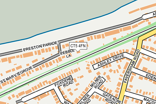
CT5 4FN is located in the Seasalter electoral ward, within the local authority district of Canterbury and the English Parliamentary constituency of Canterbury. The Sub Integrated Care Board (ICB) Location is NHS Kent and Medway ICB - 91Q and the police force is Kent. This postcode has been in use since February 2017.


GetTheData
Source: OS OpenMap – Local (Ordnance Survey)
Source: OS VectorMap District (Ordnance Survey)
Licence: Open Government Licence (requires attribution)
| Easting | 608987 |
| Northing | 165153 |
| Latitude | 51.347022 |
| Longitude | 0.999609 |
GetTheData
Source: Open Postcode Geo
Licence: Open Government Licence
| Country | England |
| Postcode District | CT5 |
➜ See where CT5 is on a map ➜ Where is Whitstable? | |
GetTheData
Source: Land Registry Price Paid Data
Licence: Open Government Licence
| Ward | Seasalter |
| Constituency | Canterbury |
GetTheData
Source: ONS Postcode Database
Licence: Open Government Licence
2023 28 APR £1,120,000 |
2019 10 MAY £865,000 |
2, PEBBLE LANE, SEASALTER, WHITSTABLE, CT5 4FN 2005 1 SEP £199,000 |
2, PEBBLE LANE, SEASALTER, WHITSTABLE, CT5 4FN 2000 31 AUG £102,000 |
GetTheData
Source: HM Land Registry Price Paid Data
Licence: Contains HM Land Registry data © Crown copyright and database right 2025. This data is licensed under the Open Government Licence v3.0.
| Eden Road (Faversham Road) | Seasalter | 204m |
| Eden Road (Faversham Road) | Seasalter | 221m |
| Seasalter Cross (Faversham Road) | Seasalter | 425m |
| Lucerne Drive East (Lucerne Drive) | Seasalter | 427m |
| Seasalter Cross (Faversham Road) | Seasalter | 445m |
| Whitstable Station | 2.6km |
| Chestfield & Swalecliffe Station | 4.9km |
GetTheData
Source: NaPTAN
Licence: Open Government Licence
| Percentage of properties with Next Generation Access | 100.0% |
| Percentage of properties with Superfast Broadband | 100.0% |
| Percentage of properties with Ultrafast Broadband | 0.0% |
| Percentage of properties with Full Fibre Broadband | 0.0% |
Superfast Broadband is between 30Mbps and 300Mbps
Ultrafast Broadband is > 300Mbps
| Percentage of properties unable to receive 2Mbps | 0.0% |
| Percentage of properties unable to receive 5Mbps | 0.0% |
| Percentage of properties unable to receive 10Mbps | 0.0% |
| Percentage of properties unable to receive 30Mbps | 0.0% |
GetTheData
Source: Ofcom
Licence: Ofcom Terms of Use (requires attribution)
GetTheData
Source: ONS Postcode Database
Licence: Open Government Licence


➜ Get more ratings from the Food Standards Agency
GetTheData
Source: Food Standards Agency
Licence: FSA terms & conditions
| Last Collection | |||
|---|---|---|---|
| Location | Mon-Fri | Sat | Distance |
| Seasalter Cross | 16:00 | 11:45 | 353m |
| Seasalter Post Office | 17:00 | 11:45 | 453m |
| Hodgson Road | 16:15 | 11:45 | 510m |
GetTheData
Source: Dracos
Licence: Creative Commons Attribution-ShareAlike
The below table lists the International Territorial Level (ITL) codes (formerly Nomenclature of Territorial Units for Statistics (NUTS) codes) and Local Administrative Units (LAU) codes for CT5 4FN:
| ITL 1 Code | Name |
|---|---|
| TLJ | South East (England) |
| ITL 2 Code | Name |
| TLJ4 | Kent |
| ITL 3 Code | Name |
| TLJ44 | East Kent |
| LAU 1 Code | Name |
| E07000106 | Canterbury |
GetTheData
Source: ONS Postcode Directory
Licence: Open Government Licence
The below table lists the Census Output Area (OA), Lower Layer Super Output Area (LSOA), and Middle Layer Super Output Area (MSOA) for CT5 4FN:
| Code | Name | |
|---|---|---|
| OA | E00122386 | |
| LSOA | E01024108 | Canterbury 009D |
| MSOA | E02005018 | Canterbury 009 |
GetTheData
Source: ONS Postcode Directory
Licence: Open Government Licence
| CT5 4AA | Preston Parade | 103m |
| CT5 4SU | Ashley Drive | 133m |
| CT5 4SH | Milner Road | 159m |
| CT5 4QY | Foxdene Road | 178m |
| CT5 4AL | Faversham Road | 194m |
| CT5 4SJ | Gateacre Road | 200m |
| CT5 4AB | St Marys Grove | 212m |
| CT5 4AU | Wauchope Road | 236m |
| CT5 4AR | Faversham Road | 241m |
| CT5 4AD | Preston Parade | 249m |
GetTheData
Source: Open Postcode Geo; Land Registry Price Paid Data
Licence: Open Government Licence