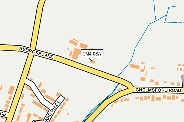
CM4 0SA is located in the Tipps Cross electoral ward, within the local authority district of Brentwood and the English Parliamentary constituency of Brentwood and Ongar. The Sub Integrated Care Board (ICB) Location is NHS Mid and South Essex ICB - 99E and the police force is Essex. This postcode has been in use since January 1980.


GetTheData
Source: OS OpenMap – Local (Ordnance Survey)
Source: OS VectorMap District (Ordnance Survey)
Licence: Open Government Licence (requires attribution)
| Easting | 560621 |
| Northing | 202188 |
| Latitude | 51.695466 |
| Longitude | 0.322660 |
GetTheData
Source: Open Postcode Geo
Licence: Open Government Licence
| Country | England |
| Postcode District | CM4 |
➜ See where CM4 is on a map ➜ Where is Blackmore? | |
GetTheData
Source: Land Registry Price Paid Data
Licence: Open Government Licence
Elevation or altitude of CM4 0SA as distance above sea level:
| Metres | Feet | |
|---|---|---|
| Elevation | 70m | 230ft |
Elevation is measured from the approximate centre of the postcode, to the nearest point on an OS contour line from OS Terrain 50, which has contour spacing of ten vertical metres.
➜ How high above sea level am I? Find the elevation of your current position using your device's GPS.
GetTheData
Source: Open Postcode Elevation
Licence: Open Government Licence
| Ward | Tipps Cross |
| Constituency | Brentwood And Ongar |
GetTheData
Source: ONS Postcode Database
Licence: Open Government Licence
2023 25 SEP £935,000 |
6, SANDFORD PADDOCKS, RED ROSE LANE, BLACKMORE, INGATESTONE, CM4 0SA 2021 21 MAY £650,000 |
2021 7 MAY £895,000 |
8, SANDFORD PADDOCKS, RED ROSE LANE, BLACKMORE, INGATESTONE, CM4 0SA 2021 4 MAY £675,000 |
7, SANDFORD PADDOCKS, RED ROSE LANE, BLACKMORE, INGATESTONE, CM4 0SA 2021 30 APR £650,000 |
2, SANDFORD PADDOCKS, RED ROSE LANE, BLACKMORE, INGATESTONE, CM4 0SA 2021 11 MAR £685,000 |
2021 8 MAR £775,000 |
GetTheData
Source: HM Land Registry Price Paid Data
Licence: Contains HM Land Registry data © Crown copyright and database right 2024. This data is licensed under the Open Government Licence v3.0.
| Blackmore Mead (Chelmsford Road) | Blackmore | 278m |
| Blackmore Mead (Chelmsford Road) | Blackmore | 302m |
| Elkins Green (Chelmsford Road) | Blackmore | 376m |
| Elkins Green (Chelmsford Road) | Blackmore | 388m |
| Bus Terminus (Chelmsford Road) | Blackmore | 397m |
| Ingatestone Station | 5.3km |
GetTheData
Source: NaPTAN
Licence: Open Government Licence
GetTheData
Source: ONS Postcode Database
Licence: Open Government Licence


➜ Get more ratings from the Food Standards Agency
GetTheData
Source: Food Standards Agency
Licence: FSA terms & conditions
| Last Collection | |||
|---|---|---|---|
| Location | Mon-Fri | Sat | Distance |
| Great Oxney Green | 16:55 | 09:00 | 216m |
| Cock Lane | 16:30 | 09:05 | 342m |
| Blackmore P.o. | 16:15 | 11:00 | 427m |
GetTheData
Source: Dracos
Licence: Creative Commons Attribution-ShareAlike
The below table lists the International Territorial Level (ITL) codes (formerly Nomenclature of Territorial Units for Statistics (NUTS) codes) and Local Administrative Units (LAU) codes for CM4 0SA:
| ITL 1 Code | Name |
|---|---|
| TLH | East |
| ITL 2 Code | Name |
| TLH3 | Essex |
| ITL 3 Code | Name |
| TLH36 | Heart of Essex |
| LAU 1 Code | Name |
| E07000068 | Brentwood |
GetTheData
Source: ONS Postcode Directory
Licence: Open Government Licence
The below table lists the Census Output Area (OA), Lower Layer Super Output Area (LSOA), and Middle Layer Super Output Area (MSOA) for CM4 0SA:
| Code | Name | |
|---|---|---|
| OA | E00109078 | |
| LSOA | E01021469 | Brentwood 001E |
| MSOA | E02004464 | Brentwood 001 |
GetTheData
Source: ONS Postcode Directory
Licence: Open Government Licence
| CM4 0RX | Orchard Piece | 204m |
| CM4 0RZ | Orchard Piece | 265m |
| CM4 0SP | Blackmore Mead | 284m |
| CM4 0RU | Fingrith Hall Road | 296m |
| CM4 0RY | Orchard Piece | 298m |
| CM4 0SD | Chelmsford Road | 312m |
| CM4 0QN | Woollard Way | 344m |
| CM4 0RT | The Green | 386m |
| CM4 0SB | Jericho Place | 387m |
| CM4 0RL | The Green | 392m |
GetTheData
Source: Open Postcode Geo; Land Registry Price Paid Data
Licence: Open Government Licence